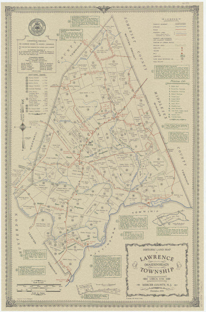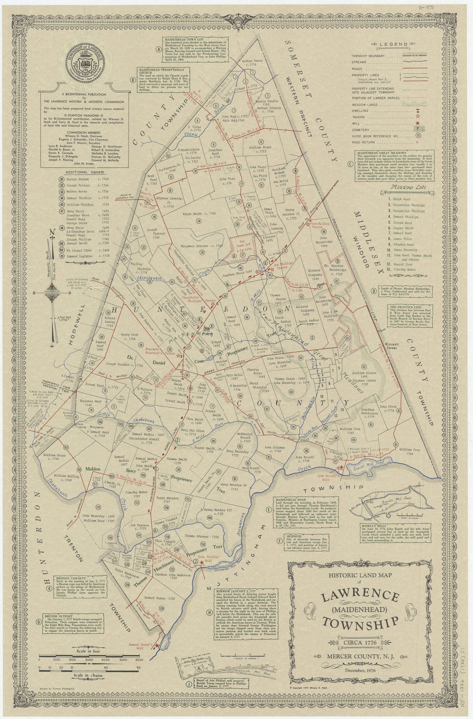
Historic land map of Lawrence (Maidenhead) Township, circa 1776, Mercer County, N.J.: December 1976: this map has been prepared from primary source material by D. Stanton Hammond, III as his Bi-centennial contribution [ca. 1977]
Map No. N.J. 1776 (1977).Fl
Cadastral map showing land ownership as of 1776. Includes indexes, historical notes, 2 insets, seal, and list of Commission members. Accompanied by text and index: Your guide to our Bicentennial map, a history of land ownership, Lawrence (Maidenhead) Township, Mercer County, New Jersey, circa 1776. (36 p. 22 cm.). BHS missing accompanying text and index.
Map area shown
Relation
Full catalog recordSize
87 × 56 cmDownload
Low Resolution Image
Creator
Hammond, D. Stanton,Publisher
Brooklyn Historical SocietyCitation
Historic land map of Lawrence (Maidenhead) Township, circa 1776, Mercer County, N.J.: December 1976: this map has been prepared from primary source material by D. Stanton Hammond, III as his Bi-centennial contribution; [ca. 1977], Map Collection, N.J. 1776 (1977).Fl; Brooklyn Historical Society.Scale
Scale [ca. 1:14,500]Loading zoom image...