Historic traces on upper Manhattan: with the present lines of city streets: prepared by Morris William Ehrilich [ca. 1910]
Map No. M-[18th-19th Century] (1910).Fl
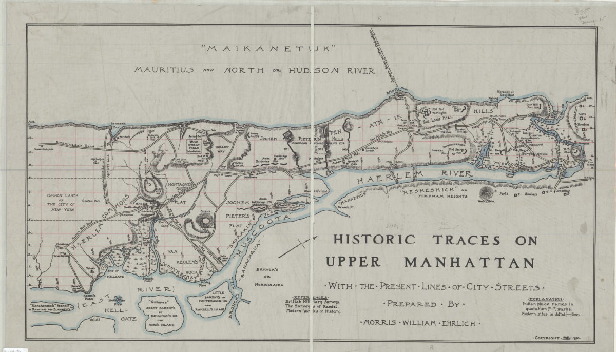
Historical map. Shows forts, Indian trails, and troop movements ca. 1776. Relief shown by hachures. Oriented with north to the upper right. Includes key and bibliographical references.
Places
Map area shown
Genre
Historical mapsRelation
Full catalog recordSize
44 × 80 cmDownload
Low Resolution Image
Creator
Ehrlich, Morris William,Publisher
Brooklyn Historical SocietyCitation
Historic traces on upper Manhattan: with the present lines of city streets: prepared by Morris William Ehrilich; [ca. 1910], Map Collection, M-[18th-19th Century] (1910).Fl; Brooklyn Historical Society.Scale
Scale not givenLoading zoom image...