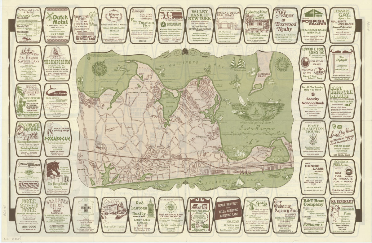
Historical guide and map to East Hampton: Springs, Amagansett, Sag Harbor [ca. 1973]
Map No. L.I.-1973.Fl
Pictorial map covering Long Island from Sag Harbor east to Napeague Harbor. Shows roads, points of interest, and Long Island Railroad. Oriented with north to the upper right. Includes advertisements. On verso: Advertisements, guide for shopping and services, and Village map of East Hampton & Amagansett.
Map area shown
Genre
Pictorial mapsRelation
Full catalog recordSize
61 × 93 cmDownload
Low Resolution Image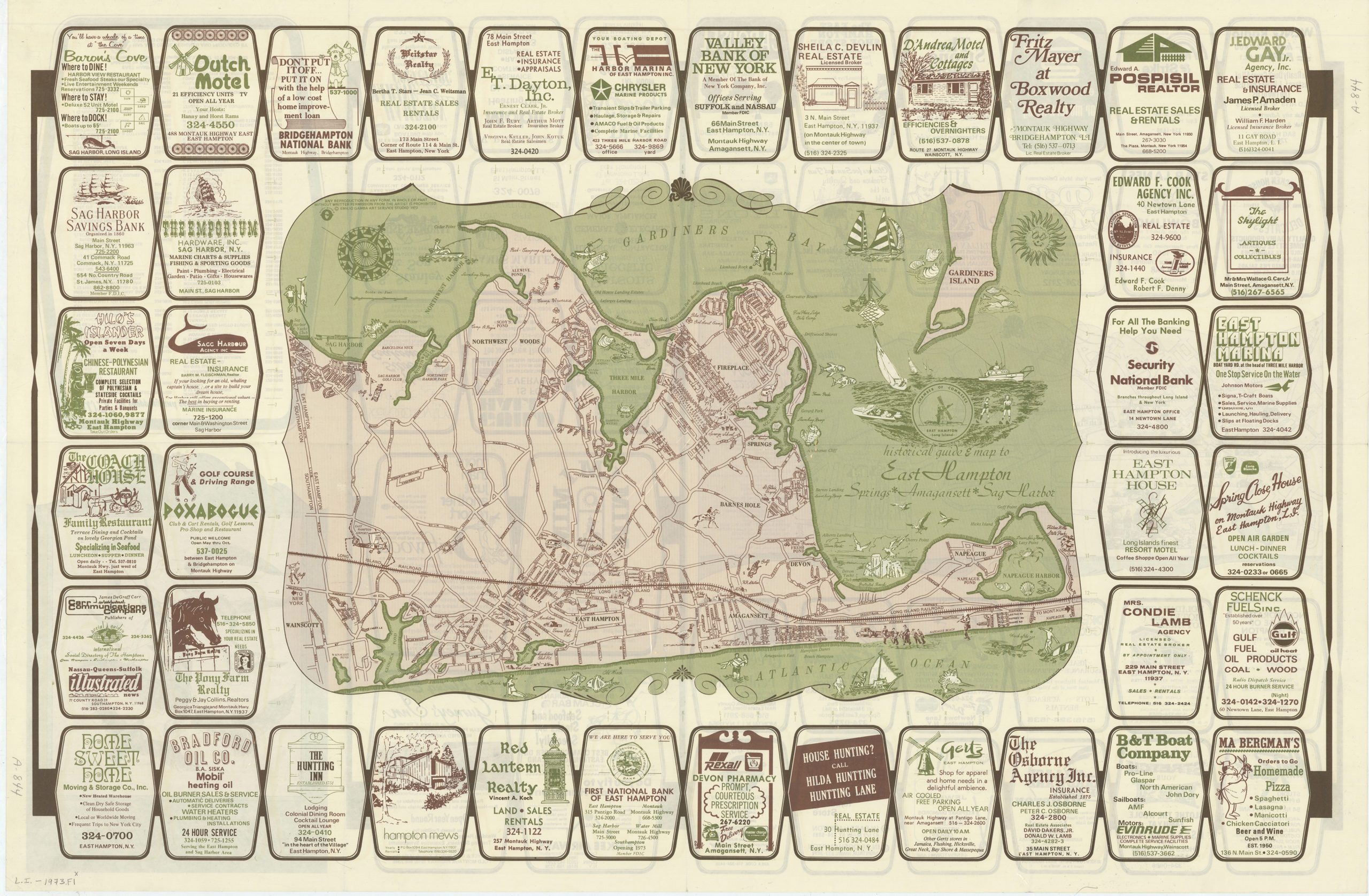
Creator
Emilio Gamba Art Service Studio,Publisher
Brooklyn Historical SocietyCitation
Historical guide and map to East Hampton: Springs, Amagansett, Sag Harbor; [ca. 1973], Map Collection, L.I.-1973.Fl; Brooklyn Historical Society.Scale
Scale [ca. 1:40,000]Loading zoom image...