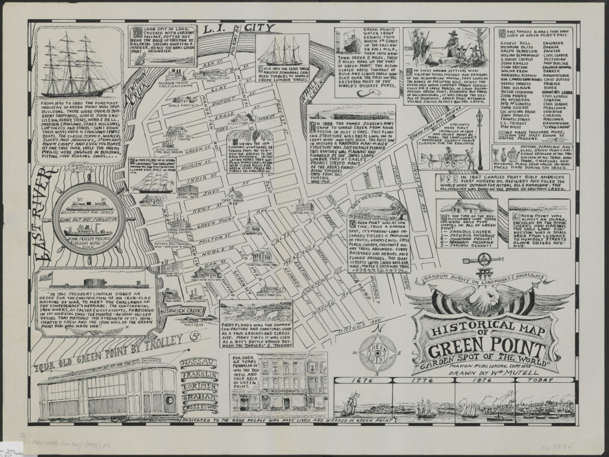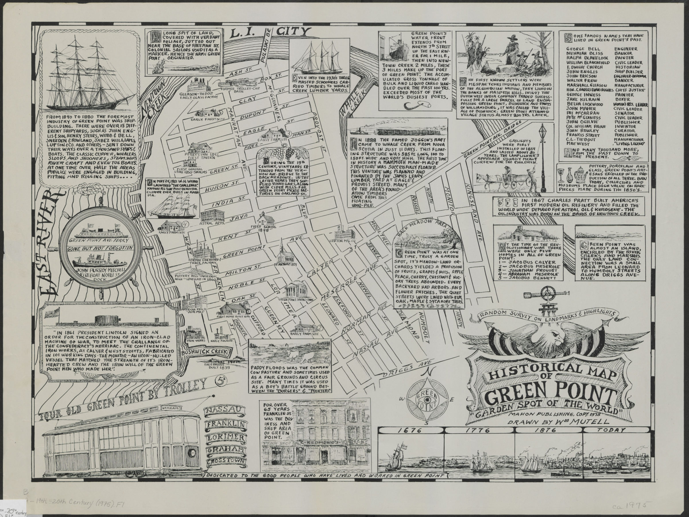
Historical map of Green Point: garden spot of the world: drawn by Wm. Mutell [1975]
Map No. B A-19th-20th century (1975).Fl
Selected buildings shown pictorially. At head of title: Random survey on landmarks & highlights. Includes ill. and historical notes.
Map area shown
Genre
Pictorial mapsRelation
Full catalog recordSize
43 × 58 cmDownload
Low Resolution Image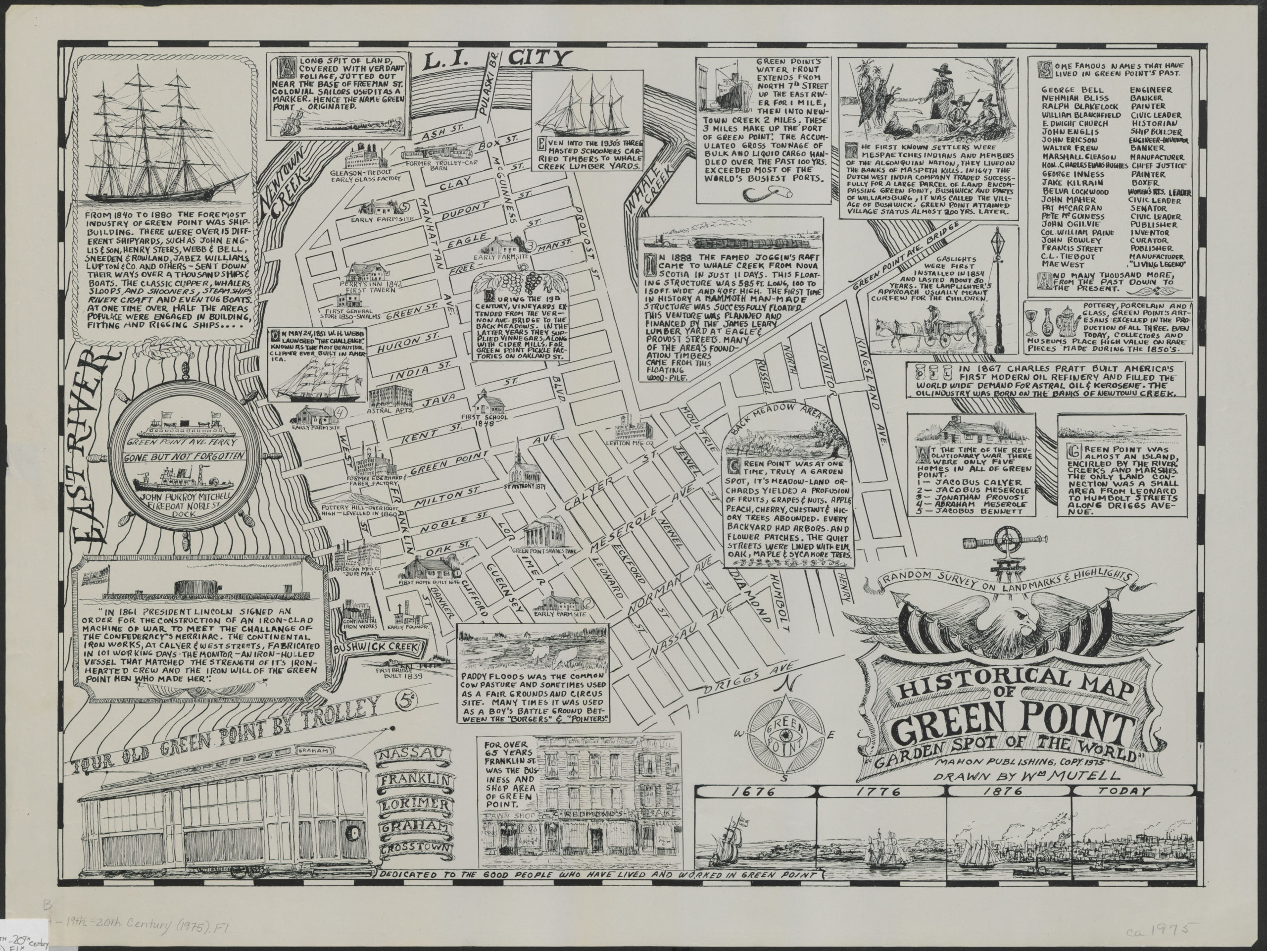
Creator
Mutell, Wm,Publisher
Brooklyn Historical SocietyCitation
Historical map of Green Point: garden spot of the world: drawn by Wm. Mutell; [1975], Map Collection, B A-19th-20th century (1975).Fl; Brooklyn Historical Society.Scale
Scale not givenLoading zoom image...