
Historical map of New York City [ca. 1932]
Map No. NYC-1932.Fl
Pictorial map showing historic sites and events through the early 19th century keyed to locations of National City Bank offices as of 1932. Oriented with north to the upper right. “January 1, 1932”–Verso. Includes ill, notes, and inset of Upper New York Bay between Staten Island, Manhattan and Brooklyn. On verso: Key and ill.
Places
Map area shown
Relation
Full catalog recordSize
40 × 49 cmDownload
Low Resolution Image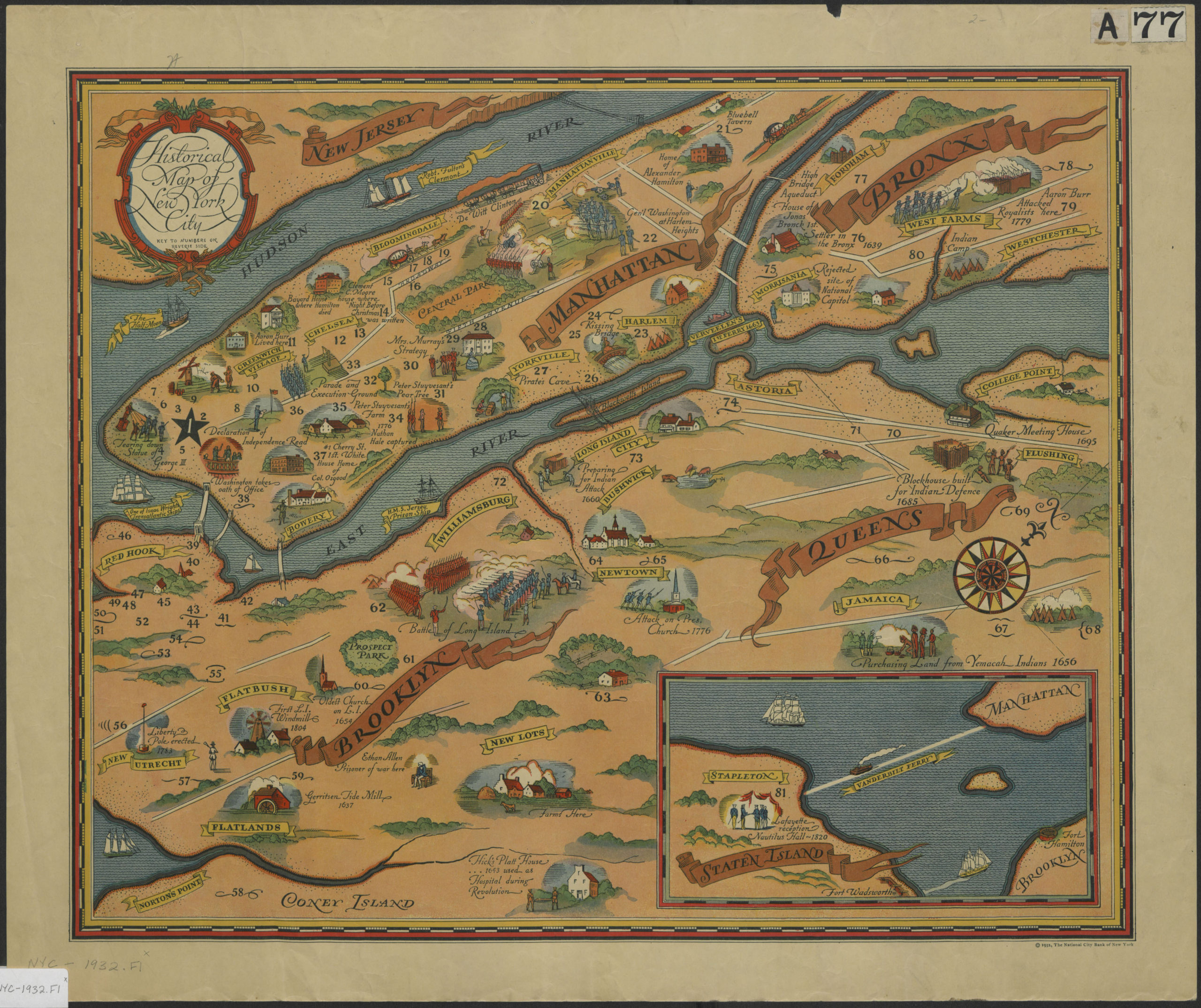
Creator
National City Bank of New York,Publisher
Brooklyn Historical SocietyCitation
Historical map of New York City; [ca. 1932], Map Collection, NYC-1932.Fl; Brooklyn Historical Society.Scale
Not drawn to scaleLoading zoom image... 