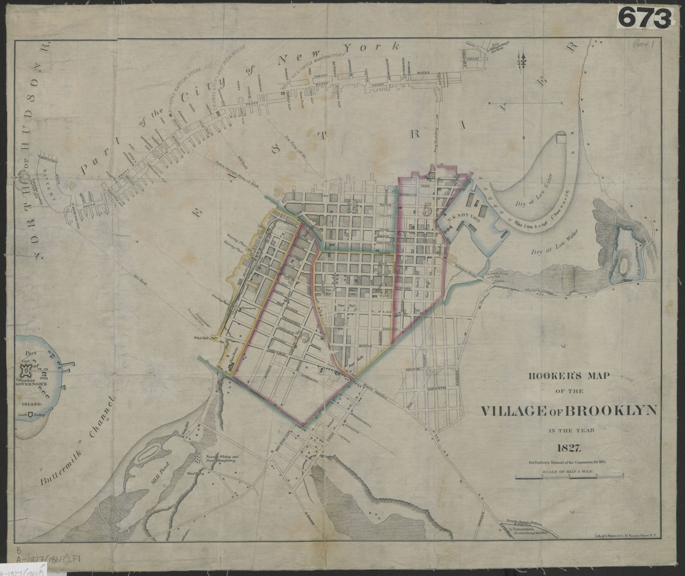
Hooker’s map of the village of Brooklyn in the year 1827 [1861]
Map No. B A-1827 (1861?).Fl
Covers the village of Brooklyn from the modern day Carroll Gardens/Boerum Hill area to the Navy Yard. Also covers a portion of Governor’s Island and Lower Manhattan. Shows wards, areas dry at low water, ferry lines, and names of property owners. Relief shown by hachures depths shown by soundings. “For Bishop’s Manual of the Corporation for 1861.”
Map area shown
Relation
Full catalog recordSize
38 × 48 cmDownload
Low Resolution Image
Creator
Hooker, William,Publisher
Brooklyn Historical SocietyCitation
Hooker’s map of the village of Brooklyn in the year 1827; [1861], Map Collection, B A-1827 (1861?).Fl; Brooklyn Historical Society.Scale
Scale [ca. 1:10,093]Loading zoom image... 