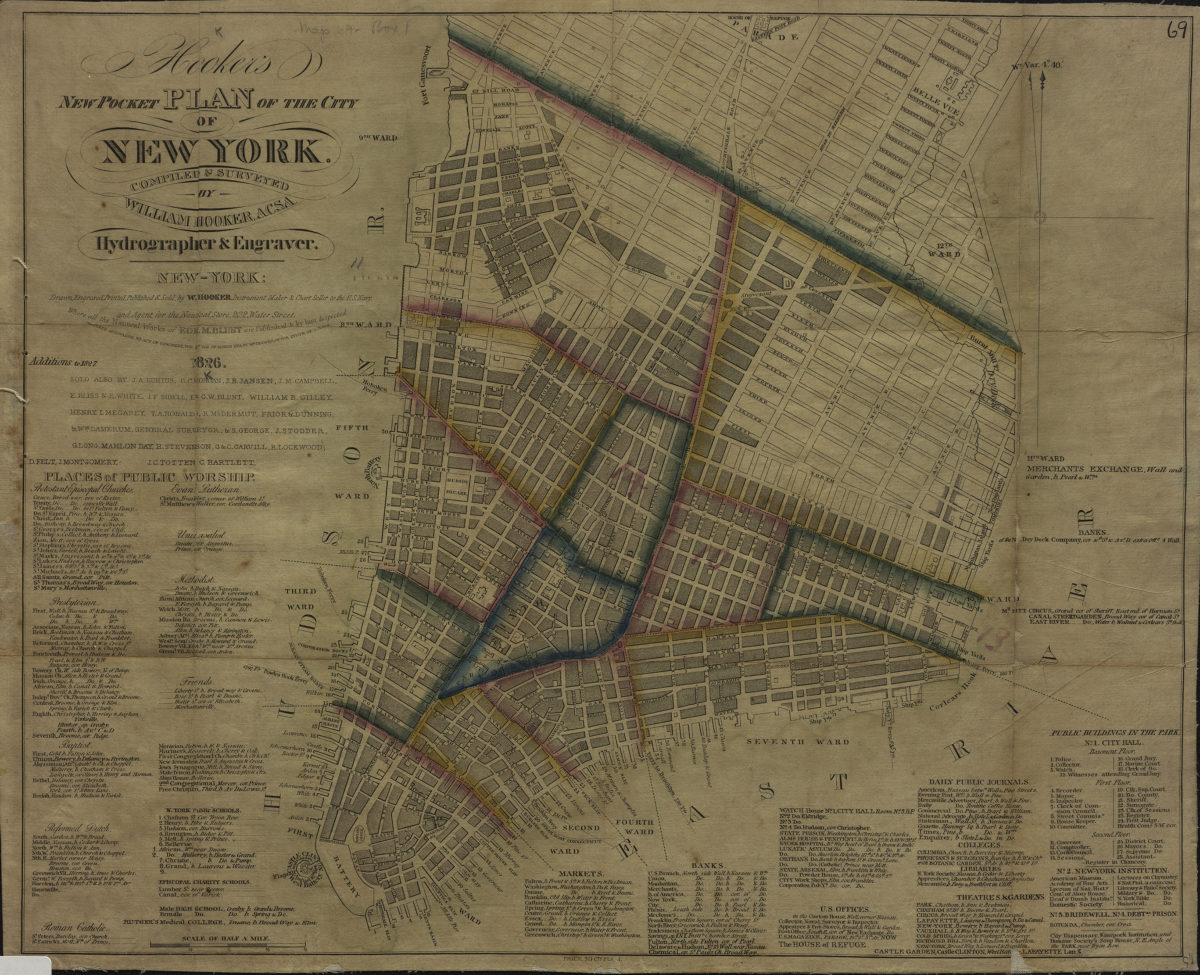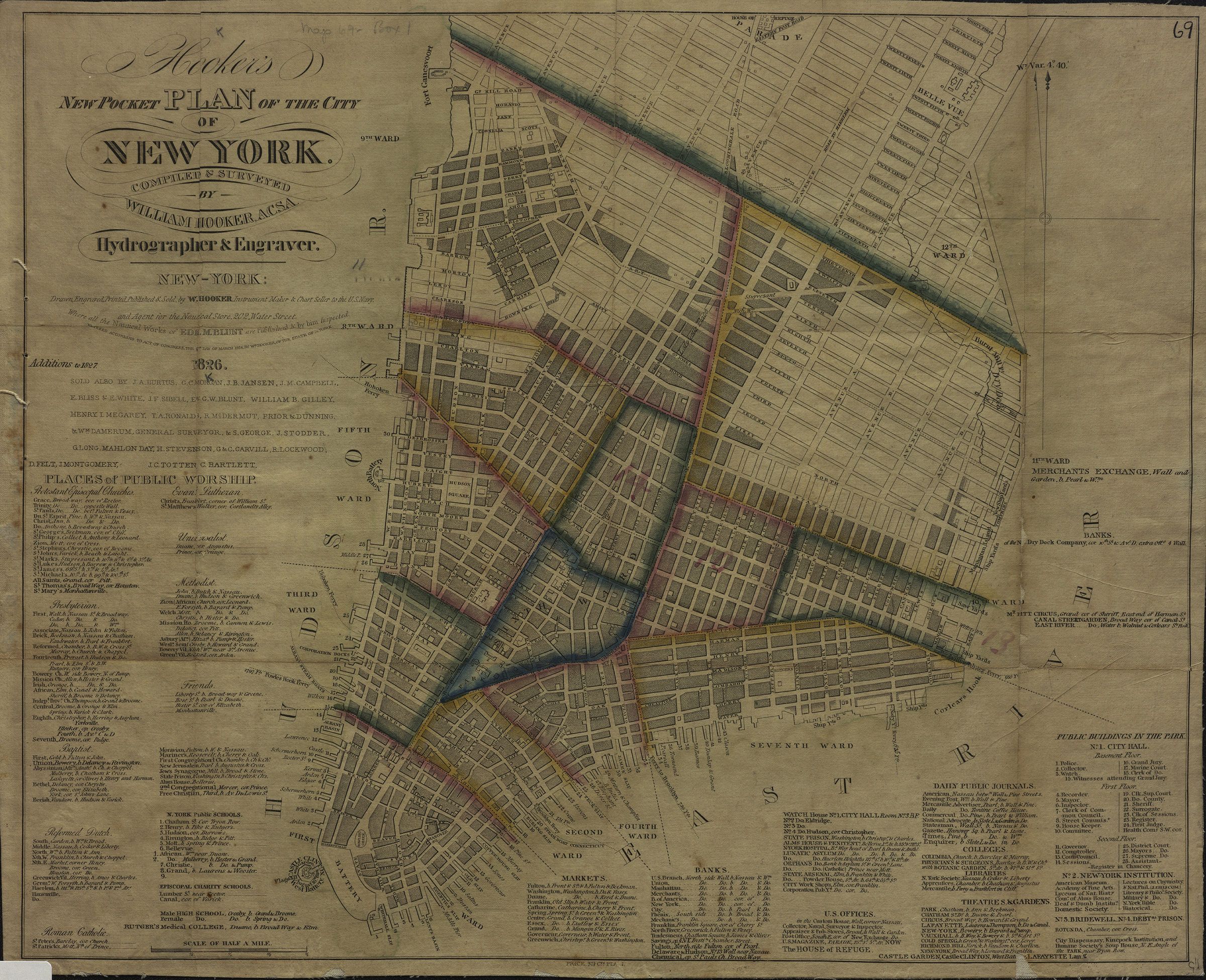
Hooker’s new pocket plan of the city of New York: compiled & surveyed by William Hooker 1826
Map No. M-1826.Fl
Covers Manhattan north to 31st St. Shows piers, ferry lines and ward boundaries. Includes lists of churches, markets, banks, colleges, libraries and other points of interest. BHS copy mounted on linen missing cover.
Map area shown
Genre
MapRelation
Full catalog recordSize
33 × 42 cmDownload
Low Resolution Image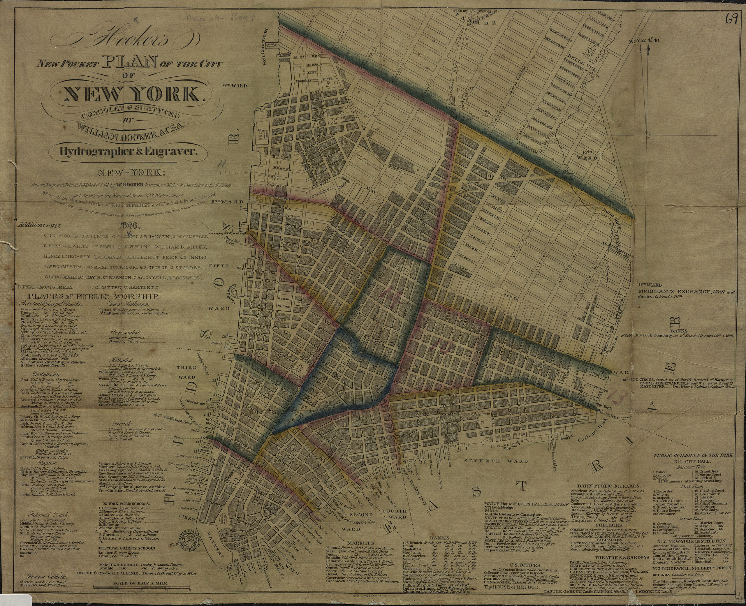
Creator
Hooker, William,Publisher
Brooklyn Historical SocietyCitation
Hooker’s new pocket plan of the city of New York: compiled & surveyed by William Hooker; 1826, Map Collection, M-1826.Fl; Brooklyn Historical Society.Scale
Scale [ca. 1:38,016]Loading zoom image...