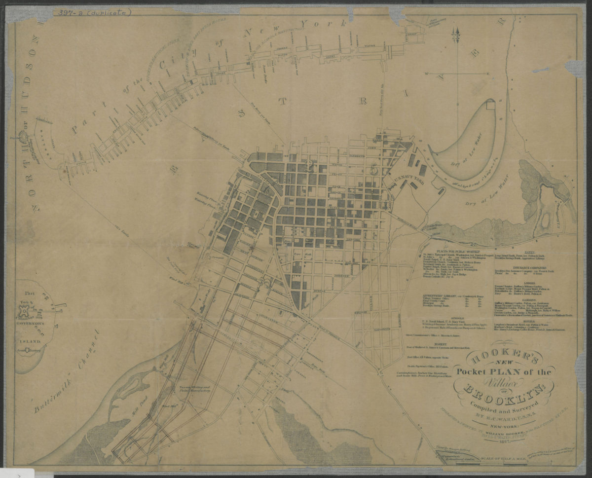
Hooker’s new pocket plan of the village of Brooklyn: compiled and surveyed by E.C. Ward, U.S.N.S. 1827
Map No. B A-1827.Fl
Covers the village of Brooklyn from the modern day Caroll Gardens/Boerum Hill area to the Navy Yard. Also covers a portion of Governor’s Island and Lower Manhattan. Shows wards, areas dry at low water, and ferry lines. Relief shown by hachures depths shown by soundings. “Entered according to Act of Congress, the 17th day of Sept. 1827, by Wm. Hooker of the State of New York.” Includes list of places for public worship, apprentices’ libraries, schools, markets, banks, insurance companies, lodges, gardens, and hotels. BHS copy has eligible typescript pasted on verso.
Map area shown
Genre
Bathymetric mapsRelation
Full catalog recordSize
38 × 48 cmDownload
Low Resolution Image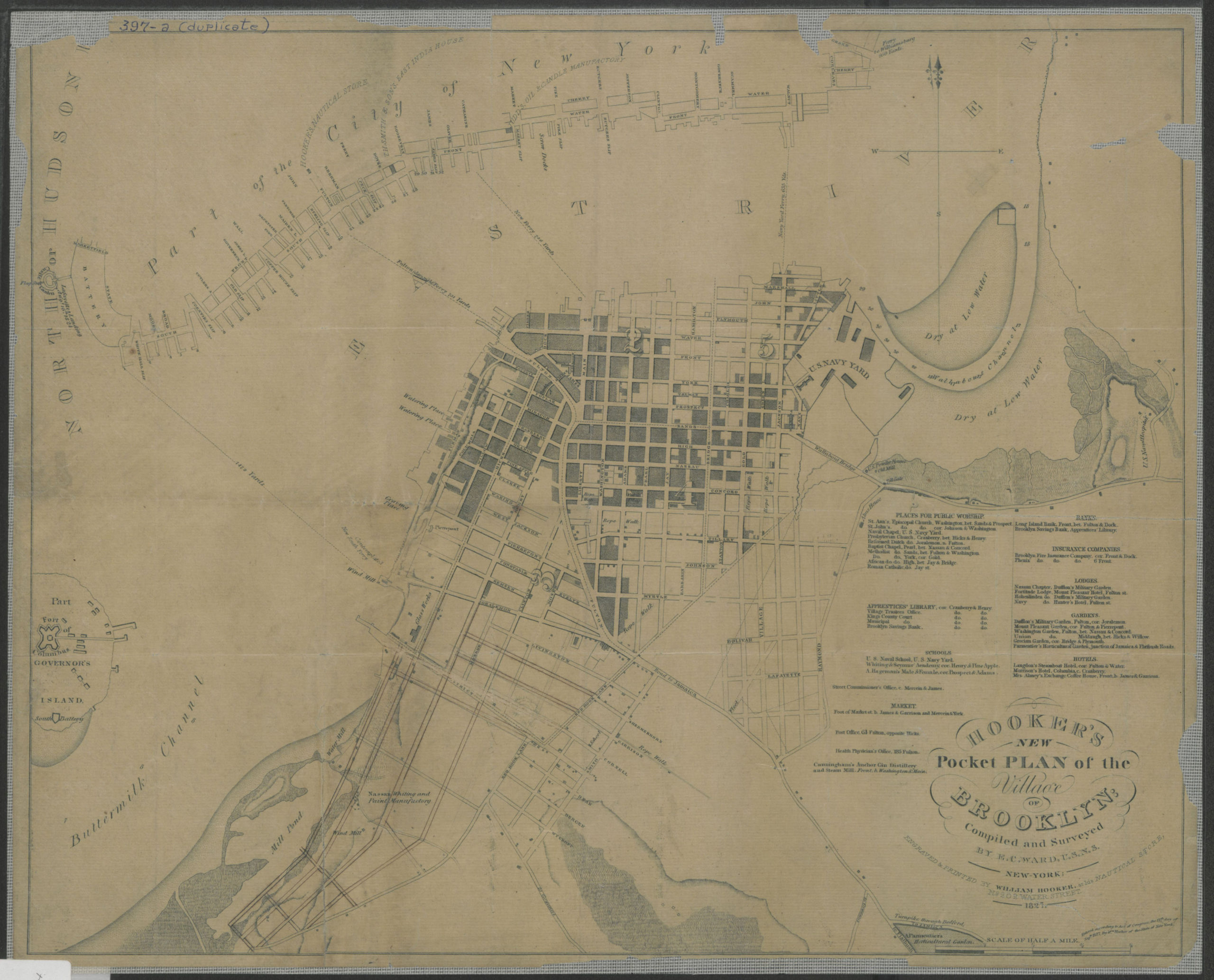
Creator
Ward, E. C.,Publisher
Brooklyn Historical SocietyCitation
Hooker’s new pocket plan of the village of Brooklyn: compiled and surveyed by E.C. Ward, U.S.N.S.; 1827, Map Collection, B A-1827.Fl; Brooklyn Historical Society.Scale
Scale [ca. 1:10,093]Loading zoom image...