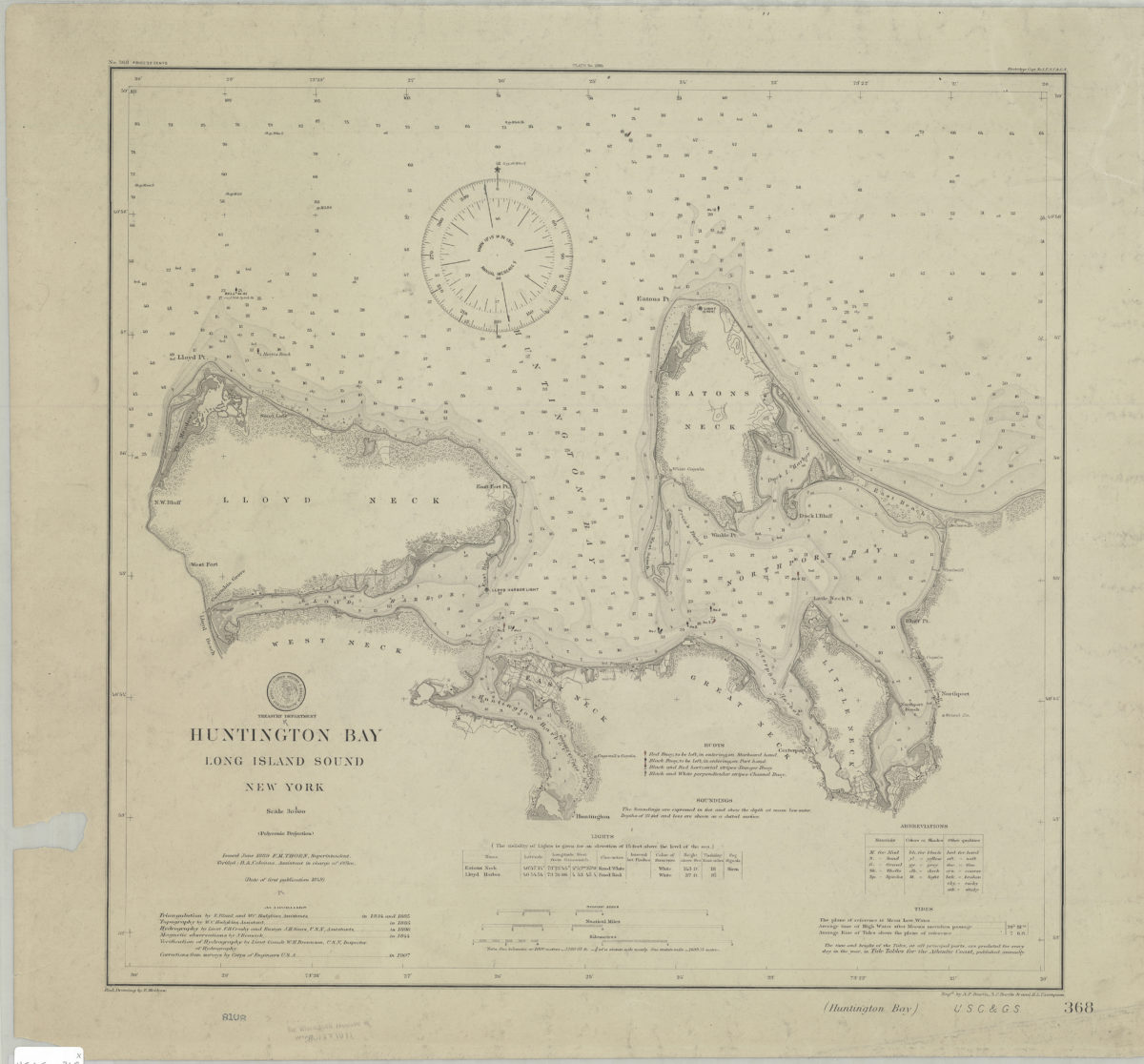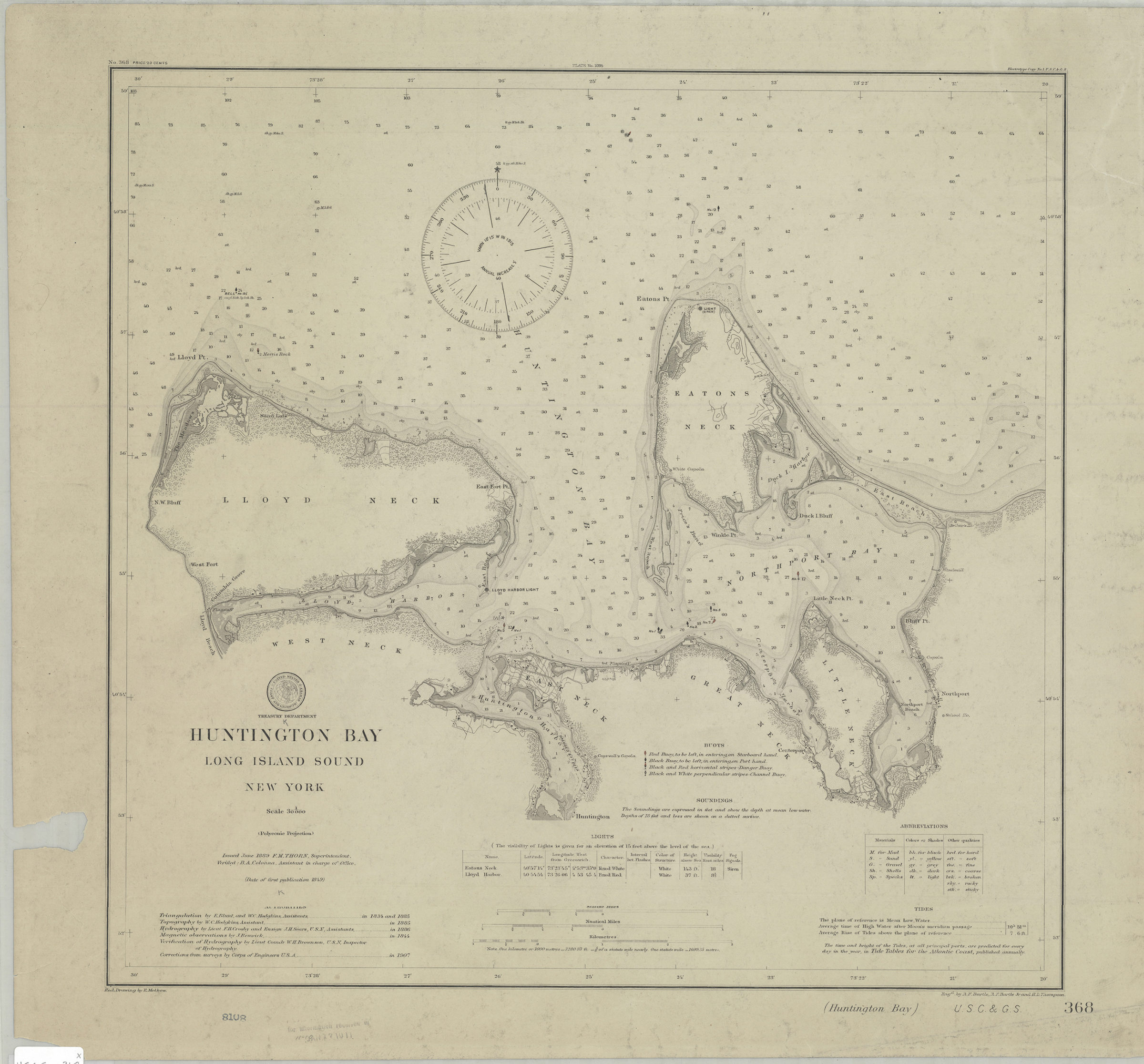
Huntington Bay, Long Island Sound, New York: U.S. Coast and Geodetic Survey ; red. drawing by E. Molkow 1889
Nautical chart also covering Lloyd Neck, West Neck, East Neck, Great Neck, Little Neck, Eatons Neck, Huntington Harbor and Northport Bay. Shows buoys, lights, and some structures. Relief shown by hachures and contours. Depths shown by shading and soundings in feet. “Issued June 1889 F.M. Thorn, Superintendent.” “Verified : B.A. Colonna, Assistant in charge of Office.” “Triangulation by E. Blunt and W.C. Hodgkins, Assistants.” “Topography by W.C. Hodgkins, Assistant.” “Hydrography by Lieut. F.H. Crosby and Ensign J.H. Sears, U.S.N, Assistants.” “Magnetic observations by J. Renwick.” “Verification of Hydrography by Lieut Comdr W.H. Brownson, U.S.N, Inspector of Hydrography.” “Corrections from surveys by Corps of Engineers U.S.A.” “(Date of first publication 1849)” Includes seal, keys, lights table, tidal table, and text. “Plate No. 2095”–Upper center margin. “No. 368 price 20 cents”–Upper left margin. “Electrotype Copy No.1.U.S.C.&.G.S.”–Upper right margin.
Map area shown
Genre
Nautical chartsRelation
Full catalog recordSize
45 × 47 cmDownload
Low Resolution Image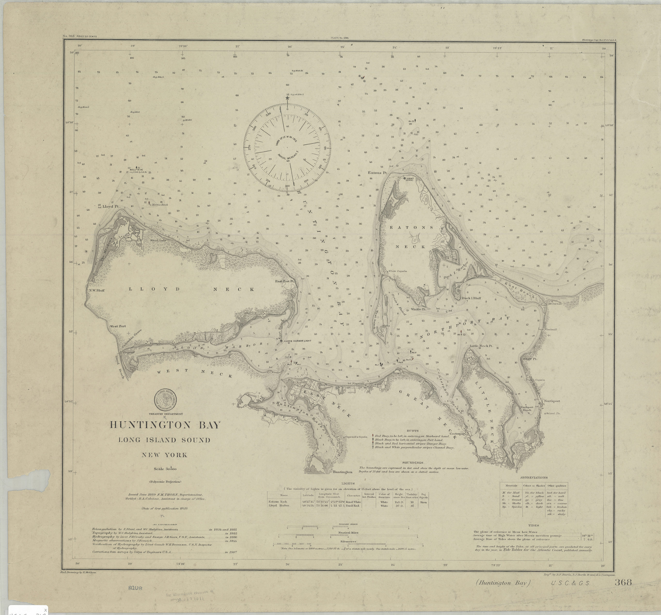
Creator
U.S. Coast and Geodetic Survey,Publisher
Brooklyn Historical SocietyCitation
Huntington Bay, Long Island Sound, New York: U.S. Coast and Geodetic Survey ; red. drawing by E. Molkow; 1889, Map Collection, U.S.C.S.-368.Fl; Brooklyn Historical Society.Scale
Scale 1:30,000