I [heart symbol] NY: Division of Tourism, New York State Department of Commerce [1987]
Map No. NYS-[1987].Fl
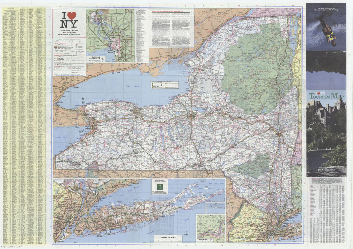
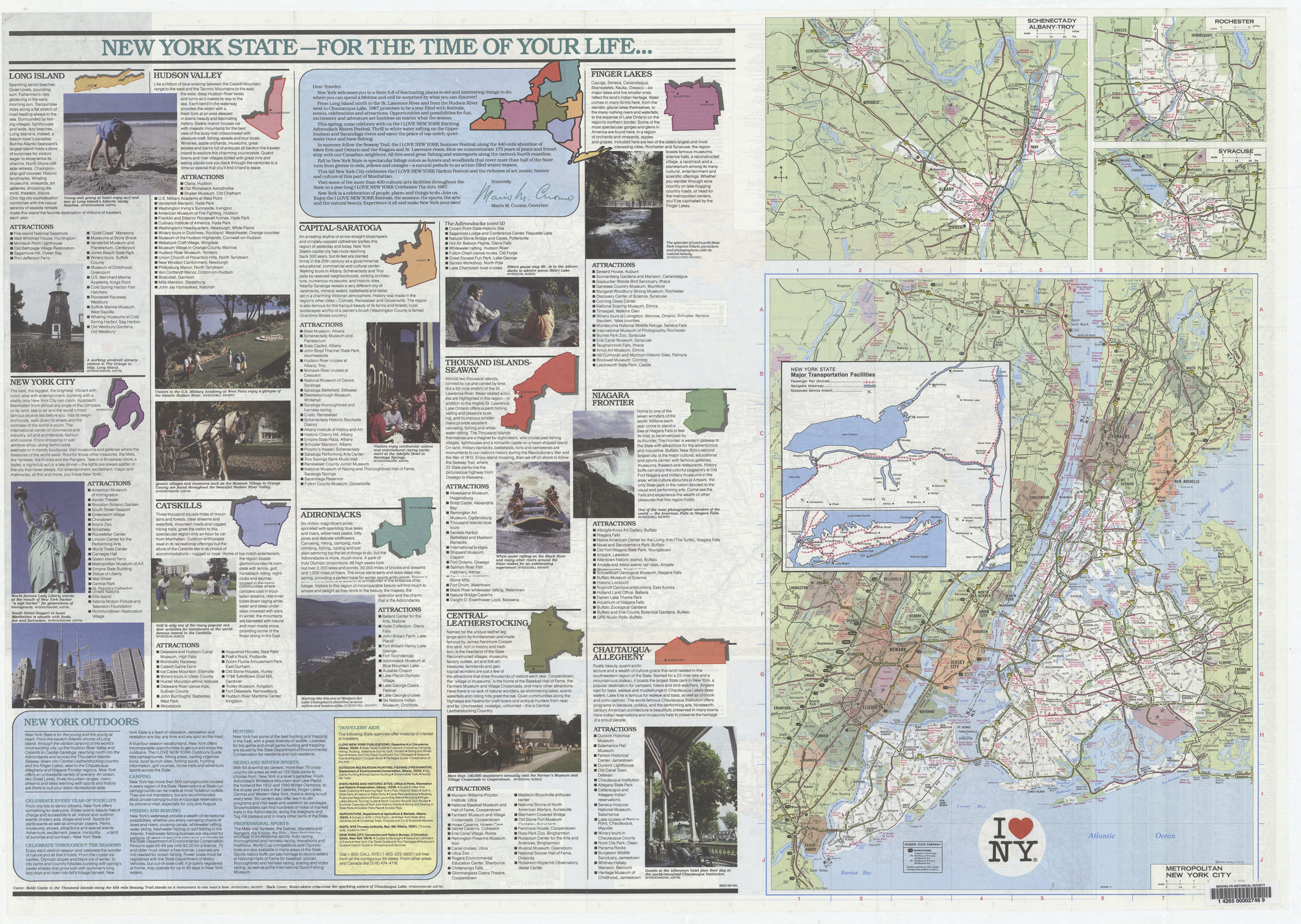
Road map of New York State with insets of metropolitan areas. Copyight: Rand McNally & Co. Relief indicated by spot heights. Includes text, indexes, distance table, insets of Buffalo-Noagra Falls, Long Island, Fishers Island, and Bighamton, and col. ill. On verso: text, tourist information, indexes, state map of tourism regions, metropolitan area route maps for Schenectady-Albany-Troy, Rochester, Syracuse and Metropolitan New York City, inset map of New York State major transportation facilities, and col. ill. “876604-20.”
Map area shown
Relation
Full catalog recordSize
65 × 91 cmDownload
Low Resolution Image
Creator
Rand McNally and Company,Publisher
Brooklyn Historical SocietyCitation
I [heart symbol] NY: Division of Tourism, New York State Department of Commerce; [1987], Map Collection, NYS-[1987].Fl; Brooklyn Historical Society.Scale
Scale [ca. 1:868,032]Loading zoom image...