Information for visitors to Federal Reserve Bank of New York [1956-1966]
Map No. M-[1956?].Fl
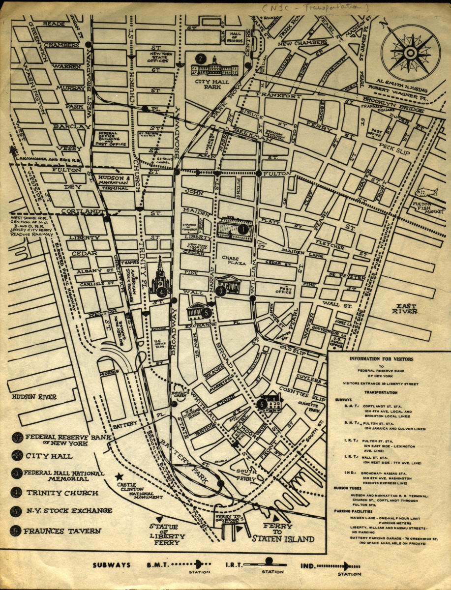
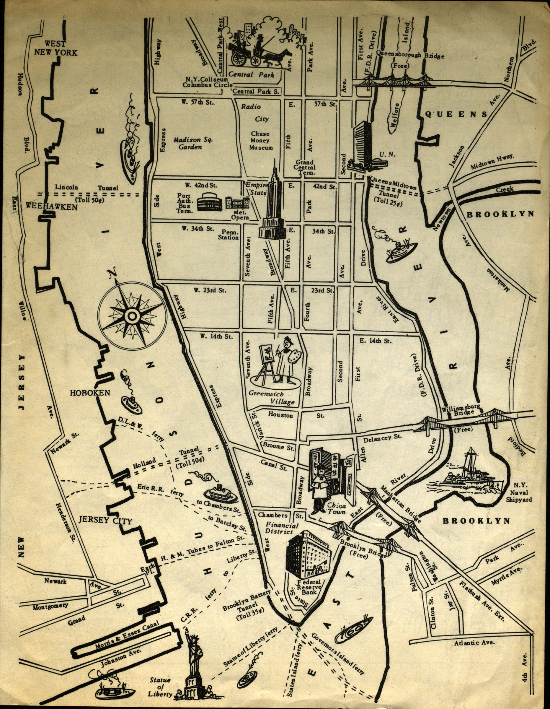
Pictorial tourist map covering lower Manhattan South of Reade Street and North of the Staten Island Ferry, portions of Brooklyn, New Jersey and Queens. Shows subways, Hudson Tubes and parking facilities. Includes index of points of interest.
Map area shown
Relation
Full catalog recordSize
27 × 21 cmDownload
Low Resolution Image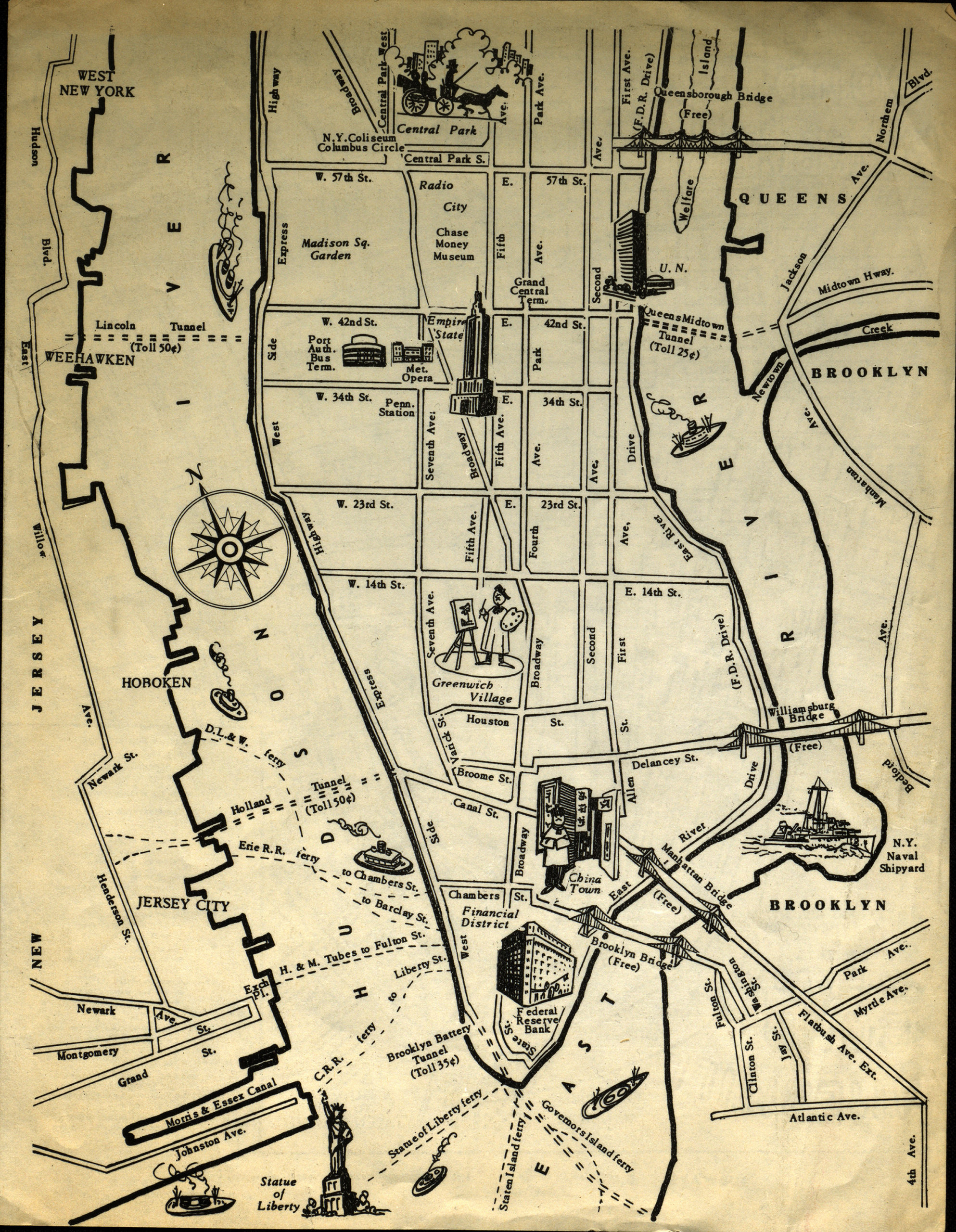
Creator
Federal Reserve Bank of New York, Federal Reserve Bank of New York,Publisher
Brooklyn Historical Society, Brooklyn Historical SocietyCitation
Information for visitors to Federal Reserve Bank of New York; [1956-1966], Map Collection, M-[1956?].Fl; Brooklyn Historical Society.Scale
Scale not givenLoading zoom image...