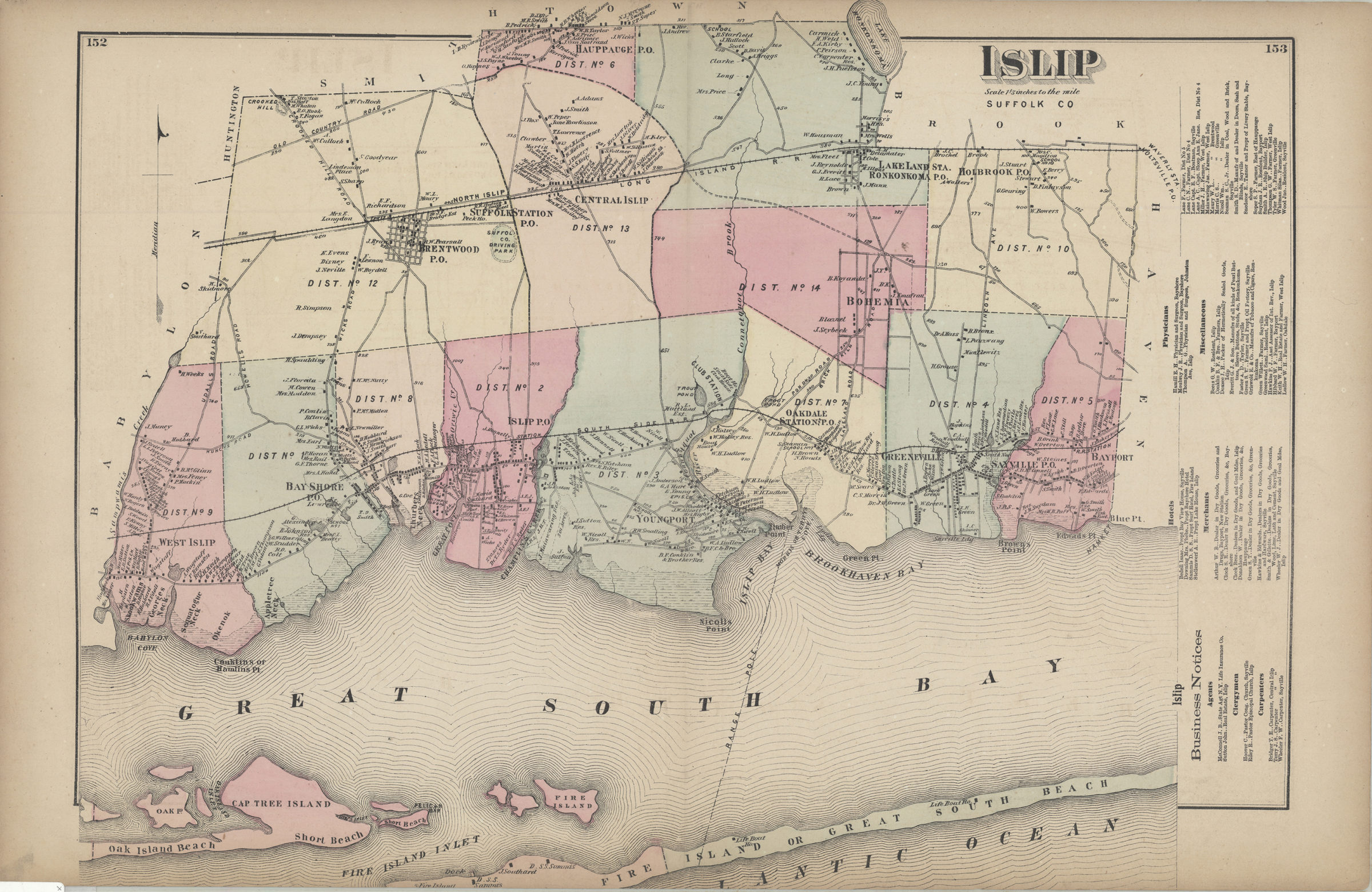
Islip, Suffolk County [1873]
Map No. L.I.-[1873]p.Fl
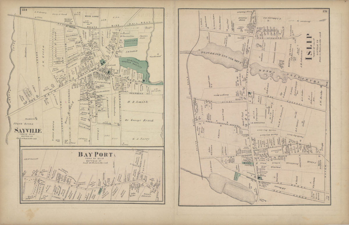
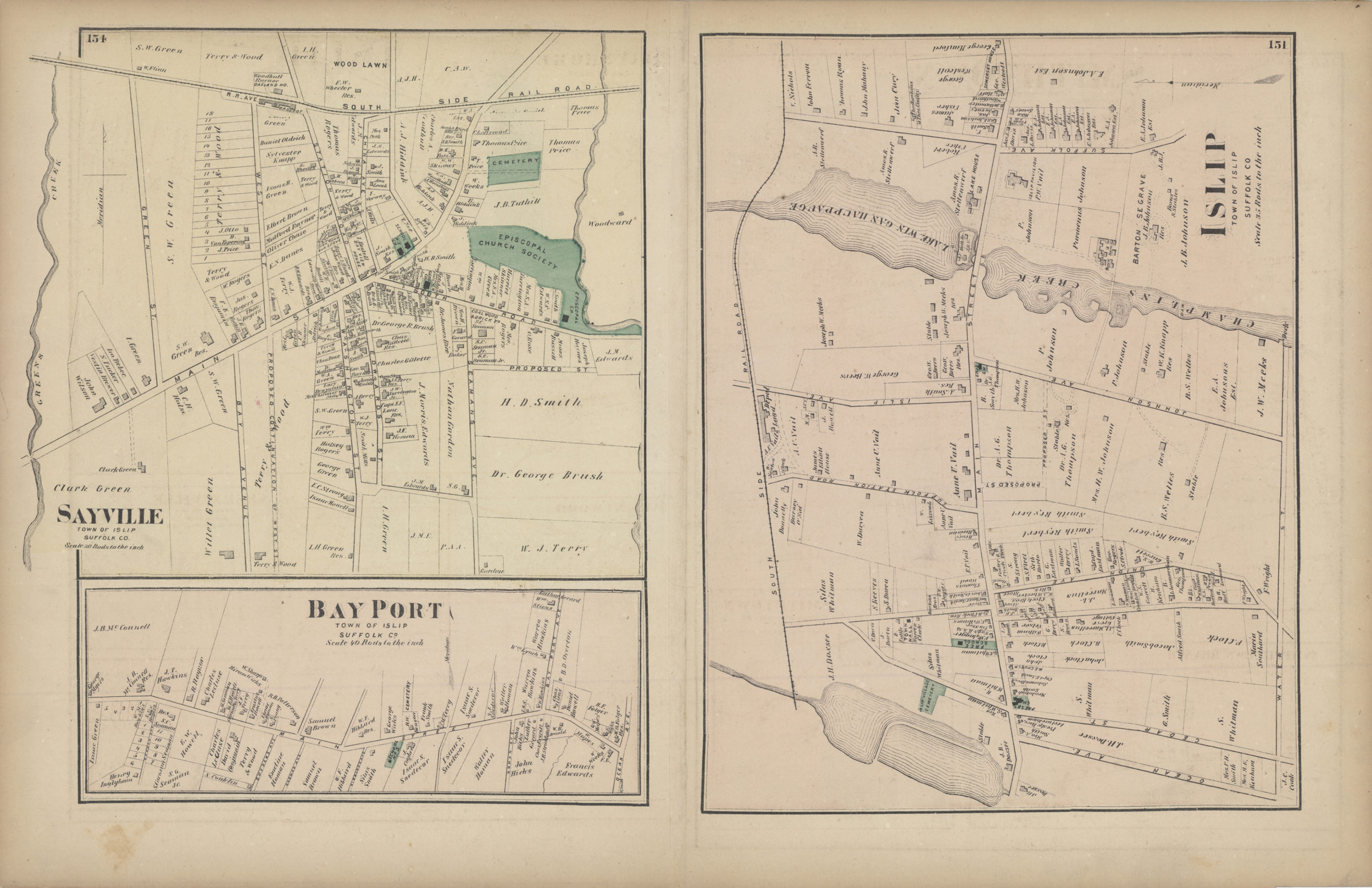
Cadastral map. Shows property (including buildings), names of landowners, administrative divisions, and railroads. Extracted from: Atlas of Long Island, New York. New York : Beers, Comstock & Cline, 1873, p. 151-154. Includes Islip business notices. On verso: 3 ancillary maps. Ancillary maps: Sayville, town of Islip, Suffolk Co. (Scale [1:5,940]. 30 rods to the in.) — Islip, town of Islip, Suffolk Co. (Scale [1:6,930]. 35 rods to the in.) — Bay Port, town of Islip, Suffolk Co. (Scale [1:7,920]. 40 rods to the in.).
Map area shown
Genre
Cadastral mapsRelation
Full catalog recordSize
40 × 54 cmDownload
Low Resolution Image
Creator
Beers, F. W.; Beers, Comstock & Cline,Publisher
Brooklyn Historical SocietyCitation
Islip, Suffolk County; [1873], Map Collection, L.I.-[1873]p.Fl; Brooklyn Historical Society.Scale
Scale [1:52,800] 1 1/5 inLoading zoom image...