Jamaica, Long Island, N.Y. [ca. 1895]
Map No. Q-1895.Fl
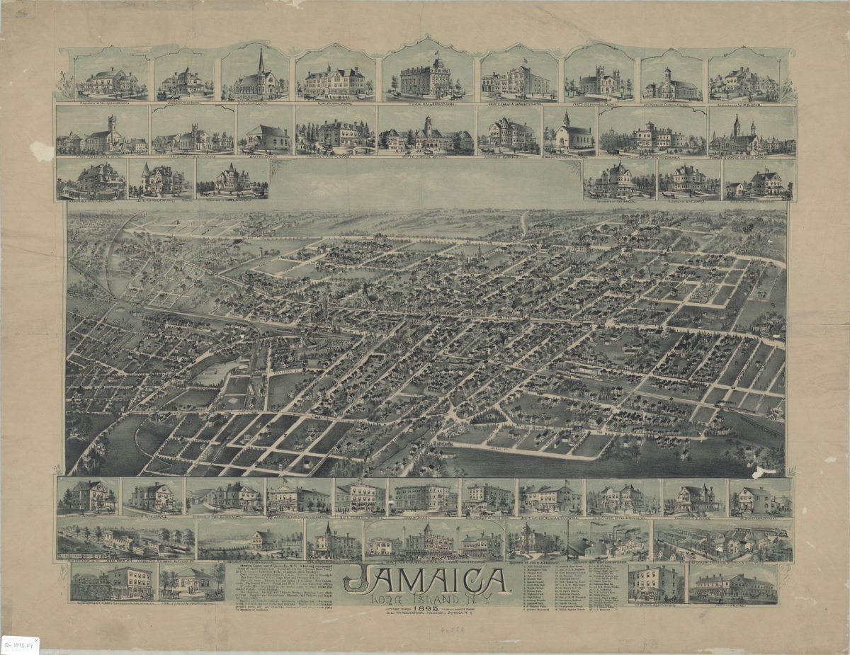
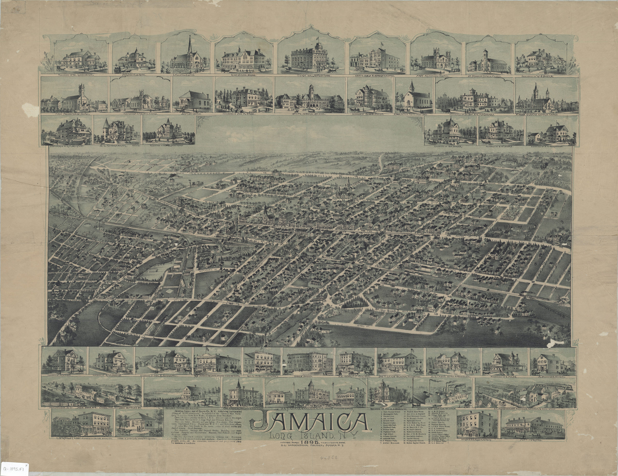
Pictorial map. Relief shown pictorially. Includes text, ill. (primarily of residences), and index to churches, schools, parks, and businesses.
Map area shown
Genre
Pictorial mapsRelation
Full catalog recordSize
54 × 68 cmDownload
Low Resolution Image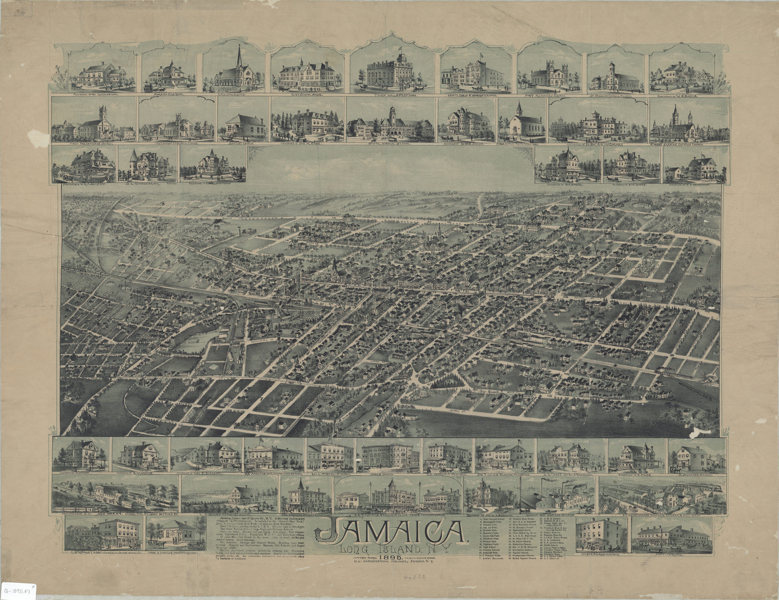
Creator
Hardenbrook, D. L.; O.H. Bailey & Co.,Publisher
Brooklyn Historical SocietyCitation
Jamaica, Long Island, N.Y.; [ca. 1895], Map Collection, Q-1895.Fl; Brooklyn Historical Society.Scale
Scale not givenLoading zoom image...