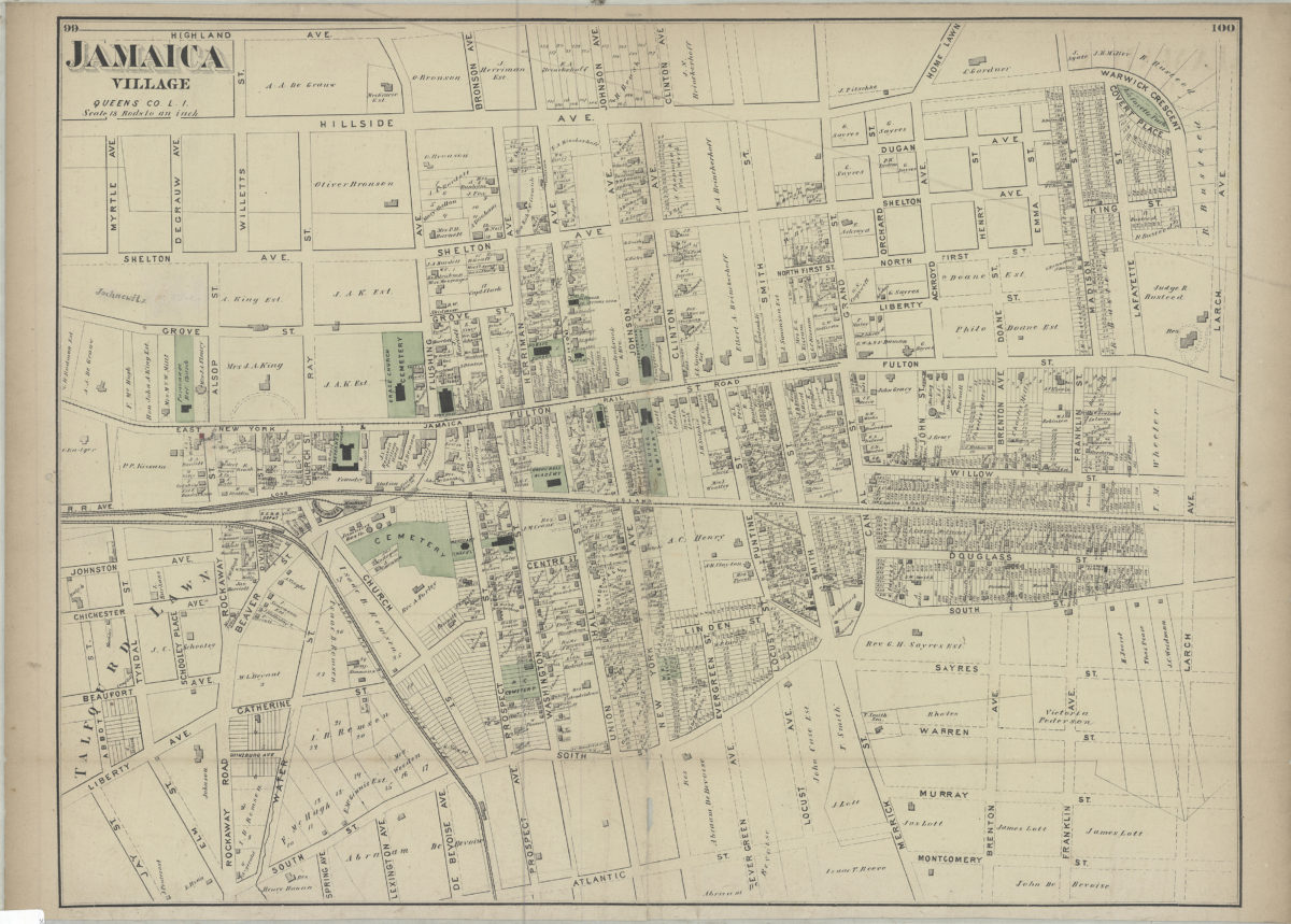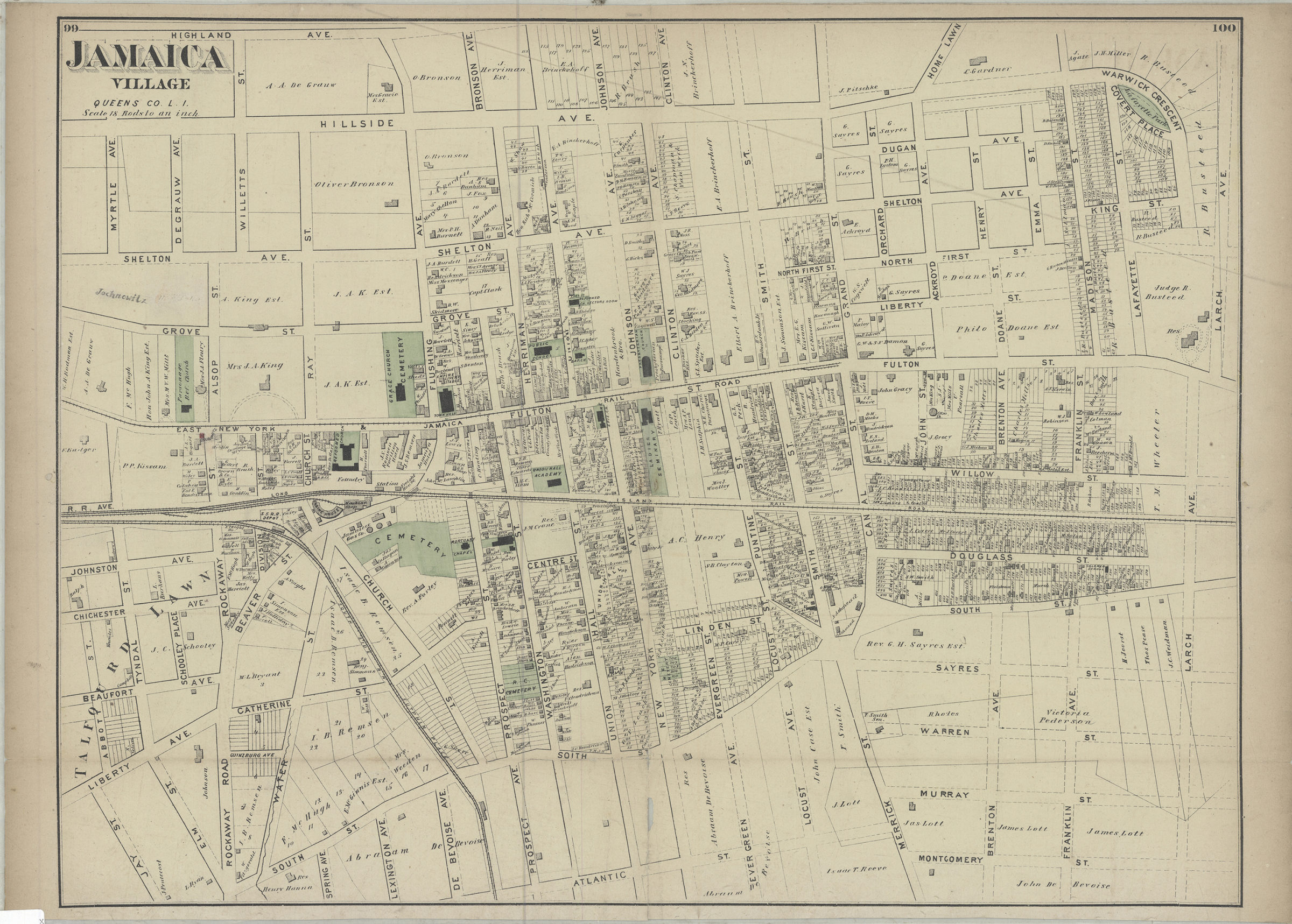
Jamaica Village, Queens Co., L.I. [1873]
Map No. Q-[1873]p.Fl
Cadastral map. Covers area north from Atlantic St. to Highland Ave. and east from Abbot St. to Larch Ave. Shows lot numbers, buildings, names of landowners, and railroads. Extracted from: Atlas of Long Island, New York. New York : Beers, Comstock & Cline, 1873, p. 99-100.
Map area shown
Genre
Cadastral mapsRelation
Full catalog recordSize
42 × 57 cmDownload
Low Resolution Image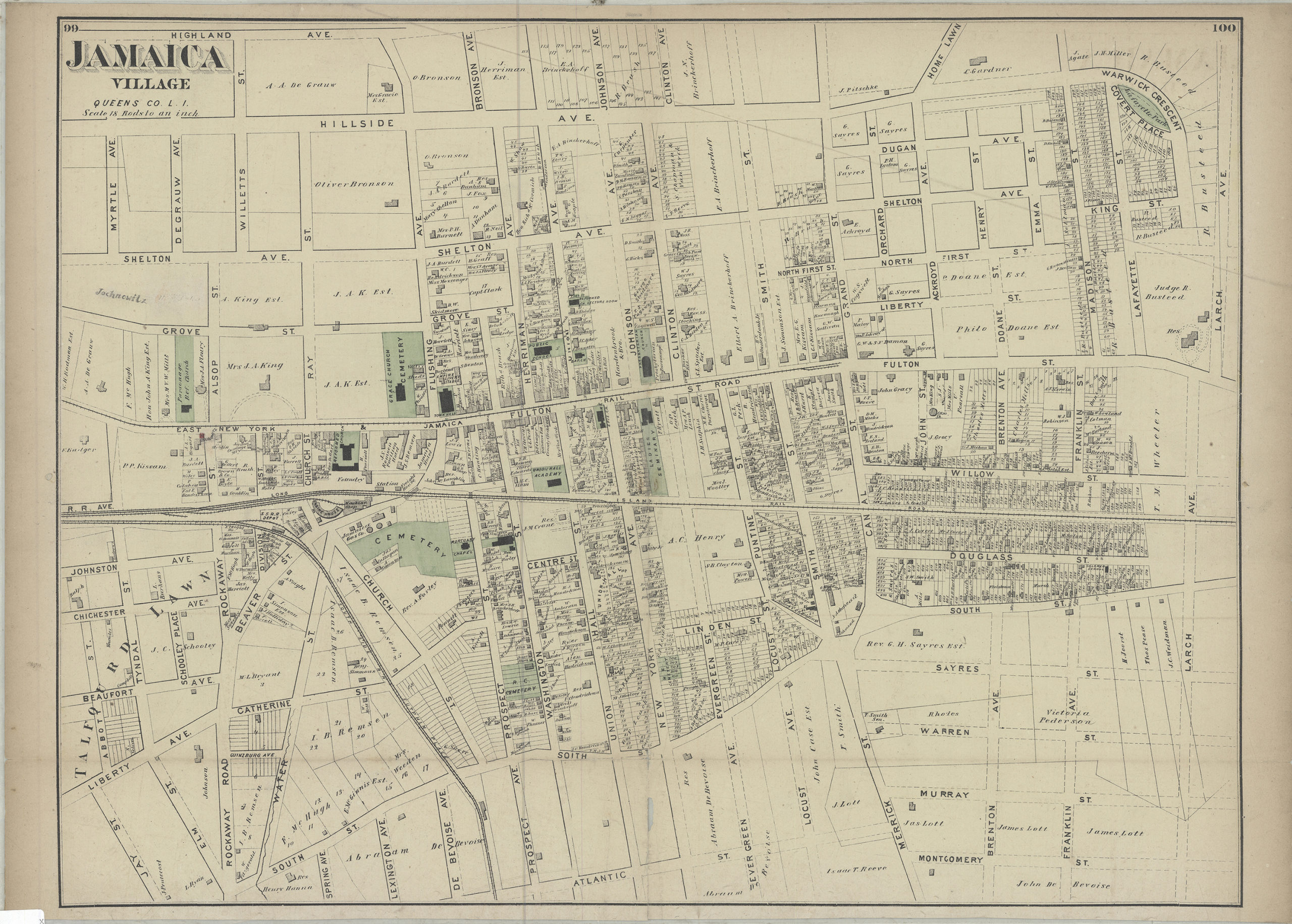
Creator
Beers, F. W.; Beers, Comstock & Cline,Publisher
Brooklyn Historical SocietyCitation
Jamaica Village, Queens Co., L.I.; [1873], Map Collection, Q-[1873]p.Fl; Brooklyn Historical Society.Scale
Scale [1:1,584] 1 in to 1Loading zoom image...