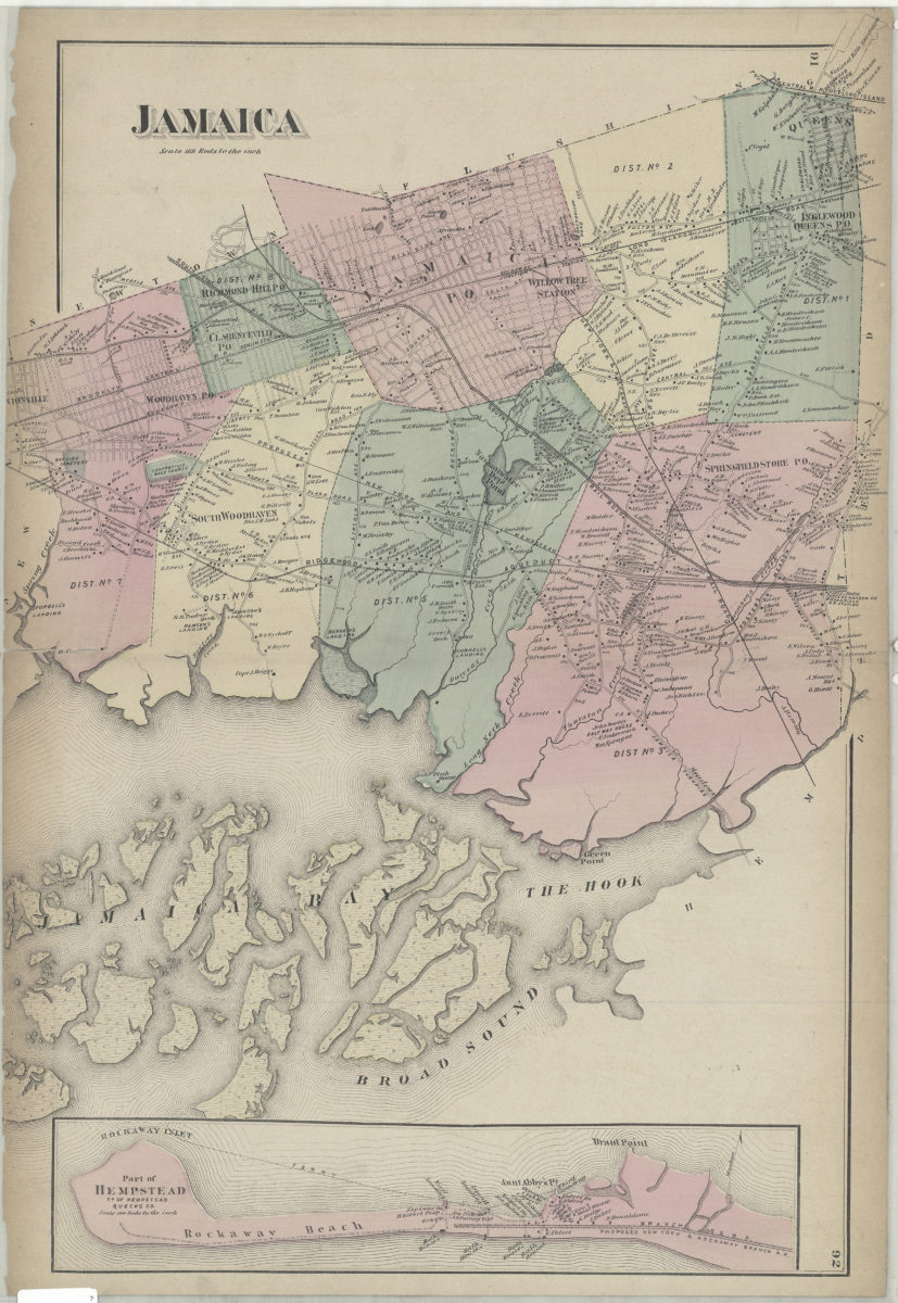
Jamaica [1873]
Map No. Q-[1873]f.Fl
Cadastral map. Shows names of landowners, railroads, districts, and the Ridgewood Aqueduct. Extracted from: Atlas of Long Island, New York. New York : Beers, Comstock & Cline, 1873, p. 91-92. Includes inset continuation: Part of Hempstead, tn. of Hempstead, Queens Co. (Scale [1:31,680]. 160 rods to the in.).
Map area shown
Genre
Cadastral mapsRelation
Full catalog recordSize
58 × 40 cmDownload
Low Resolution Image
Creator
Beers, F. W.; Beers, Comstock & Cline,Publisher
Brooklyn Historical SocietyCitation
Jamaica; [1873], Map Collection, Q-[1873]f.Fl; Brooklyn Historical Society.Scale
Scale [1:31,680] 1 in toLoading zoom image...