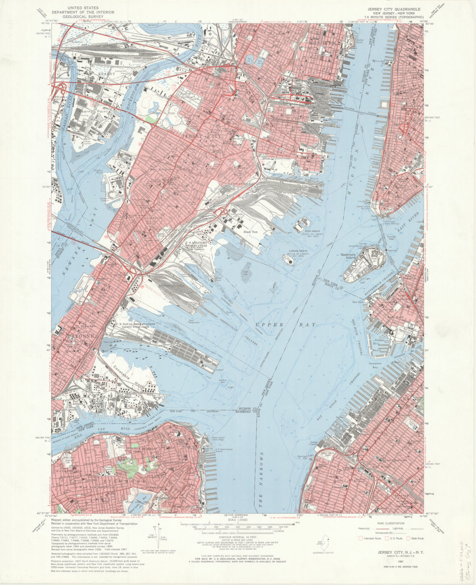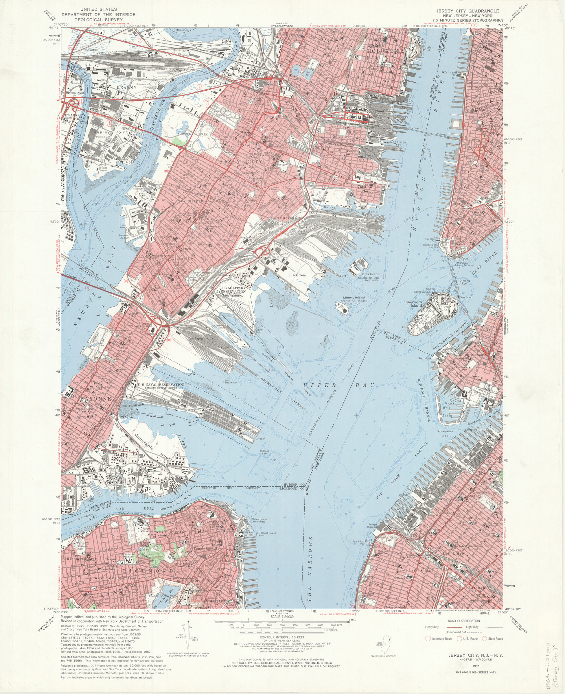
Jersey City quadrangle, New Jersey – New York: mapped, edited, and published by the Geological Survey ; revised in cooperation with New York Dept. of Transportation 1967
Shows a portion of Hudson County in New Jersey and portions of Staten Island, Brooklyn, and Manhattan. Relief shown by contours and spot heights. Depths shown by soundings and isolines. “Planimetry by photogrammetric methods and from USC & GS Charts T-5111, T-5277, T-5332, T-5450, T-5453, T-5454, T-5460, T-5461, T-5466, T-5468, T-5469, and T-5470. Topography by photogrammetric methods from aerial photographs taken 1954 and planetable surveys 1955. Revised from aerial photographs taken 1966. Field checked 1967.” “Select hydrographic data compiled from USC & GS charts 285, 287, 541 and 745 (1966). This information is not intended for navigational purposes.” Includes quadrangle location map, metric coversion scales, and decliantion diagram. “AMS 6165 II NE – Series V822.”
Places
Map area shown
Genre
Topographic mapsRelation
Full catalog recordSize
68 × 55 cmDownload
Low Resolution Image
Creator
Geological Survey (U.S.),Publisher
Brooklyn Historical SocietyCitation
Jersey City quadrangle, New Jersey – New York: mapped, edited, and published by the Geological Survey ; revised in cooperation with New York Dept. of Transportation; 1967, Map Collection, USGS-1:24,000 (Jersey City).Fl; Brooklyn Historical Society.Scale
Scale 1:24000