Joan Vingboom’s map 1639 [19??]
Map No. NYC-1639 (19--?).Fl
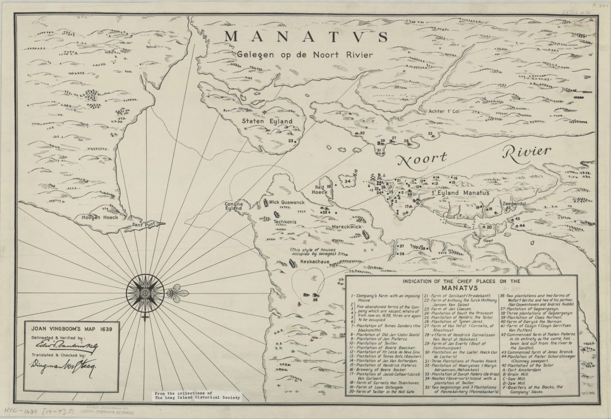
Facsimile of a manuscript map from 1639. Covers the New York City region. Shows buildings, names of landowners, and points of interest. Relief shown pictorially. Depths shown by soundings. “Delineated & Verified by: … [signature illegible] Translated & checked by … [signature illegible].” Oriented with north to the right. Includes index.
Map area shown
Relation
Full catalog recordSize
32 × 49 cmDownload
Low Resolution Image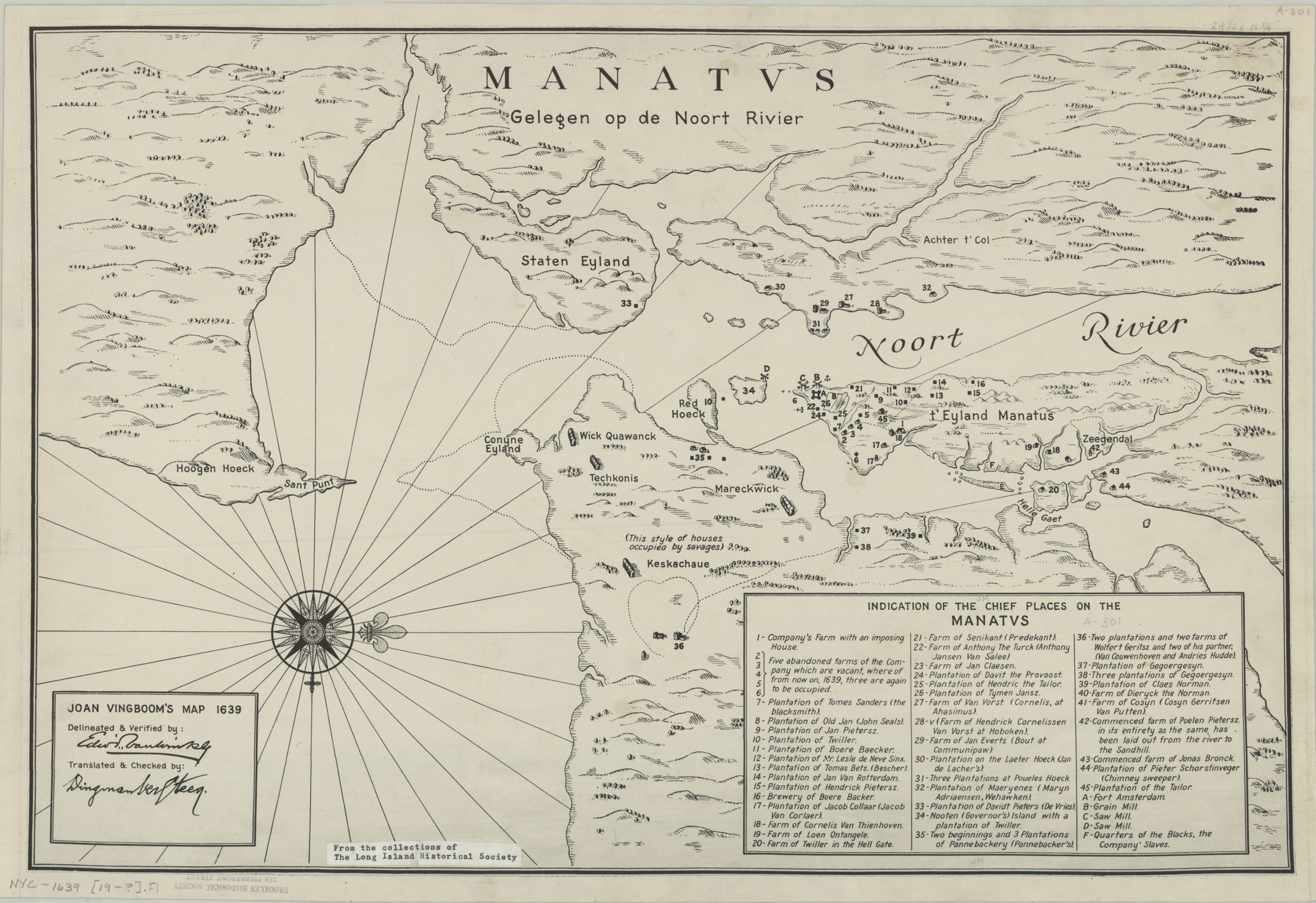
Creator
Vinckeboons, Joan,Publisher
Brooklyn Historical SocietyCitation
Joan Vingboom’s map 1639; [19??], Map Collection, NYC-1639 (19--?).Fl; Brooklyn Historical Society.Scale
Scale not givenLoading zoom image...