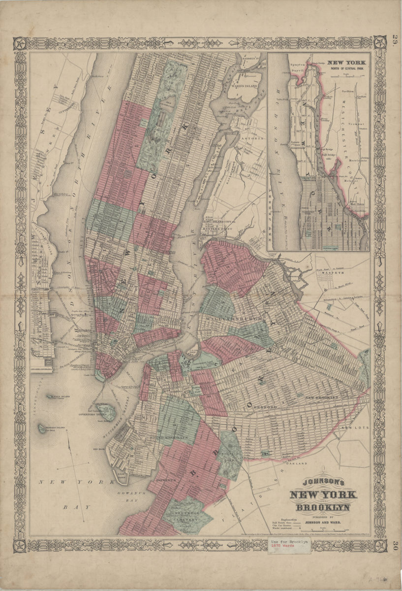
Johnson’s New York and Brooklyn [1866]
Covers the entirety of Manhattan also covers Randel’s Island, Ward’s Island, Blackwells Island, Ellis Island, Bedloes Island, and Governors Island as well as portions of the South Bronx, southern Queens, and eastern New Jersey. Covers Brooklyn north from approximately 46th St. to Green Point and east to the Cemetery of the Evergreens minimally details portions of Flatbush and New Lots. Shows wards, railroads, city car routes, and ferry lines. Extracted from unknown atlas. “Entered according to Act of Congress in the Year 1866 by A.J. Johnson in the Clerks Office of the District Court of the United States for the Southern District of New York.” Includes key, inset continuation map, and decorative border. Inset continuation map: New York north of Central Park. “29”–Upper right corner of recto. “30”–Lower right corner of recto.
Map area shown
Genre
MapRelation
Full catalog recordSize
55 × 39 cmDownload
Low Resolution Image
Creator
Johnson, A. J.,Publisher
Brooklyn Historical SocietyCitation
Johnson’s New York and Brooklyn; [1866], Map Collection, B A-[1866].Fl; Brooklyn Historical Society.Scale
Scale [ca. 1:32,183]