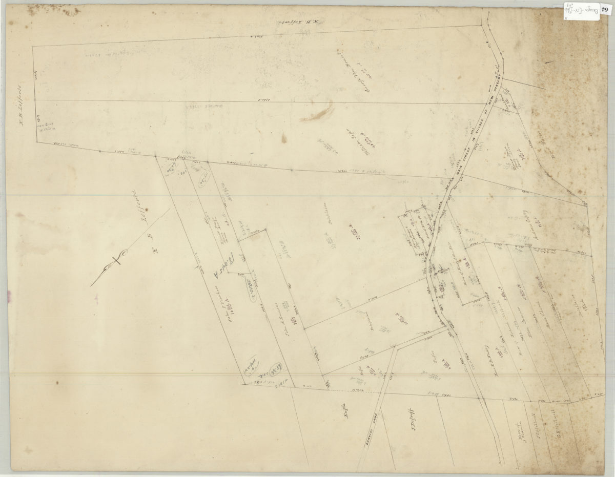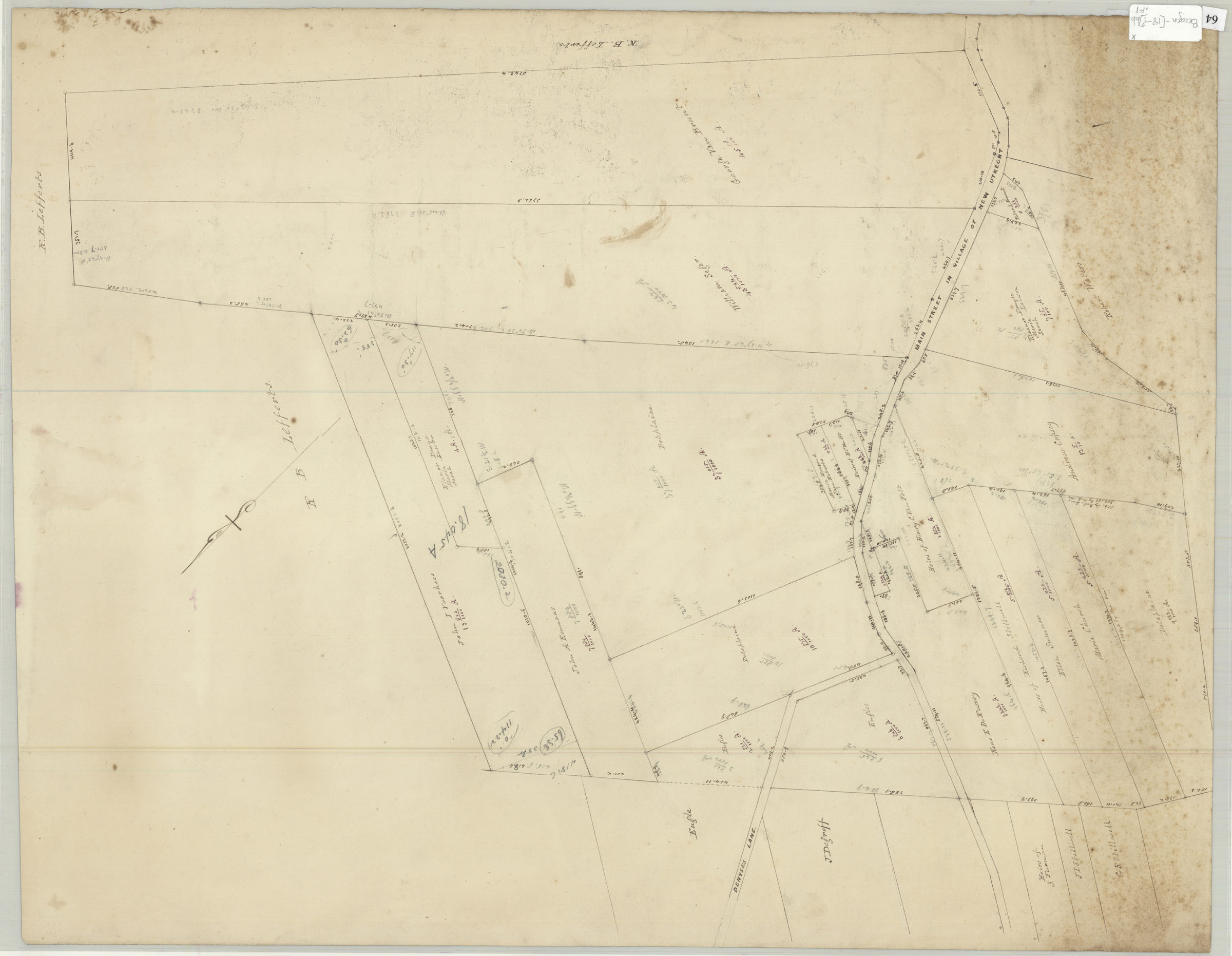
Land of G. Van Brunt, Sieger, Delaplaine, A. Cropsey & c [18??]
Map No. Bergen-[18--?]bb.Fl
Cadastral survey map covering area along Main Street in the village of New Utrecht near Denyses Lane in modern-day Bay Ridge. Showing property (including dimensions) and names of landowners. Verso title. Attributed to Teunis G. Bergen, based on handwriting on piece. Oriented with north to the upper right.
Map area shown
Relation
Full catalog recordSize
50 × 63 cmDownload
Low Resolution Image
Creator
Bergen, Teunis G.,Publisher
Brooklyn Historical SocietyCitation
Land of G. Van Brunt, Sieger, Delaplaine, A. Cropsey & c; [18??], Map Collection, Bergen-[18--?]bb.Fl; Brooklyn Historical Society.Scale
Scale not givenLoading zoom image...