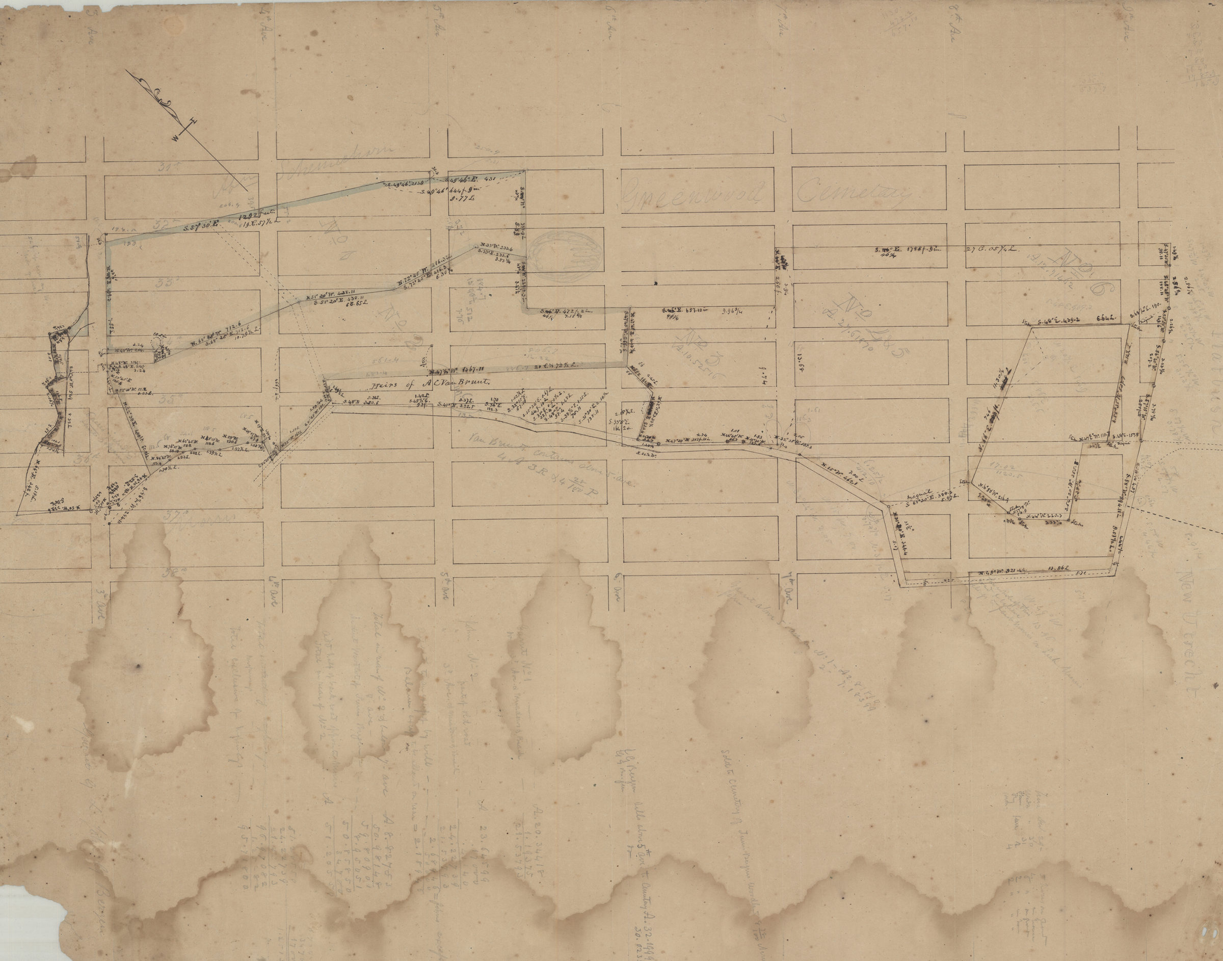

Land of John G. & Garret G. Bergen [185?]
Map No. Bergen-[185-?]f.Fl
Cadastral map covering area bounded by 3rd Ave., 38th St., 9th Ave. and 31st St. (modern-day Sunset Park, including what is now Greenwood Cemetery). Shows property and names of landowners. Verso title. Likely attributed to T.G. Bergen, based on handwriting on piece. Oriented with north to the upper left. Includes notes and calculations
Map area shown
Relation
Full catalog recordSize
56 × 71 cmDownload
Low Resolution Image
Creator
Bergen, Teunis G., Bergen, Teunis G.,Publisher
Brooklyn Historical Society, Brooklyn Historical SocietyCitation
Land of John G. & Garret G. Bergen; [185?], Map Collection, Bergen-[185-?]f.Fl; Brooklyn Historical Society.Scale
Scale not givenLoading zoom image... 