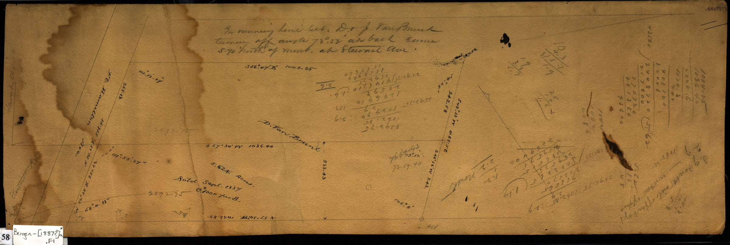
Line between D. & J. Van Brunt [1887]
Map No. Bergen-[1887?]a.Fl
Cadastral survey map of area along Fort Hamilton Avenue near Stewart Avenue in modern-day Bay Ridge. Shows measurements and property lines. Attributed to Van Brunt Bergen, based on handwriting on piece. “Sold Sept. 1887.” Includes calculations. Area covered identical to: Property of D. Van Brunt, Sept. 1887, from surveys of T.G. Bergen / V. B. Bergen, C.E. (Bergen-1887b.Fl ), also held by BHS.
Map area shown
Relation
Full catalog recordSize
18 × 55 cmDownload
Low Resolution Image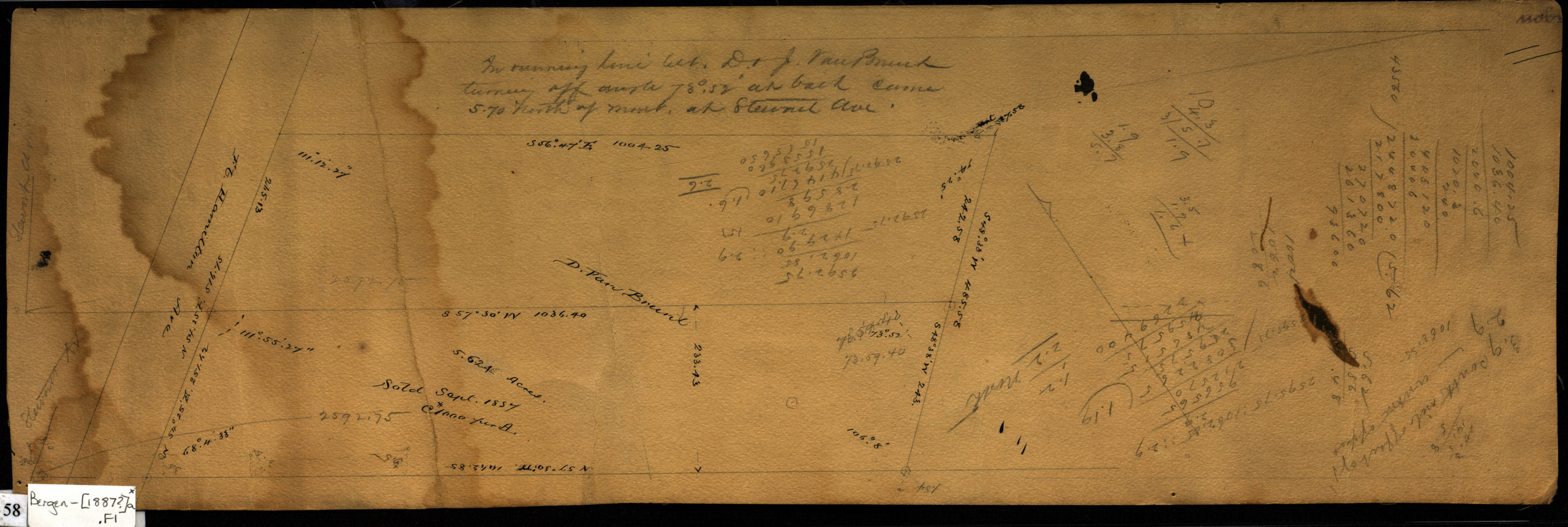
Creator
Bergen, Van Brunt,Publisher
Brooklyn Historical SocietyCitation
Line between D. & J. Van Brunt; [1887], Map Collection, Bergen-[1887?]a.Fl; Brooklyn Historical Society.Scale
Scale not givenLoading zoom image... 