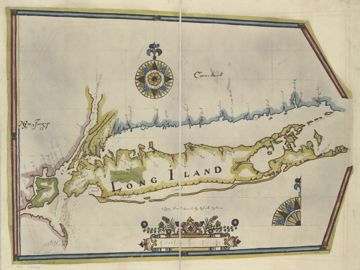
Long Iland sirvaide: by Robartt [sic] Ryder 1949
Map No. L.I.-1675 (1949).Fl
Facsimile. Also covers the New York Metropolitan Area. Depths shown by soundings. “From the manuscript original (drawn about 1675) in the John Carter Brown Library, 1949.” From the Blathwayt Atlas. “Reproduced in collotype by the Meriden Gravure Company.” Accompanied by 4 p. of text: Map of Long Island by Robert Ryder, of about 1675. Meriden, Conn. : Meriden Gravure Co., 1950. Irregularly shaped. Includes decorative border, cartouche, and 2 compass roses. BHS does not have accompanying text.
Places
Map area shown
Genre
Historical mapsRelation
Full catalog recordSize
56 × 77 cmDownload
Low Resolution Image
Creator
Ryder, Robart,Publisher
Brooklyn Historical SocietyCitation
Long Iland sirvaide: by Robartt [sic] Ryder; 1949, Map Collection, L.I.-1675 (1949).Fl; Brooklyn Historical Society.Scale
Scale [ca. 1:266,780]Loading zoom image...