Long Island City, Queens Co., L.I. [1873]
Map No. Q-[1873]n.Fl
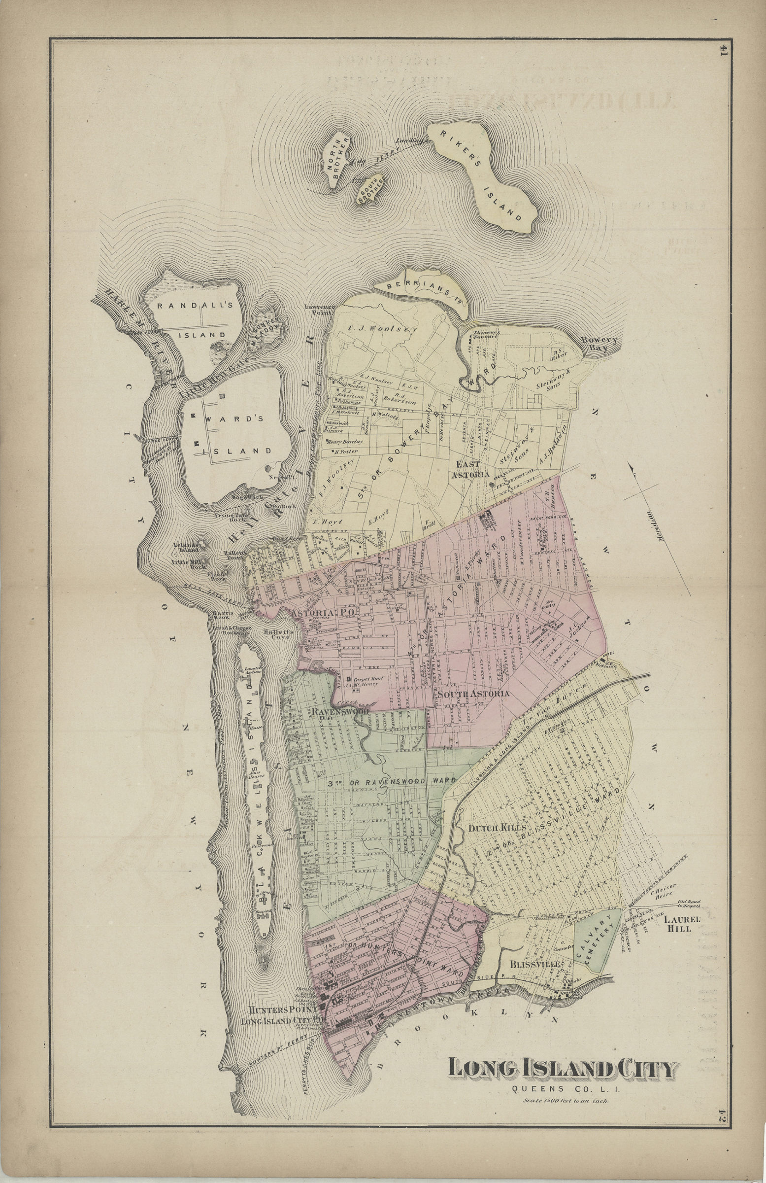
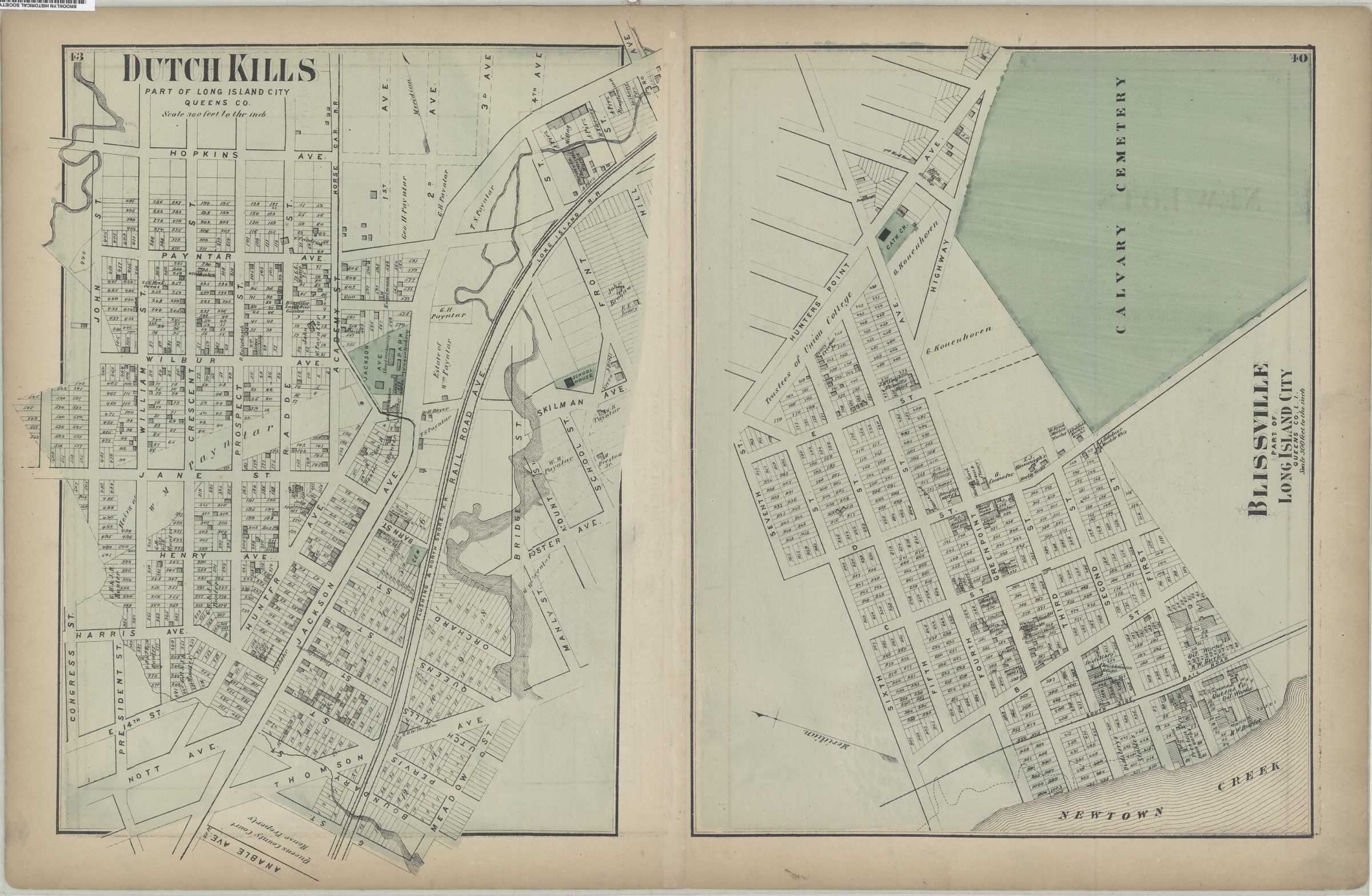
Cadastral map. Shows property (including lot numbers and buildings), names of landowners, administrative divisions, and railroads. Extracted from: Atlas of Long Island, New York. New York : Beers, Comstock & Cline, 1873, p. 40-43. On verso: 2 ancillary maps. Ancillary maps: Dutch Kills, part of Long Island City, Queens Co. (Scale [1:3,600]. 300 ft. to the in.) — Blissville, part of Long Island City, Queens Co., L.I. (Scale [1:3,600]. 300 ft. to the in.).
Map area shown
Genre
Cadastral mapsRelation
Full catalog recordSize
57 × 36 cmDownload
Low Resolution Image
Creator
Beers, F. W.; Beers, Comstock & Cline,Publisher
Brooklyn Historical SocietyCitation
Long Island City, Queens Co., L.I.; [1873], Map Collection, Q-[1873]n.Fl; Brooklyn Historical Society.Scale
Scale [1:18,000] 1 in toLoading zoom image... 