
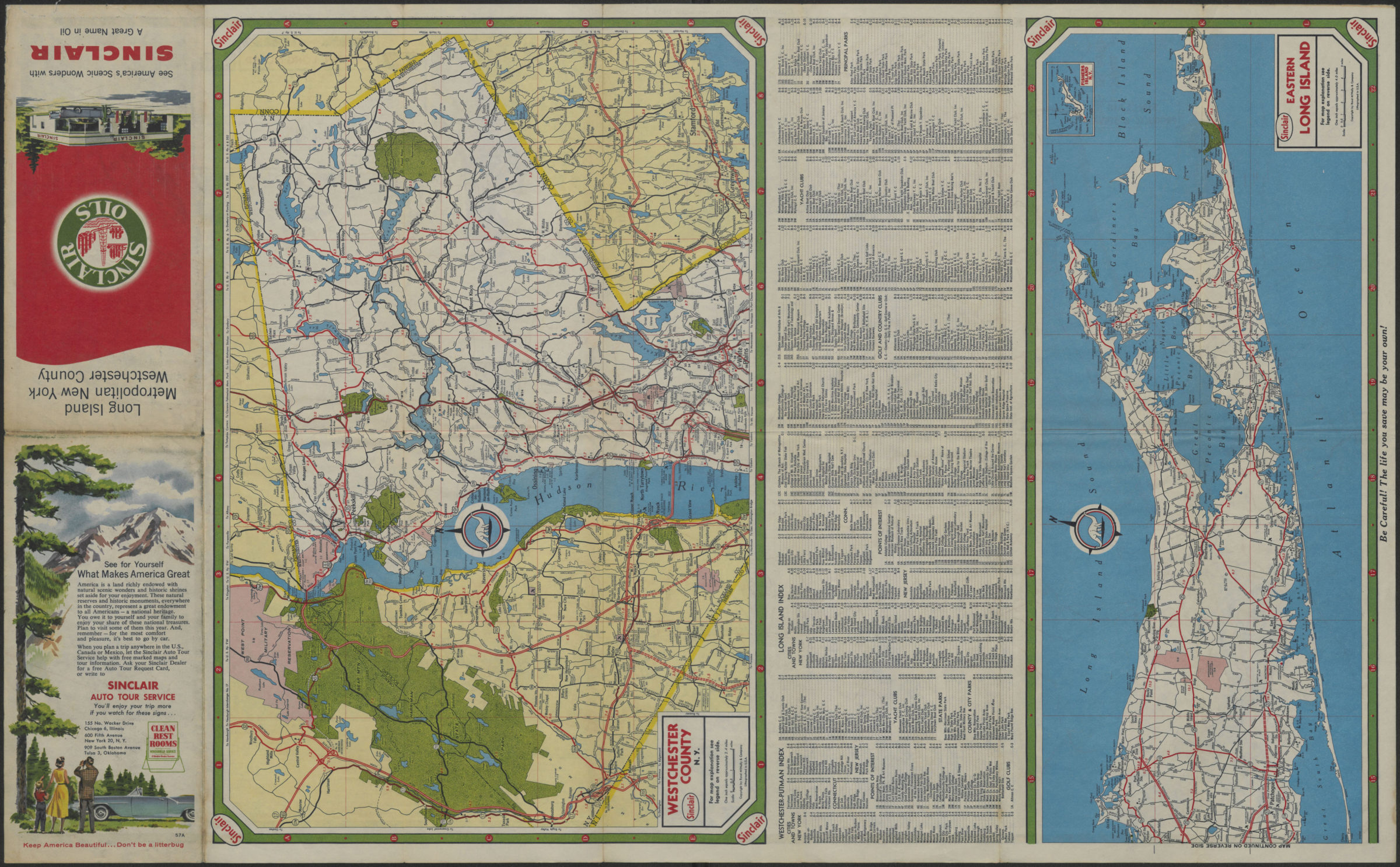
Long Island, Metropolitan New York, Westchester County [1957]
Map No. L.I.-[1957].Fl
Road maps covering western Long Island and part of New York and New Jersey, Westchester County, and eastern Long Island. Copyight: Rand McNally & Co. Relief shown by spot heights. Panel title. Includes text, indexes, lists of Greater New York ferries, bridges, tunnels and parkways, Great South Bay ferries, and radio stations. Distributed by Sinclair. “57A” Western Long Island. Westchester County. Eastern Long Island.
Map area shown
Genre
Road mapsRelation
Full catalog recordSize
46 × 74 cmDownload
Low Resolution Image
Creator
Rand McNally and Company,Publisher
Brooklyn Historical SocietyCitation
Long Island, Metropolitan New York, Westchester County; [1957], Map Collection, L.I.-[1957].Fl; Brooklyn Historical Society.Scale
Scales differLoading zoom image... 