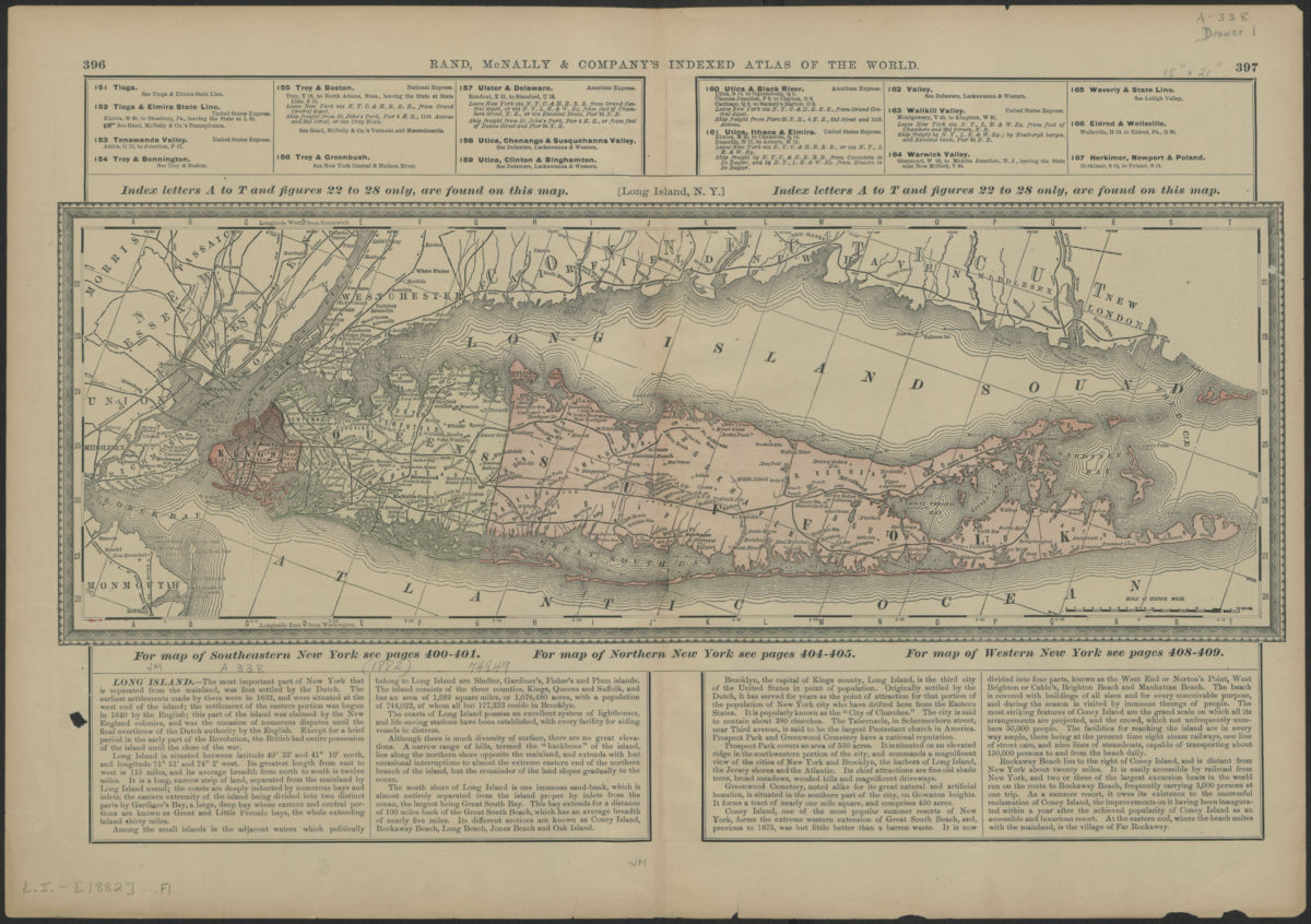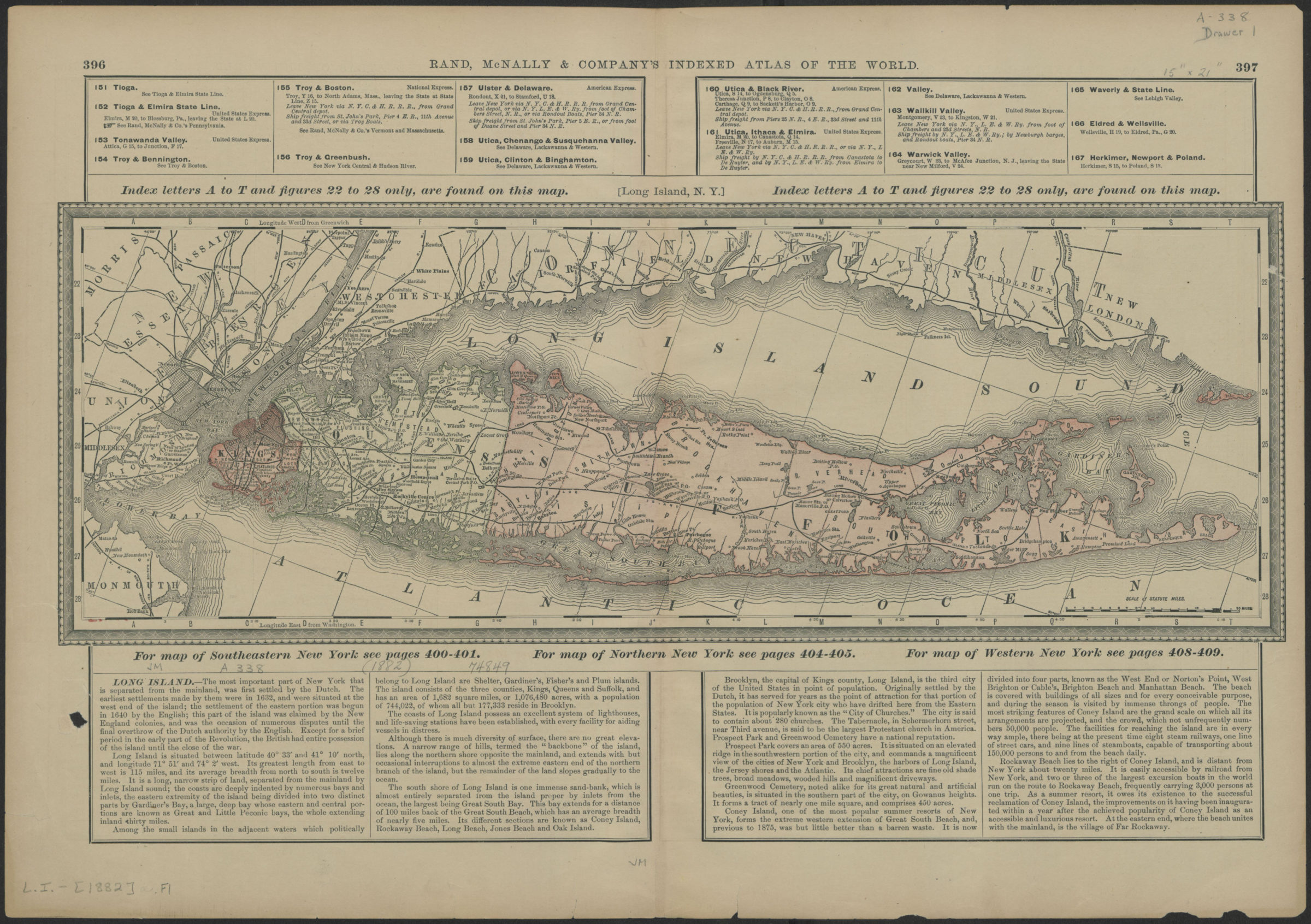
Long Island, N.Y. [1882]
Also covers New York City, Long Island Sound, and portions of eastern New Jersey and the southern coast of Connecticut. Likely extracted from: Rand McNally and Company. Indexed atlas of the world : containing large scale maps of every country and civil division upon the face of the globe : together with historical, statistical and descriptive matter relative to each. 5th ed. Chicago, Ill. : Rand McNally, 1882. Includes decorative border, unrelated index, and text. Keyed to index no relevant index present. On verso: Index unrelated to main map and text concerning New York counties, islands, lakes, rivers, and towns. “396”–Upper left margin of recto. “397”–Upper right margin of recto. “398”–Upper left margin of verso. “395”–Upper right margin of verso.
Places
Map area shown
Genre
Statistical mapsRelation
Full catalog recordSize
38 × 54 cmDownload
Low Resolution Image
Creator
Rand McNally and Company,Publisher
Brooklyn Historical SocietyCitation
Long Island, N.Y.; [1882], Map Collection, L.I.-[1882].Fl; Brooklyn Historical Society.Scale
Scale [ca. 1:450,560]