

Long Island, New York City & metro area counties: [prepared for] Texaco 1975
Map No. NYS-1975.Fl
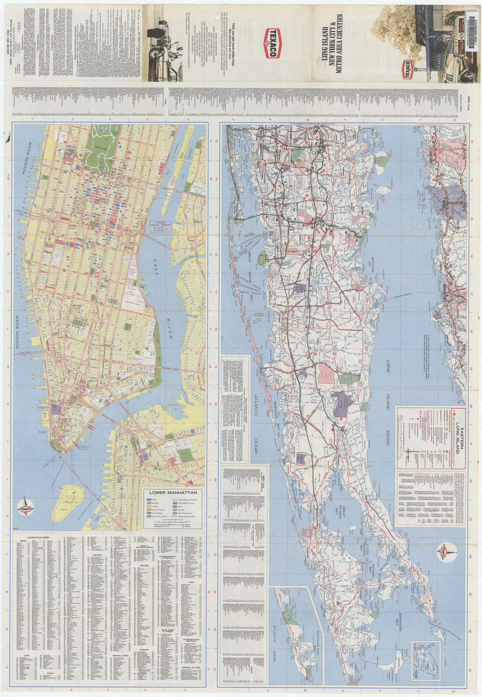
Panel title. “746501-5.” “746904-5.” “746905-5.” Includes indexes, inset map of Fishers Island and Montauk region, mileage log, and notes on greater New York ferries, bridges, tunnels, and toll roads. New York City. Lower Manhattan. Eastern Long Island.
Subjects
Places
Map area shown
Genre
Transportation mapsRelation
Full catalog recordSize
93 × 65 cmDownload
Low Resolution Image
Creator
Rand McNally and Company,Publisher
Brooklyn Historical SocietyCitation
Long Island, New York City & metro area counties: [prepared for] Texaco; 1975, Map Collection, NYS-1975.Fl; Brooklyn Historical Society.Scale
Scale differsLoading zoom image... 