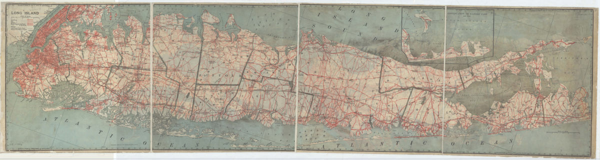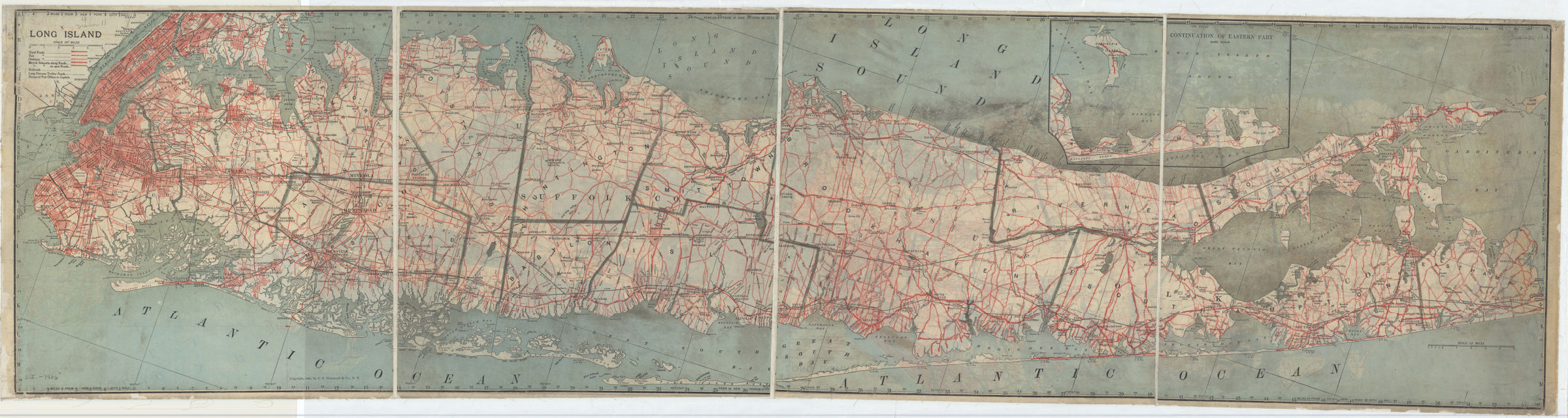
Long Island [ca. 1906]
Map No. L.I.-1906.Fl
Covers Long Island east to East Hampton. Shows railroads and distances from New York City Hall. Includes key and inset continuation map. Inset continuation map: Continuation of eastern part. BHS copy made of two copies of same map. One copy mounted on verso, the other mounted on recto. Map dissected, mounted on linen, missing cover.
Map area shown
Genre
Road mapsRelation
Full catalog recordSize
39 × 153 cmDownload
Low Resolution Image
Creator
C.S. Hammond & Company,Publisher
Brooklyn Historical SocietyCitation
Long Island; [ca. 1906], Map Collection, L.I.-1906.Fl; Brooklyn Historical Society.Scale
Scale [ca. 1:110,000]Loading zoom image...