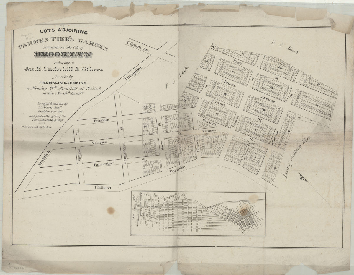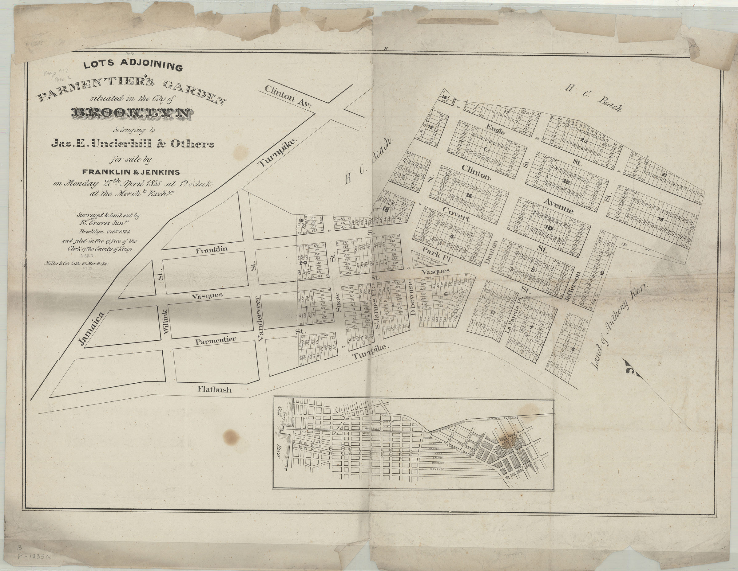
Lots adjoining Parmentier’s Garden situated in the city of Brooklyn belonging to Jas. E. Underhill & others for sale by Franklin & Jenkins on Monday, 27th April, 1835,: surveyed & laid out by R. Graves Junr., Brooklyn, Octr. 1834 1835
Map No. B P-[1835]c.Fl
Cadastral map covering area north from the Flatbush Turnpike to Clinton Ave. and east from the Jamaica Turnpike to Jefferson St. (modern-day Fort Greene). Shows property (including lot numbers and dimensions) and names of property owners. Oriented with north to the upper left. Includes location map. “20”–Upper center margin.
Map area shown
Genre
Cadastral mapsRelation
Full catalog recordSize
48 × 72 cmDownload
Low Resolution Image
Creator
Graves, Rosewell,Publisher
Brooklyn Historical SocietyCitation
Lots adjoining Parmentier’s Garden situated in the city of Brooklyn belonging to Jas. E. Underhill & others for sale by Franklin & Jenkins on Monday, 27th April, 1835,: surveyed & laid out by R. Graves Junr., Brooklyn, Octr. 1834; 1835, Map Collection, B P-[1835]c.Fl; Brooklyn Historical Society.Scale
Scale not givenLoading zoom image...