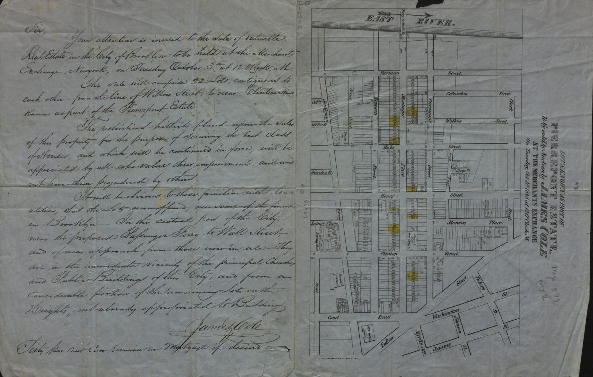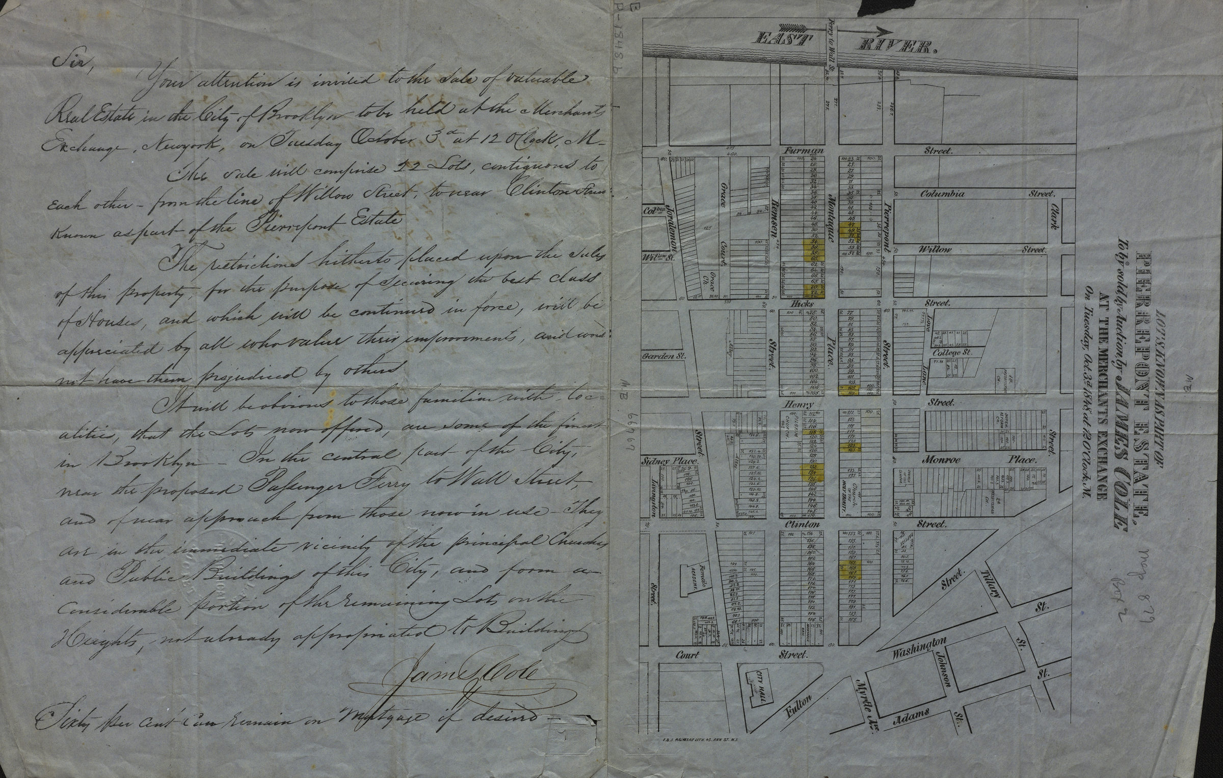
Lots known as part of Pierrepont Estate, to be sold by auction by James Cole at the Merchants Exchange on Tuesday, Oct. 3d., 1848, at 12 o’clock, M [1848]
Map No. B P-[1848]b.Fl
Cadastral map covering area north from Livingston St. to Clark St. and west from approximately Fulton St. to the East River (modern-day Brooklyn Heights). Shows property (including lot numbers and dimensions), churches, a female academy (later the Packer Collegiate Institute), and City Hall. BHS copy includes text by James Cole.
Map area shown
Genre
Cadastral mapsRelation
Full catalog recordSize
42 × 28 cmDownload
Low Resolution Image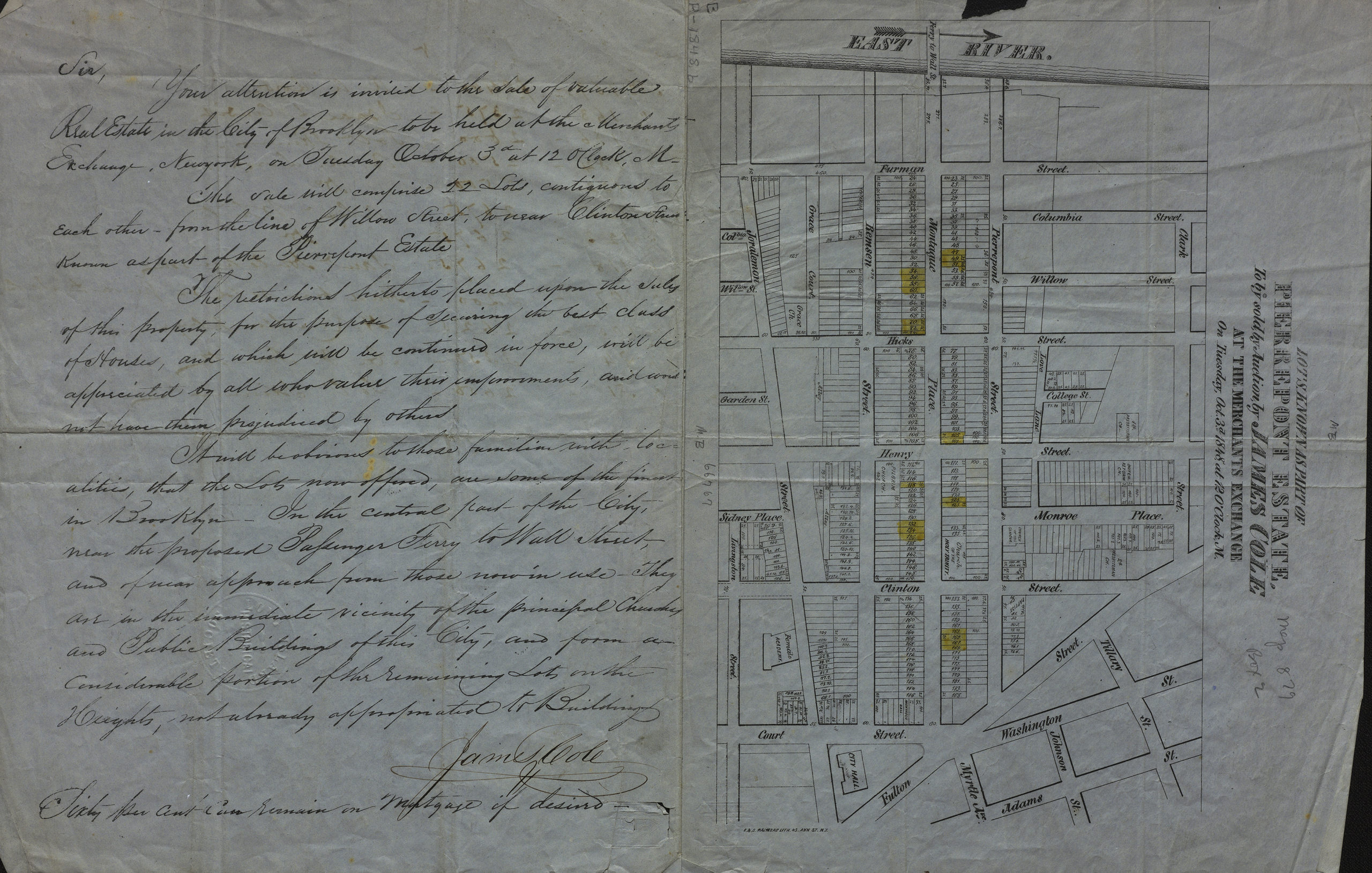
Creator
F. & S. Palmer (Firm),Publisher
Brooklyn Historical SocietyCitation
Lots known as part of Pierrepont Estate, to be sold by auction by James Cole at the Merchants Exchange on Tuesday, Oct. 3d., 1848, at 12 o’clock, M; [1848], Map Collection, B P-[1848]b.Fl; Brooklyn Historical Society.Scale
Scale not givenLoading zoom image...