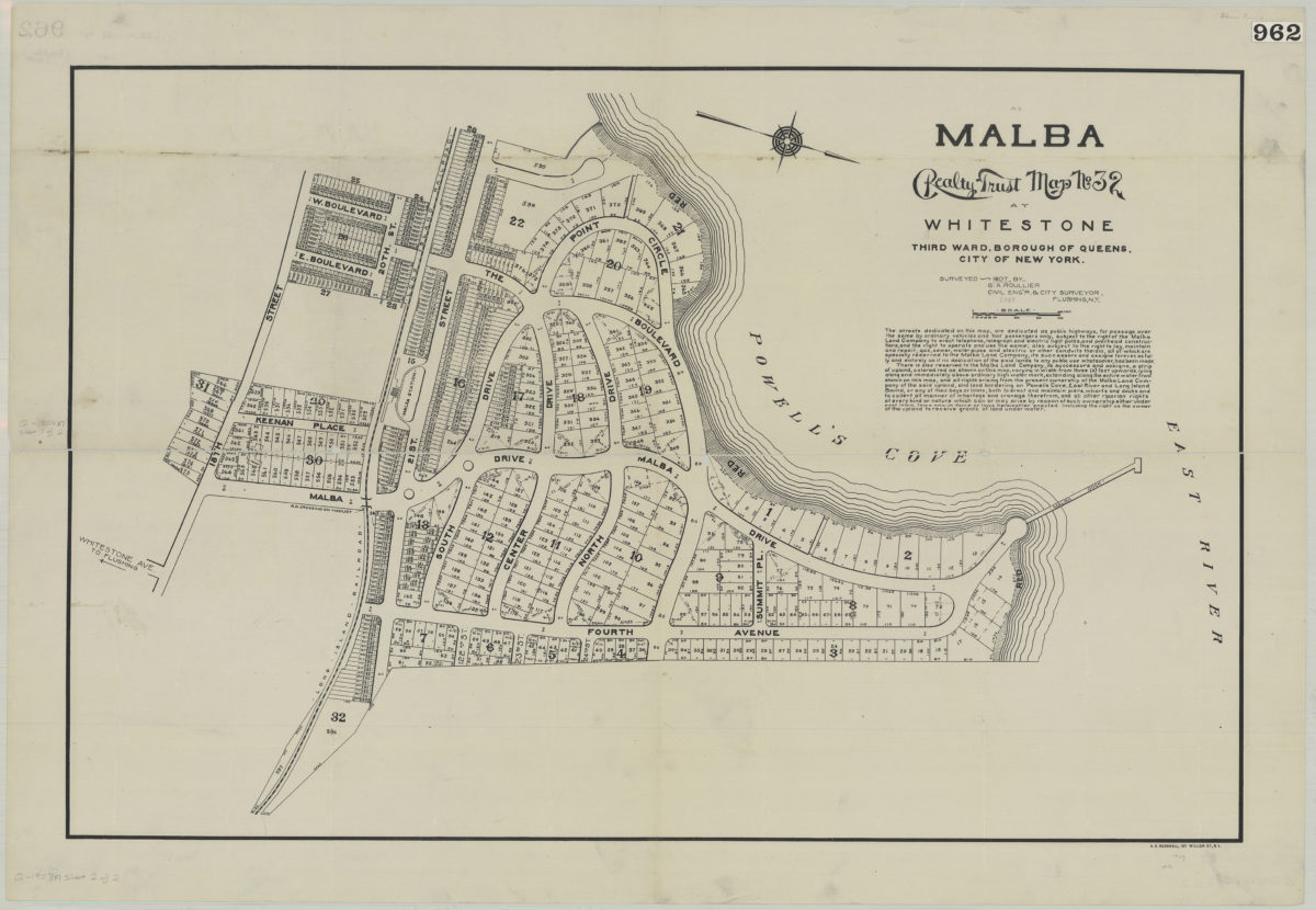
Malba Realty Trust map no. 32, at Whitestone, third ward, borough of Queens, city of New York: surveyed 1907 by G. A. Roullier, civil eng’r & city surveyor, Flushing, N.Y. 1907
Map No. Q-1907.Fl.Folio
Cadastral map covers area roughly bounded by Powell’s Cove, East River, Fourth Avenue and 18th Street in modern-day neighborhoods of Malba and Whitestone in Queens. Shows lots, including lot numbers and dimensions. Oriented with north to the lower right.
Map area shown
Genre
Cadastral mapsRelation
Full catalog recordSize
60 × 91 cmDownload
Low Resolution Image
Creator
Roullier, G. A.,Publisher
Brooklyn Historical SocietyCitation
Malba Realty Trust map no. 32, at Whitestone, third ward, borough of Queens, city of New York: surveyed 1907 by G. A. Roullier, civil eng’r & city surveyor, Flushing, N.Y.; 1907, Map Collection, Q-1907.Fl.Folio; Brooklyn Historical Society.Scale
Scale approximately 1:180Loading zoom image...