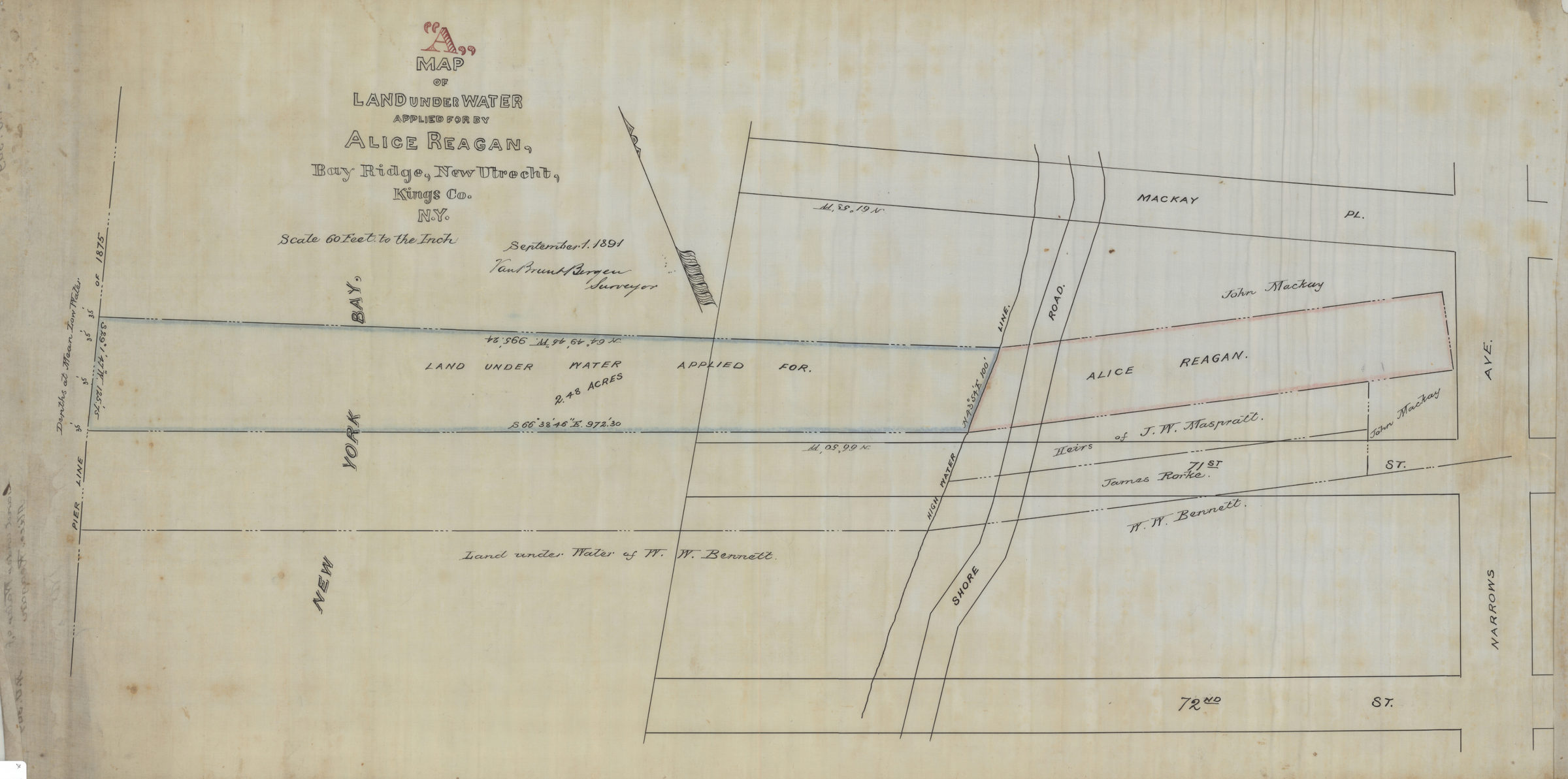
Map “A” of land under water applied for by Alice Reagan, Bay Ridge, New Utrecht, Kings Co., N.Y.: Van Brunt Bergen, surveyor September 1, 1891
Map No. Bergen-1891.Fl
Cadastral map covering area north from 72nd St. to MacKay Pl. and east from New York Bay to Narrows Ave. Shows property, names of landowners, and historical pierhead lines. Depths shown by soundings. Oriented with north to the upper left.
Subjects
Places
Map area shown
Relation
Full catalog recordSize
37 × 75 cmDownload
Low Resolution Image
Creator
Bergen, Van Brunt,Publisher
Brooklyn Historical SocietyCitation
Map “A” of land under water applied for by Alice Reagan, Bay Ridge, New Utrecht, Kings Co., N.Y.: Van Brunt Bergen, surveyor; September 1, 1891, Map Collection, Bergen-1891.Fl; Brooklyn Historical Society.Scale
Scale [1:720] 1 in to 60Loading zoom image... 