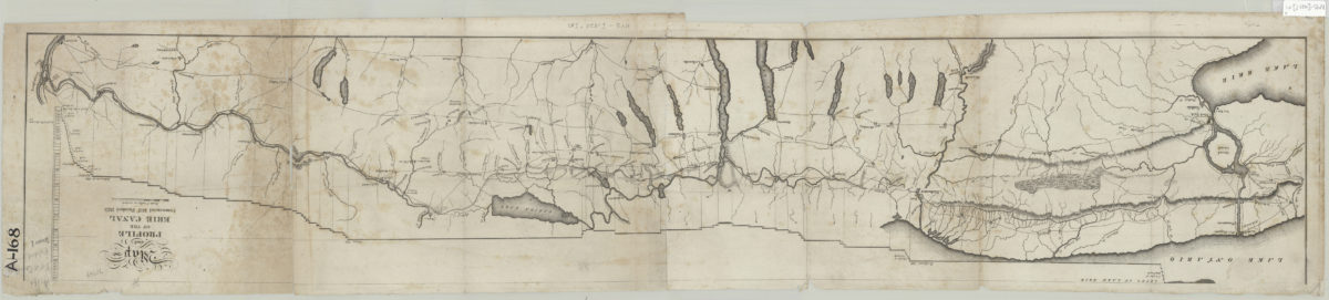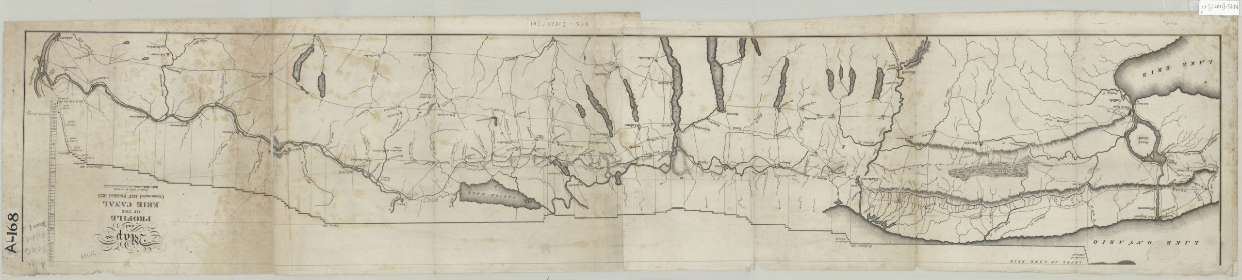
Map and profile of the Erie Canal: commenced 1817, finished 1825 [1825]
Map No. NYS-[1825?].Fl
Relief shown by hachures.
Map area shown
Genre
Thematic mapsRelation
Full catalog recordSize
22 × 115 cmDownload
Low Resolution ImageCreator
E. & E. Hosford (Firm),Publisher
Brooklyn Historical SocietyCitation
Map and profile of the Erie Canal: commenced 1817, finished 1825; [1825], Map Collection, NYS-[1825?].Fl; Brooklyn Historical Society.Scale
Scales differLoading zoom image...