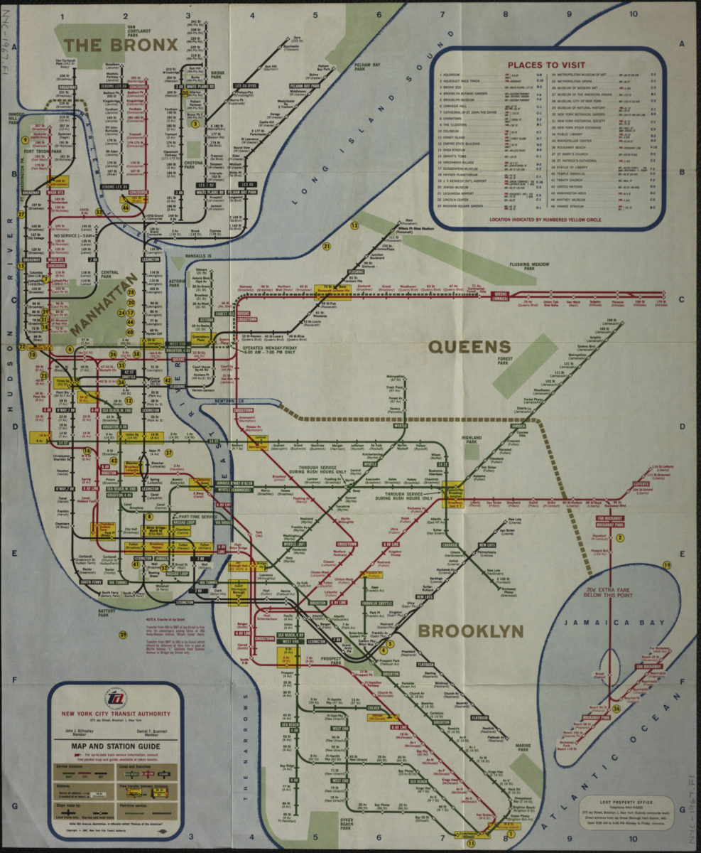
Map and station guide: New York City Transit Authority [ca. 1967]
Map No. NYC-1967.Fl
Schematic map showing subway lines in Manhattan, the Bronx, Queens, and Brooklyn. Includes key to points of interest. On verso: text, illustrations, and major routes guide.
Map area shown
Genre
Transportation mapsRelation
Full catalog recordSize
48 × 40 cmDownload
Low Resolution Image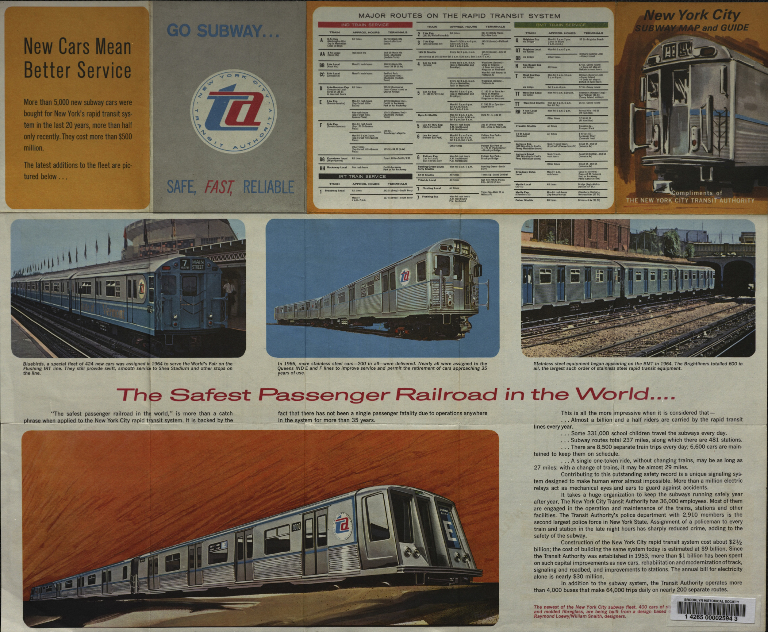
Creator
New York City Transit Authority,Publisher
Brooklyn Historical SocietyCitation
Map and station guide: New York City Transit Authority; [ca. 1967], Map Collection, NYC-1967.Fl; Brooklyn Historical Society.Scale
Not drawn to scaleLoading zoom image...