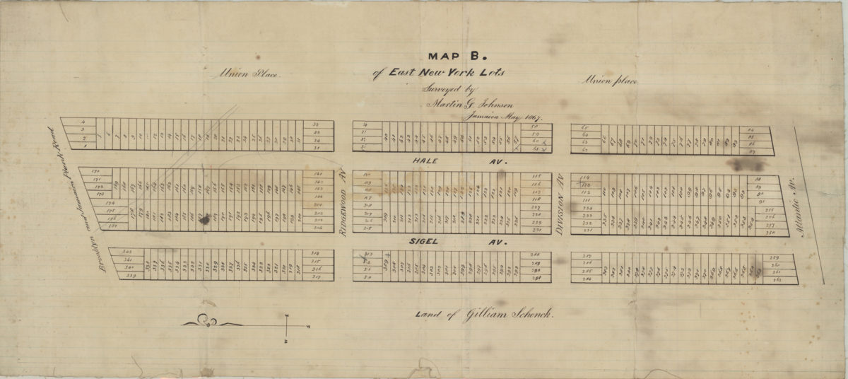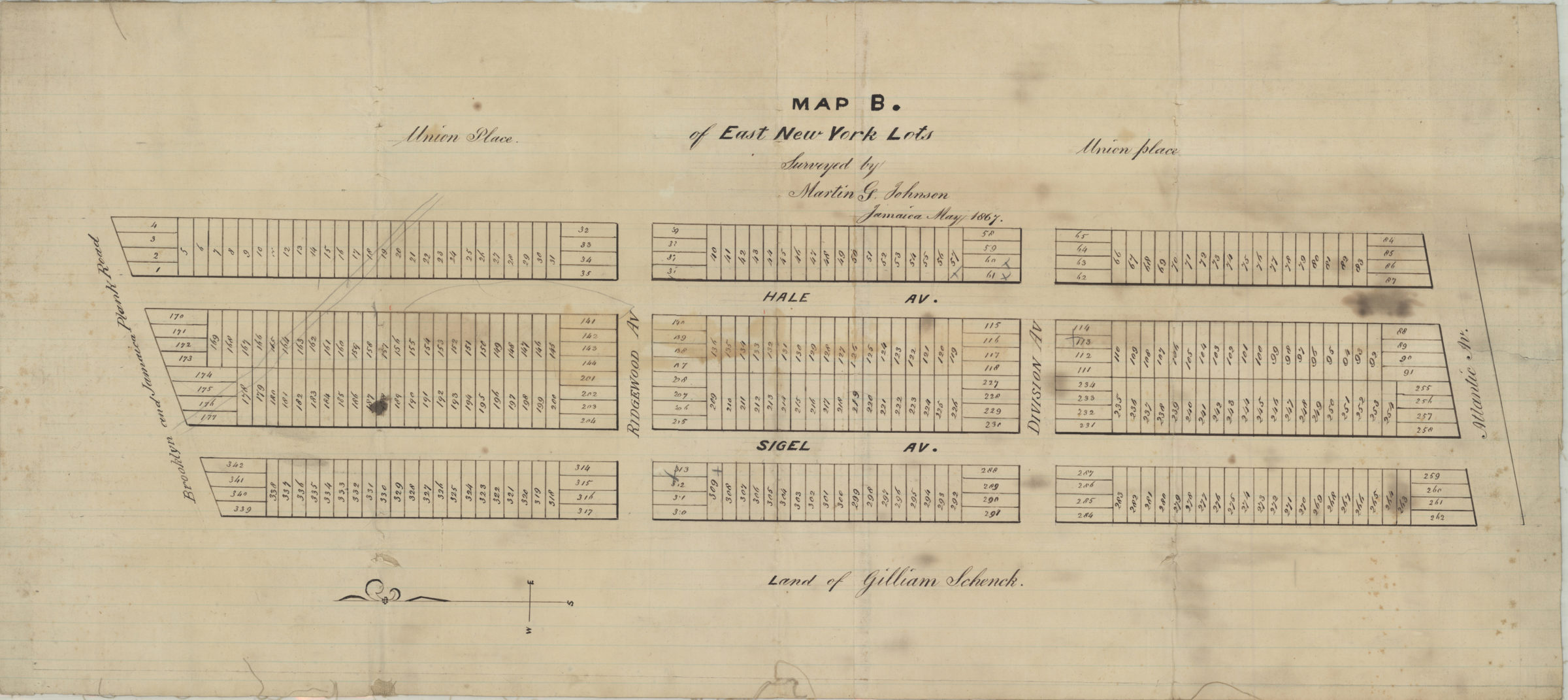
Map B of East New York lots: surveyed by Martin G. Johnson, Jamaica May 1867
Map No. B P-1867.Fl
Cadastral map covering area north from Atlantic Ave. to the Brooklyn and Jamaica Plank Rd. and east from approximately Sigel Ave. to Hale Ave. (modern-day Cypress Hills). Does not cover modern-day East New York. Shows property (including lot numbers). Oriented with north to the left.
Map area shown
Relation
Full catalog recordSize
31 × 70 cmDownload
Low Resolution Image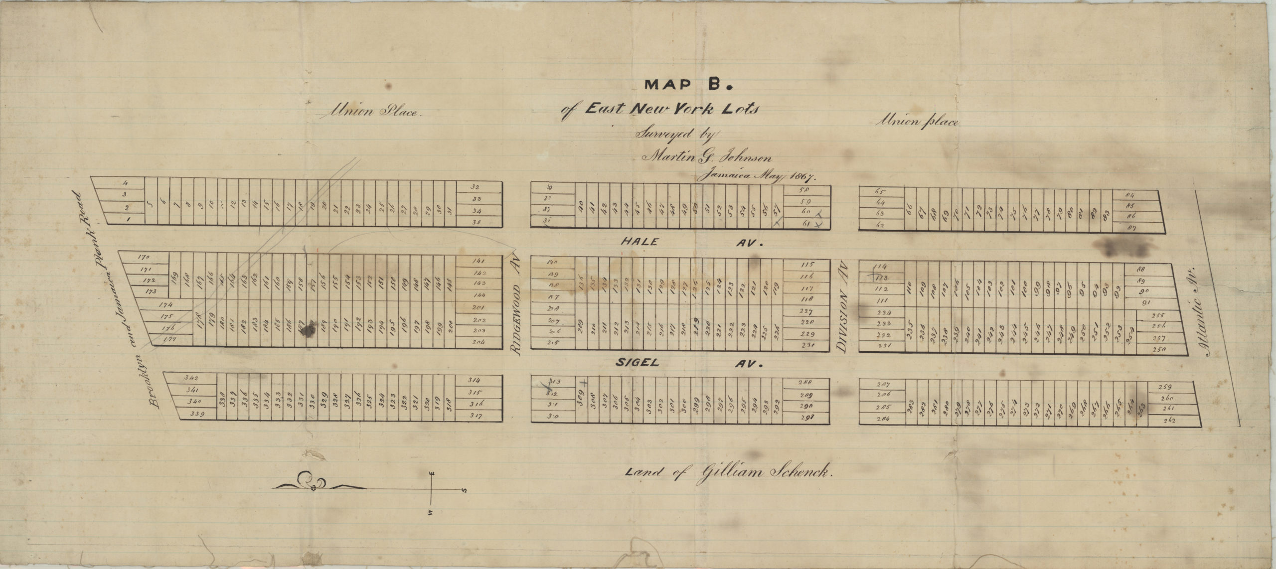
Creator
Johnson, Martin G.,Publisher
Brooklyn Historical SocietyCitation
Map B of East New York lots: surveyed by Martin G. Johnson, Jamaica; May 1867, Map Collection, B P-1867.Fl; Brooklyn Historical Society.Scale
Scale not givenLoading zoom image...