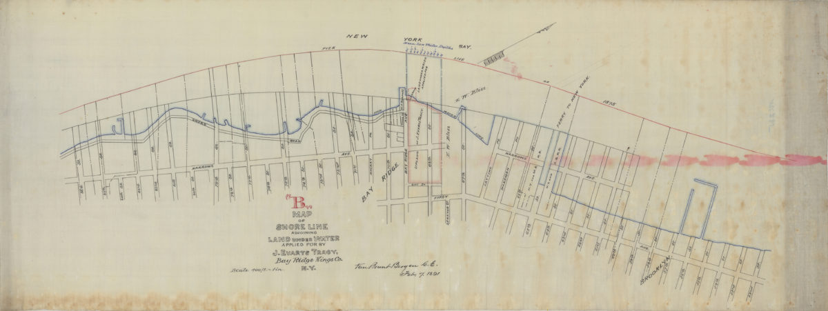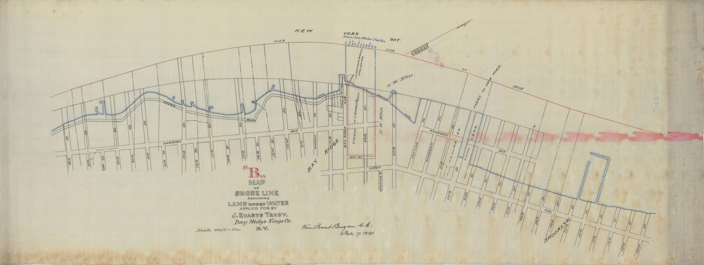
Map “B” of shore line adjoining land under water applied for by J. Evarts Tracy, Bay Ridge, Kings Co., N.Y.: Van Brunt Bergen, C.E. February 7, 1891
Map No. Bergen-1891a.Fl
Cadastral map covering area north from 86th St. to 52nd St. and west from New York Bay to 1st Ave. (modern-day Bay Ridge and Sunset Park). Shows property, names of landowners, pierhead lines, bulkhead lines, ferry lines, and high water lines. Depths shown by soundings. Oriented with north to the upper right.
Subjects
Places
Map area shown
Relation
Full catalog recordSize
30 × 79 cmDownload
Low Resolution Image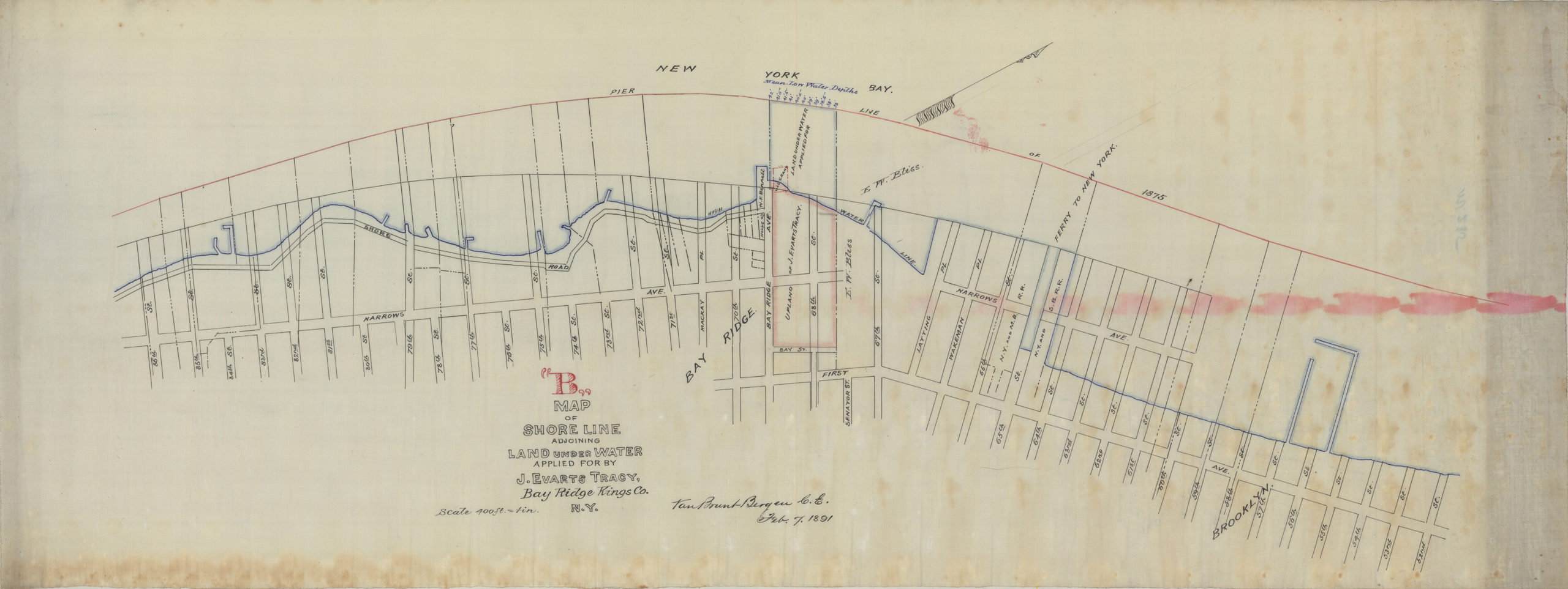
Creator
Bergen, Van Brunt,Publisher
Brooklyn Historical SocietyCitation
Map “B” of shore line adjoining land under water applied for by J. Evarts Tracy, Bay Ridge, Kings Co., N.Y.: Van Brunt Bergen, C.E.; February 7, 1891, Map Collection, Bergen-1891a.Fl; Brooklyn Historical Society.Scale
Scale [1:4,800] 1 in to 4Loading zoom image...