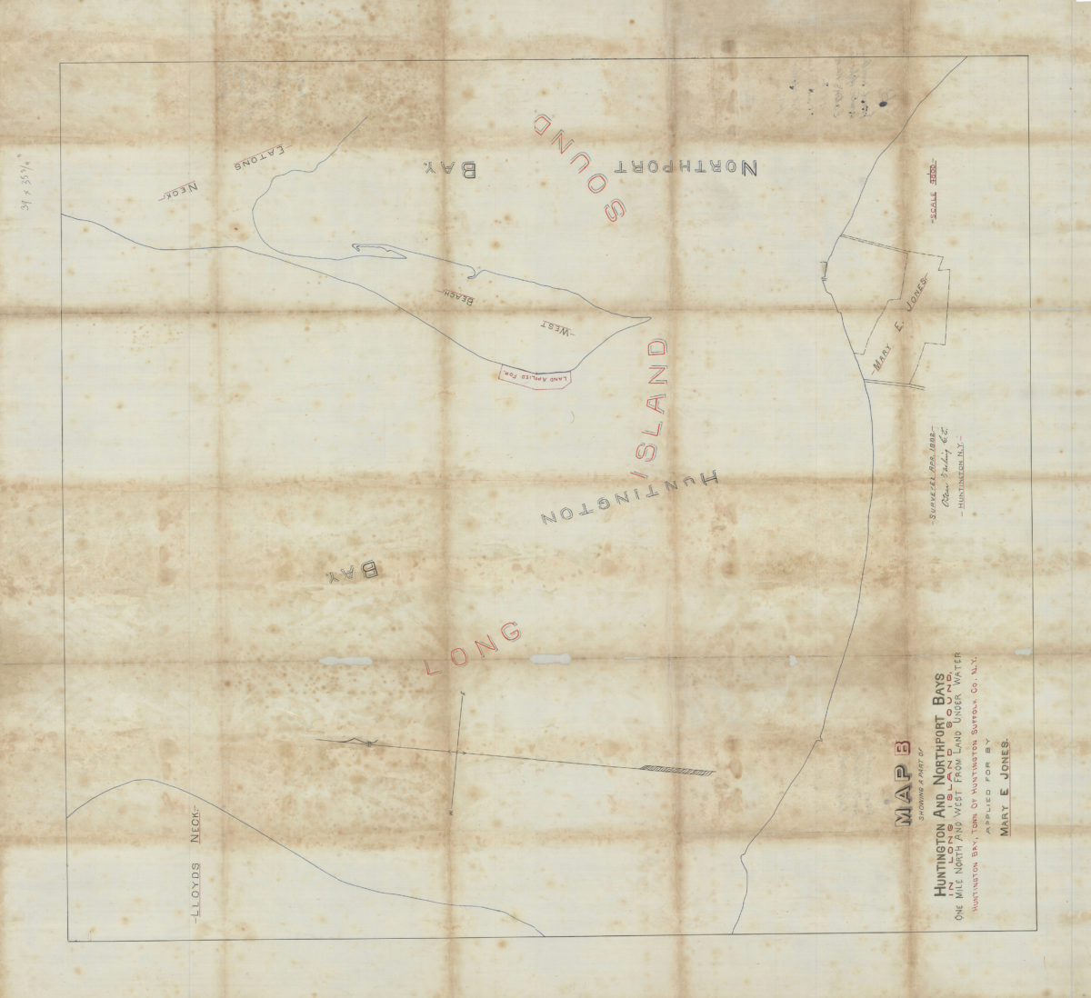
Map B showing a part of Huntington and Northport Bays in Long Island Sound, one mile north and west from land under water, Huntington Bay, town of Huntington, Suffolk Co., N.Y., applied for by Mary E. Jones: Oscar Darling, C.E. April 1882
Map No. L.I.-1882.Fl.O
Cadastral map showing water property of Mary E. Jones.
Subjects
Places
Map area shown
Relation
Full catalog recordSize
88 × 79 cmDownload
Low Resolution Image
Creator
Darling, Oscar,Publisher
Brooklyn Historical SocietyCitation
Map B showing a part of Huntington and Northport Bays in Long Island Sound, one mile north and west from land under water, Huntington Bay, town of Huntington, Suffolk Co., N.Y., applied for by Mary E. Jones: Oscar Darling, C.E.; April 1882, Map Collection, L.I.-1882.Fl.O; Brooklyn Historical Society.Scale
Scale 1:4,800Loading zoom image...