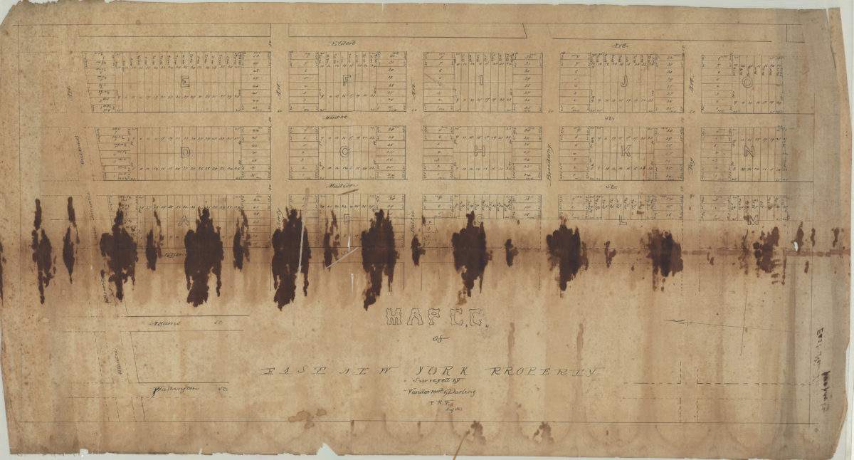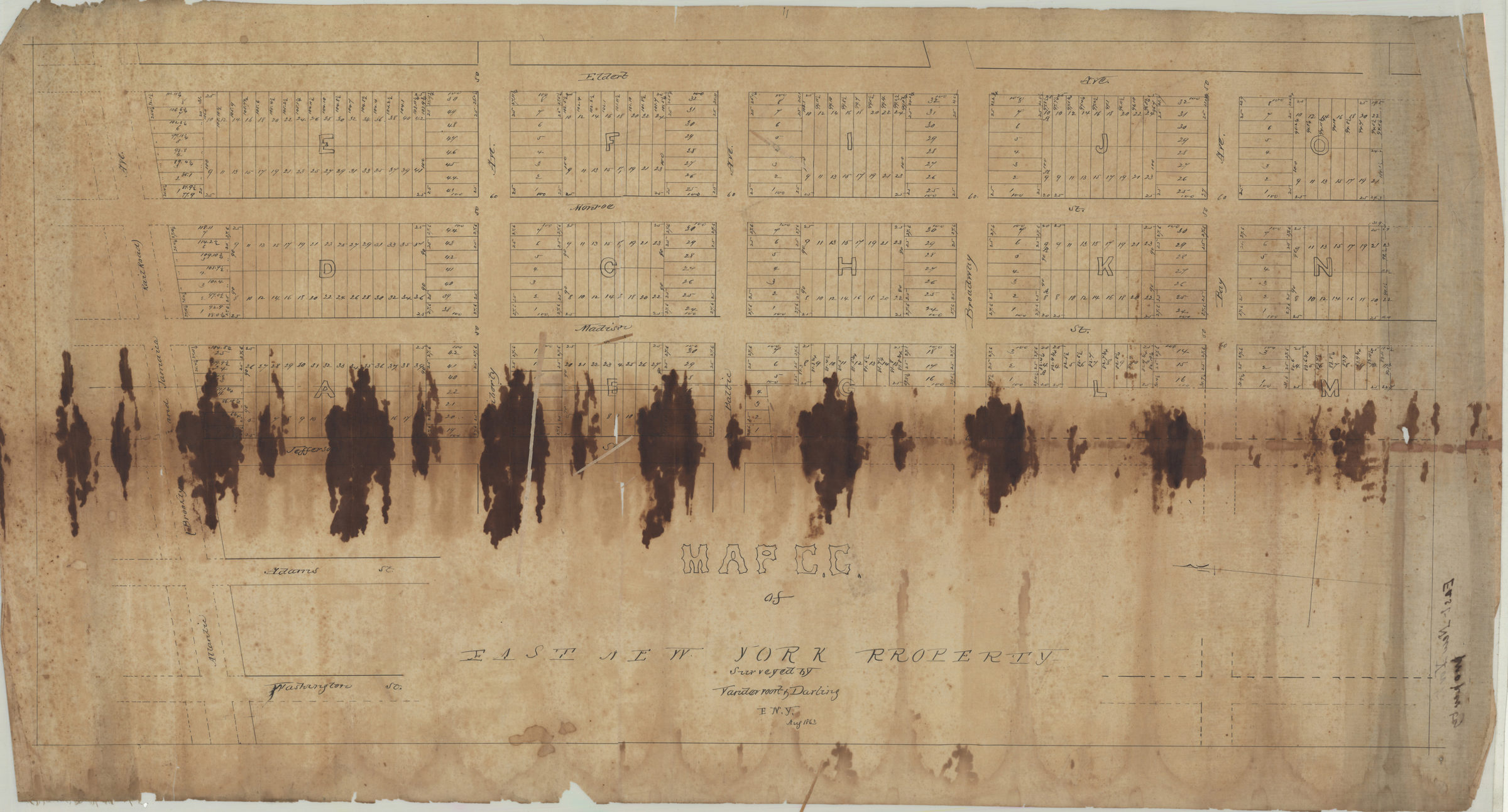
Map C.C. of East New York property: surveyed by Vandervoort & Darling 1863
Map No. B P-1863a.Fl
Cadastral map covering area bounded by Atlantic Ave., Washington St., Bay Ave., and Eldert Ave. Shows property (including lot numbers and dimensions). Oriented with north to the left.
Map area shown
Relation
Full catalog recordSize
43 × 84 cmDownload
Low Resolution Image
Creator
Vandervoort & Darling (Firm),Publisher
Brooklyn Historical SocietyCitation
Map C.C. of East New York property: surveyed by Vandervoort & Darling; 1863, Map Collection, B P-1863a.Fl; Brooklyn Historical Society.Scale
Scale not givenLoading zoom image...