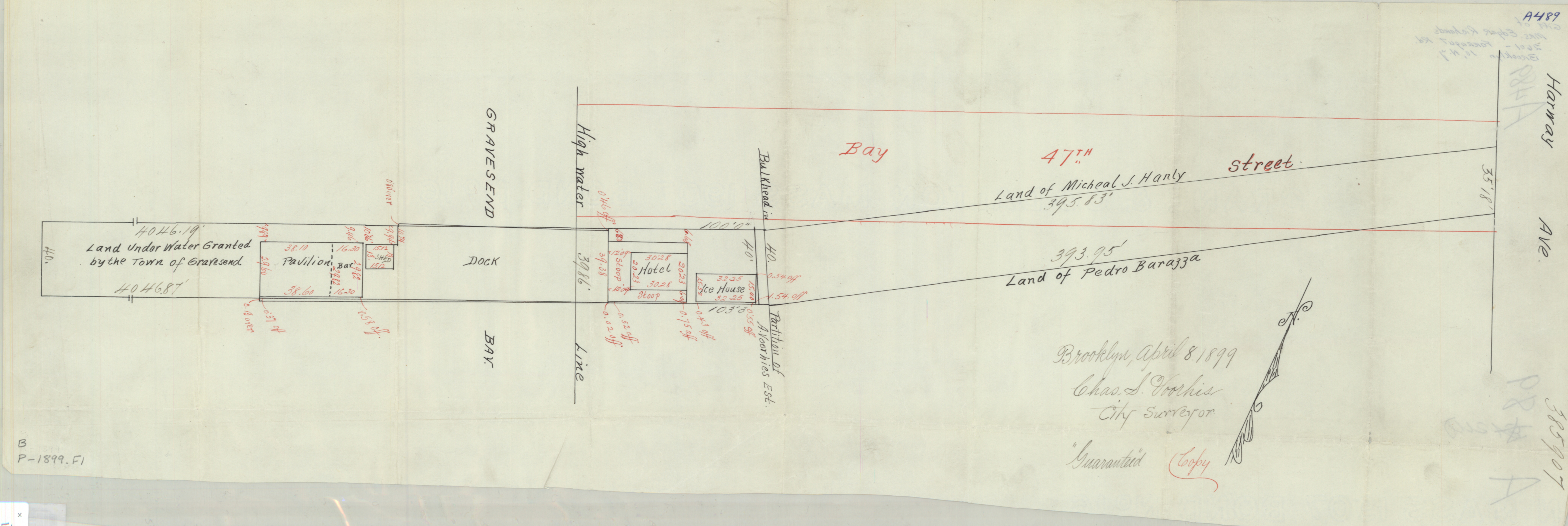
[Map covering area east from Gravesend Bay to Harway Ave. at Bay 47th St.]: Chas S. Voorhis, city surveyor, Brooklyn, April 8, 1899 1899
Map No. B P-1899.Fl
Cadastral map. Shows commercial property (including dimensions), land under water granted by the town of Gravesend, high water lines, bulkhead lines, and names of landowners. Title devised by cataloger. Oriented with north to the upper right. “Guaranteed copy.” Watermark: Crane & Co Dalton Mass 1907 Bond No 16.
Map area shown
Relation
Full catalog recordSize
23 × 72 cmDownload
Low Resolution ImageCreator
Voorhis, Chas. S.,Publisher
Brooklyn Historical SocietyCitation
[Map covering area east from Gravesend Bay to Harway Ave. at Bay 47th St.]: Chas S. Voorhis, city surveyor, Brooklyn, April 8, 1899; 1899, Map Collection, B P-1899.Fl; Brooklyn Historical Society.Scale
Scale not givenLoading zoom image... 
