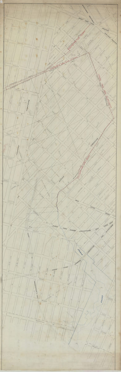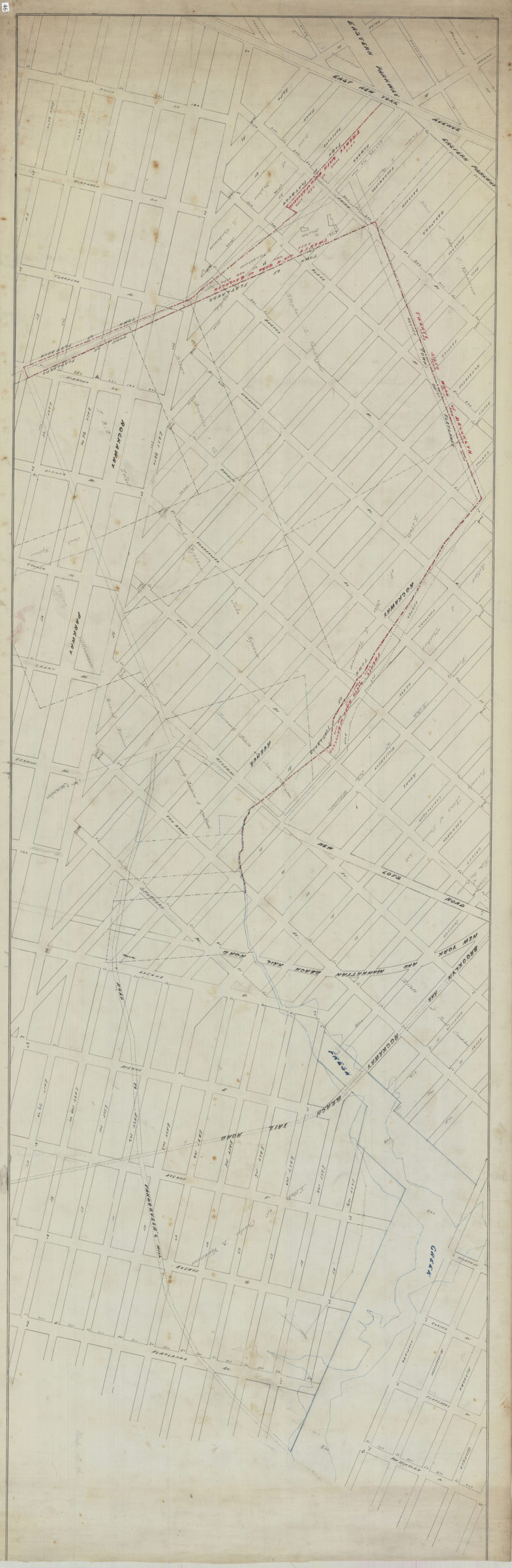
[Map covering area north from E. 93rd St. to Douglass St. and east from East New York Ave. to Flatlands Ave.]. [18??]
Map No. B P-[18--?]a.Fl.O
Cadastral map covering area in Brownsville and Canarsie. Shows property (including buildings), names of landowners, ward boundaries, and railroads. Title devised by cataloger.
Subjects
Places
Map area shown
Relation
Full catalog recordSize
50 × 159 cmDownload
Low Resolution Image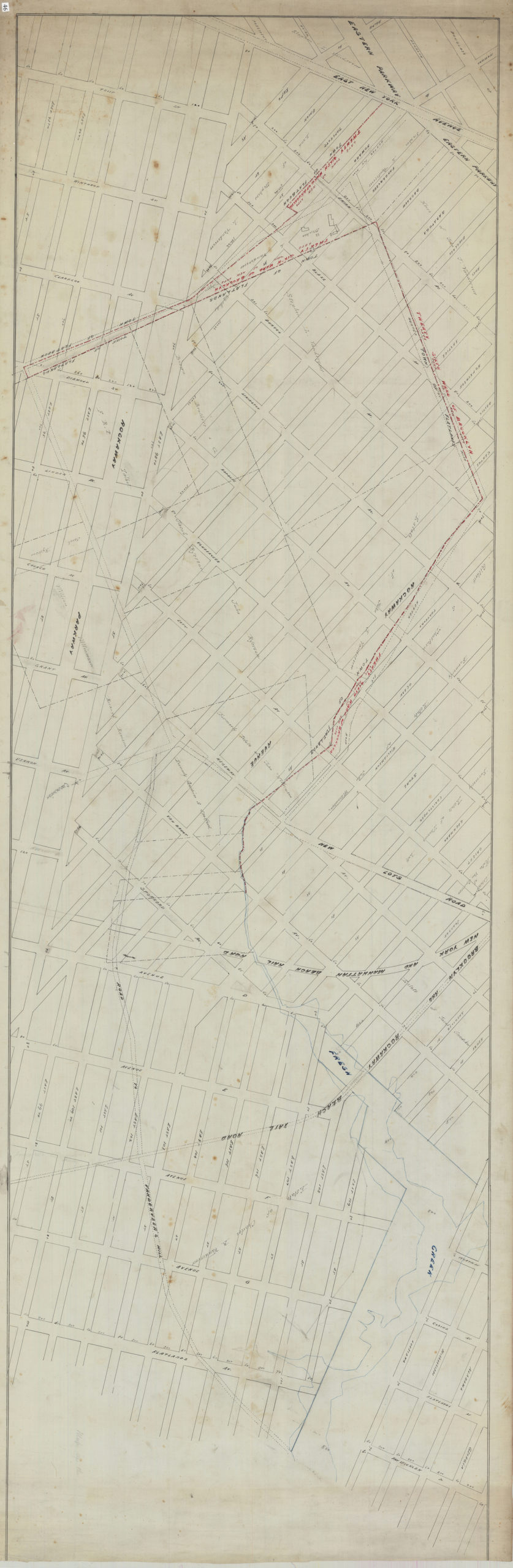
Creator
Publisher
Brooklyn Historical SocietyCitation
[Map covering area north from E. 93rd St. to Douglass St. and east from East New York Ave. to Flatlands Ave.].; [18??], Map Collection, B P-[18--?]a.Fl.O; Brooklyn Historical Society.Scale
Scale not givenLoading zoom image...