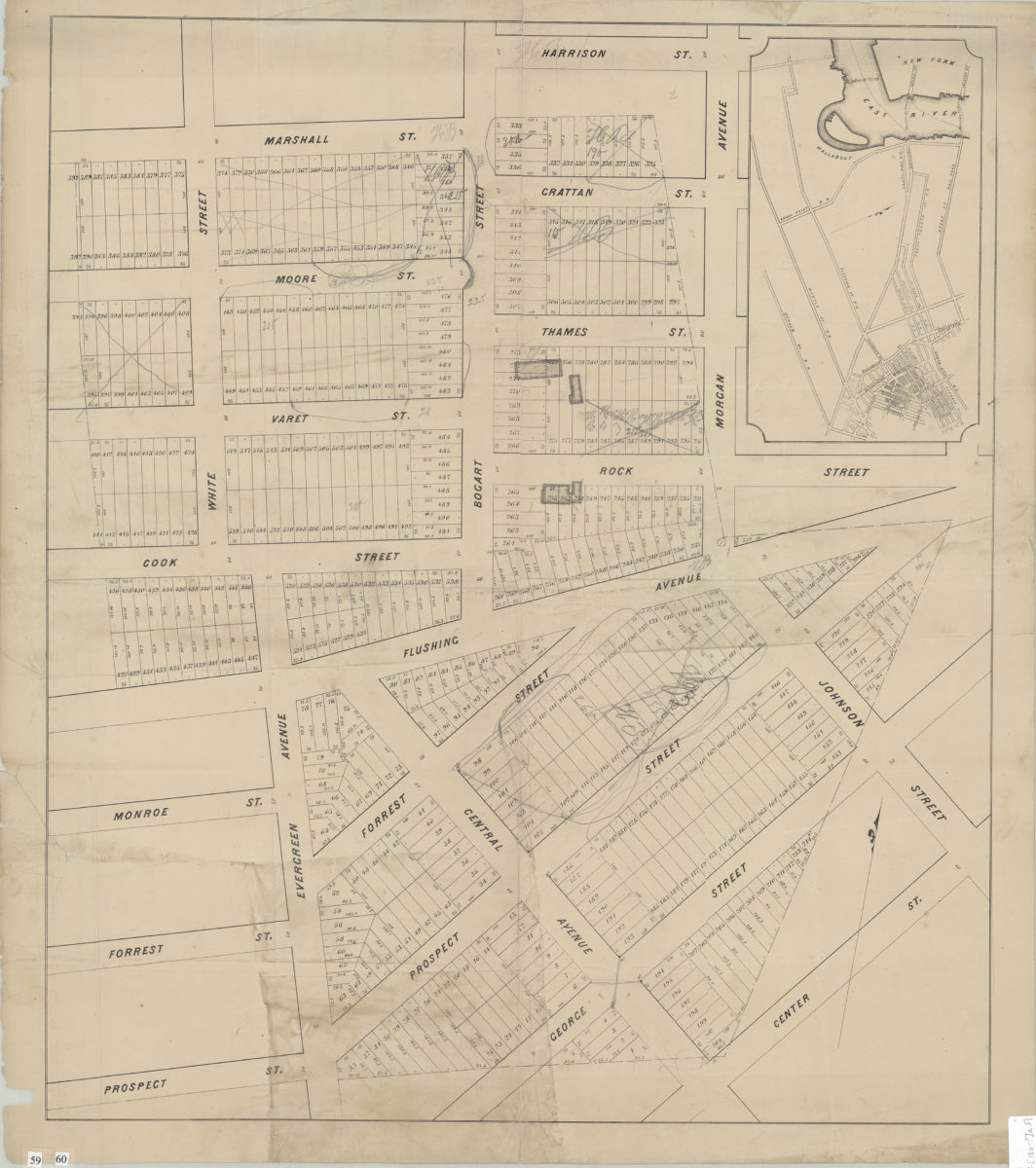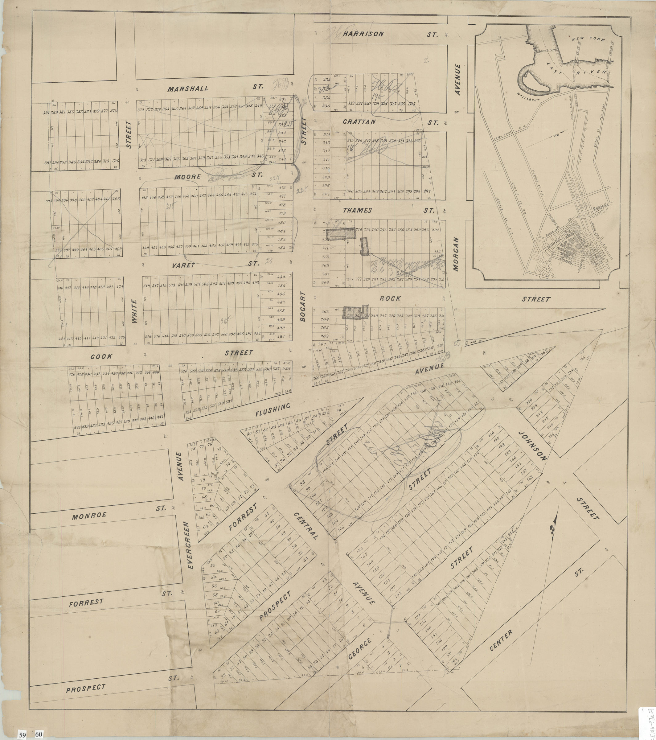
[Map covering area north from Prospect St. to Harrison St. and east from White St. to Morgan Ave.]. [186?]
Map No. B P-[186-?]a.Fl
Cadastral map covering area in modern-day Williamsburg and Bushwick. Shows property (including lot numbers, dimensions, and buildings). Title devised by cataloger. Includes location map. BHS copy annotated in gray pencil.
Subjects
Places
Map area shown
Genre
Cadastral mapsRelation
Full catalog recordSize
56 × 65 cmDownload
Low Resolution Image
Creator
Publisher
Brooklyn Historical SocietyCitation
[Map covering area north from Prospect St. to Harrison St. and east from White St. to Morgan Ave.].; [186?], Map Collection, B P-[186-?]a.Fl; Brooklyn Historical Society.Scale
Scale not givenLoading zoom image...