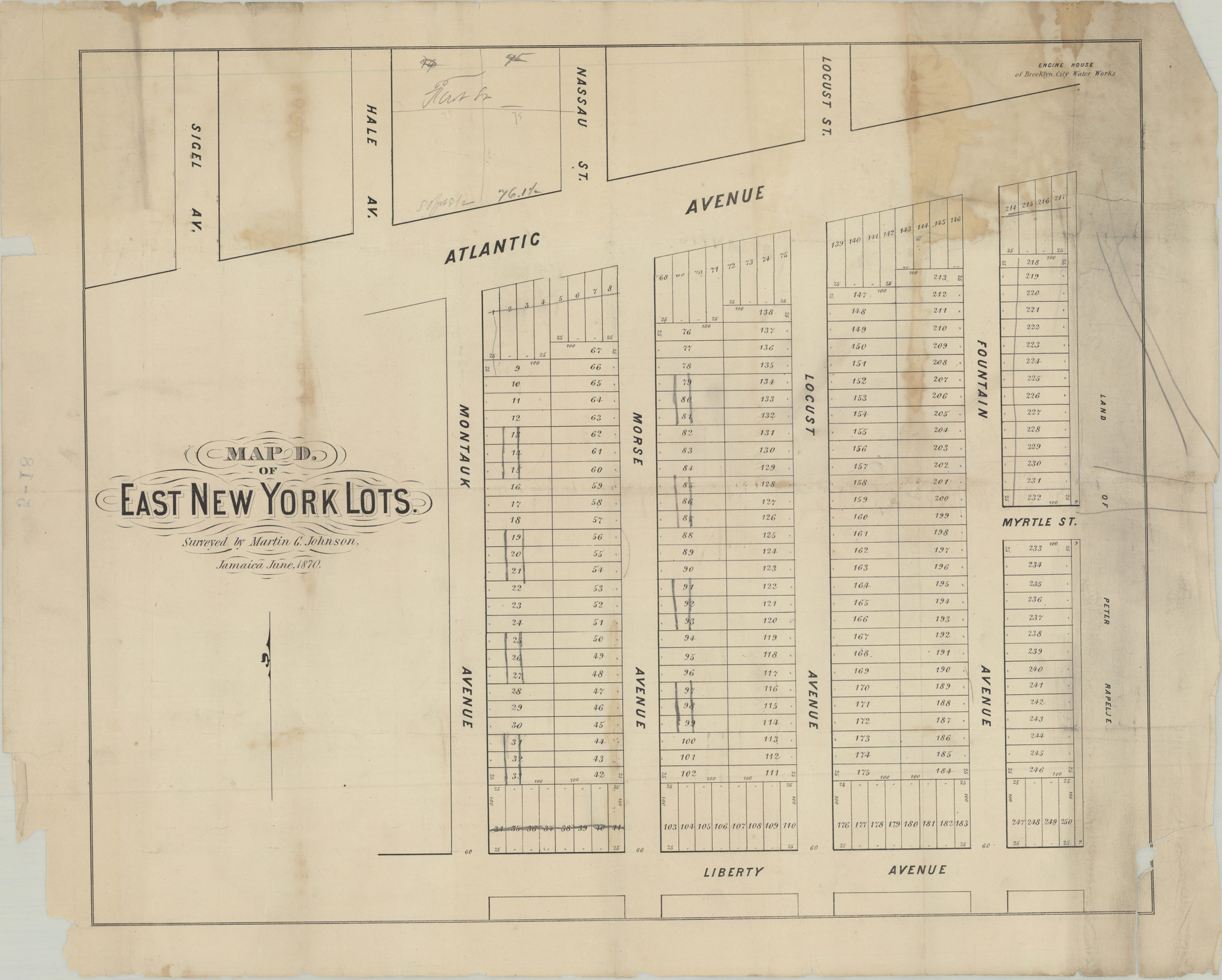
Map D of East New York lots: surveyed by Martin G. Johnson, Jamaica, June 1870 [1870]
Map No. B P-[1870]c.Fl
Cadastral map covering area east from Sigel Ave. to approximately Fountain Ave. and north from Liberty Ave. to Atlantic Ave. Shows property (including lot numbers and dimensions), and names of landowners. BHS copy annotated in gray pencil.
Map area shown
Genre
Cadastral mapsRelation
Full catalog recordSize
44 × 53 cmDownload
Low Resolution Image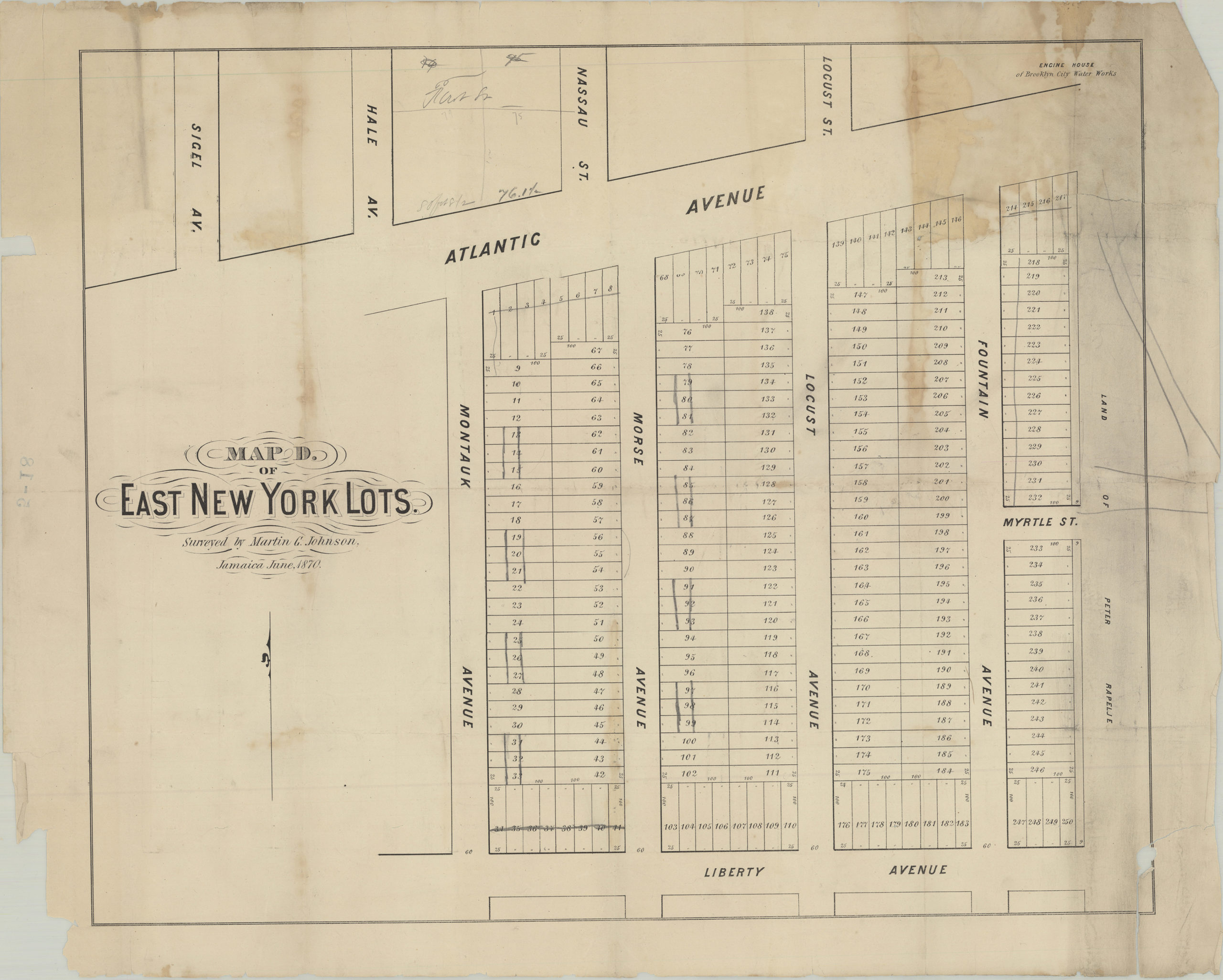
Creator
Johnson, Martin G.,Publisher
Brooklyn Historical SocietyCitation
Map D of East New York lots: surveyed by Martin G. Johnson, Jamaica, June 1870; [1870], Map Collection, B P-[1870]c.Fl; Brooklyn Historical Society.Scale
Scale not givenLoading zoom image... 