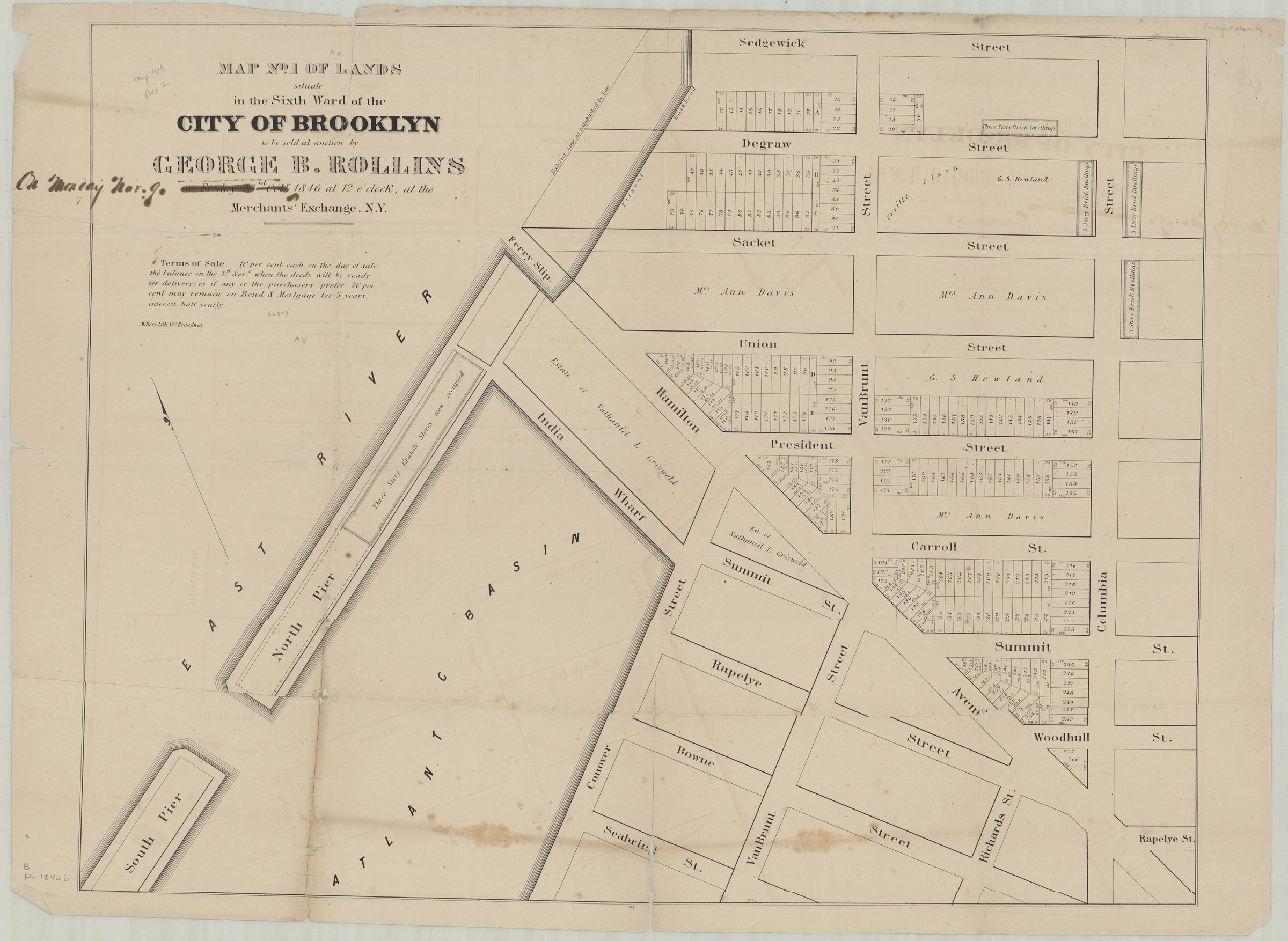
Map no. 1 of lands situate[d] in the Sixth Ward of the city of Brooklyn, to be sold at auction by George B. Rollins on Friday, 23rd Oct., 1846, at 12 o’clock at the Merchants’ Exchange, N.Y. 1846
Map No. B P-[1846]b.Fl;B P-[1846]b.Fl c.2
Cadastral map covering area east from the Atlantic Basin to Columbia St. and north from Seabring St. to Sedgewick St. (modern-day Red Hook). Shows property (including lot numbers and dimensions), names of property owners, exterior and bulkhead lines, piers, and a ferry slip. Oriented with north to the upper left. “1098”–Lower center margin. BHS has 2 copies: copy 1 annotated in ink copy 2 annotated in gray pencil.
Map area shown
Genre
Cadastral mapsRelation
Full catalog recordSize
56 × 73 cmDownload
Low Resolution Image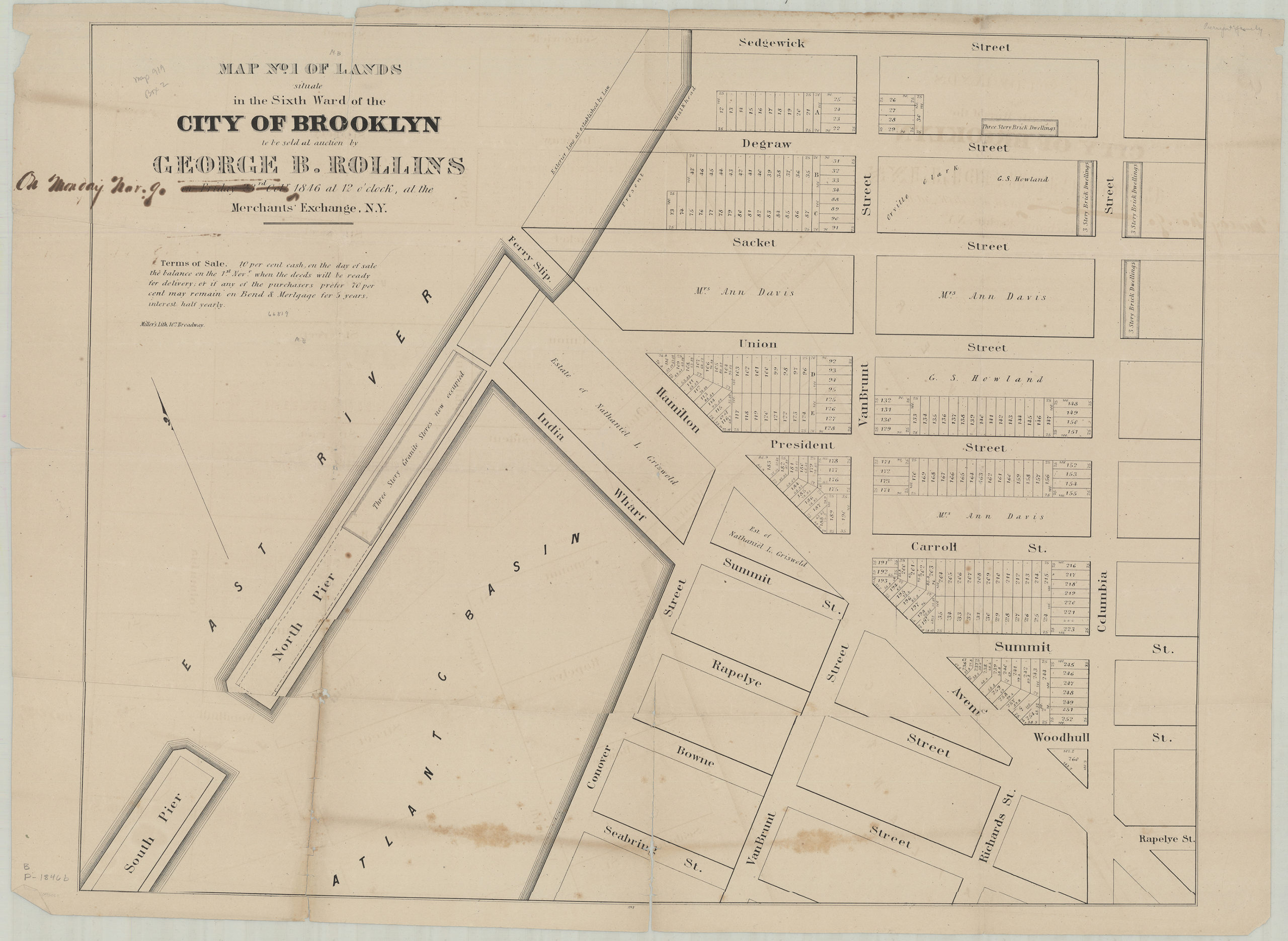
Creator
Miller & Co.,Publisher
Brooklyn Historical SocietyCitation
Map no. 1 of lands situate[d] in the Sixth Ward of the city of Brooklyn, to be sold at auction by George B. Rollins on Friday, 23rd Oct., 1846, at 12 o’clock at the Merchants’ Exchange, N.Y.; 1846, Map Collection, B P-[1846]b.Fl;B P-[1846]b.Fl c.2; Brooklyn Historical Society.Scale
Scale not givenLoading zoom image... 