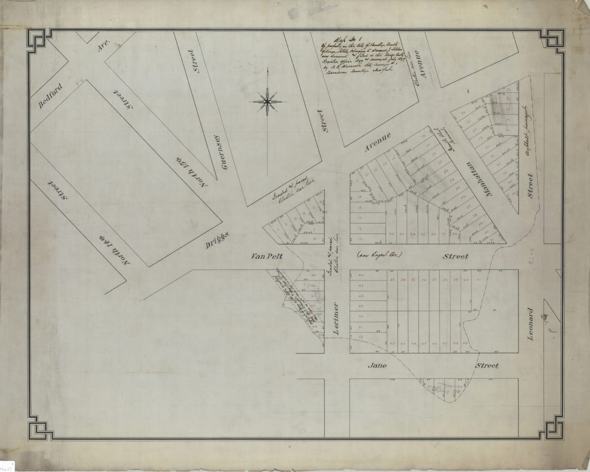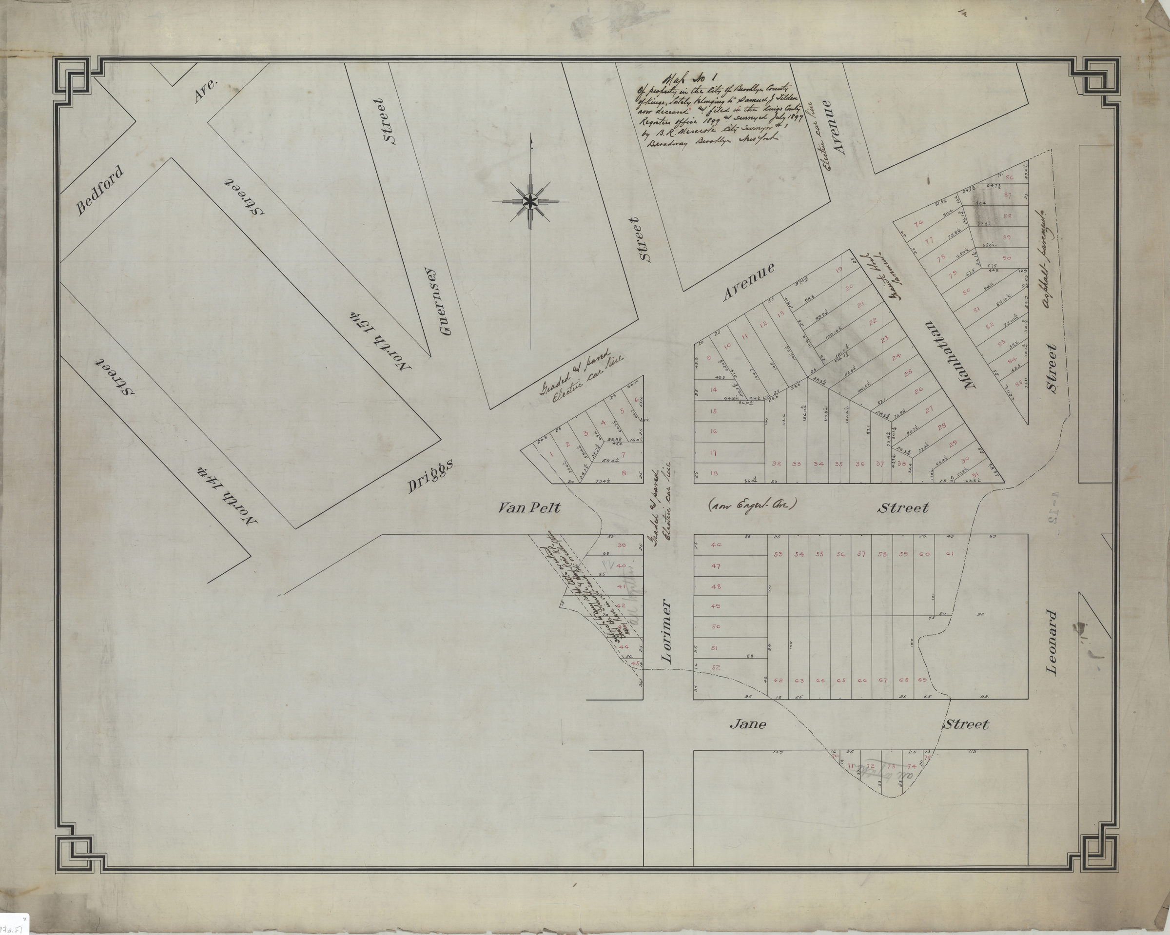

Map no. 1 of property in the city of Brooklyn, county of Kings, lately belonging to Samuel J. Tilden, now deceased, and filed in the Kings County Register’s Office, 1899, and surveyed July 1897: by B.R. Meserole, city surveyor July 1897
Map No. B P-1897d.Fl
Cadastral map covering area north from Jane St. to Driggs Ave. and east from N. 14th St. to Leonard St. (modern-day Greenpoint and Williamsburg, including what is now McCarren Park). Shows property (including lot numbers and dimensions), and status of roads.
Subjects
Places
Map area shown
Relation
Full catalog recordSize
62 × 80 cmDownload
Low Resolution Image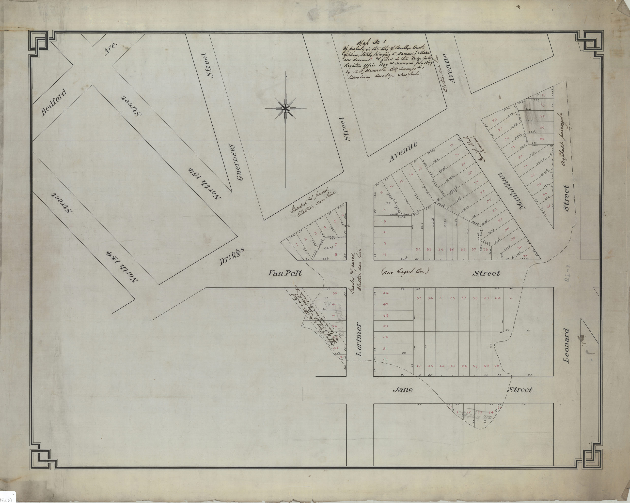
Creator
Meserole, B. R., Meserole, B. R.,Publisher
Brooklyn Historical Society, Brooklyn Historical SocietyCitation
Map no. 1 of property in the city of Brooklyn, county of Kings, lately belonging to Samuel J. Tilden, now deceased, and filed in the Kings County Register’s Office, 1899, and surveyed July 1897: by B.R. Meserole, city surveyor; July 1897, Map Collection, B P-1897d.Fl; Brooklyn Historical Society.Scale
Scale not givenLoading zoom image...