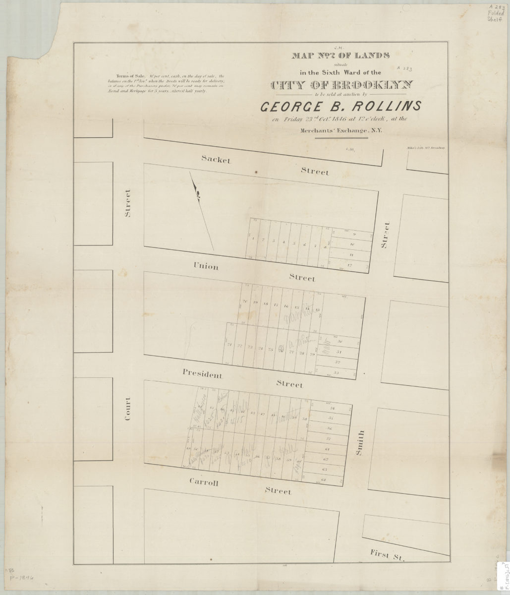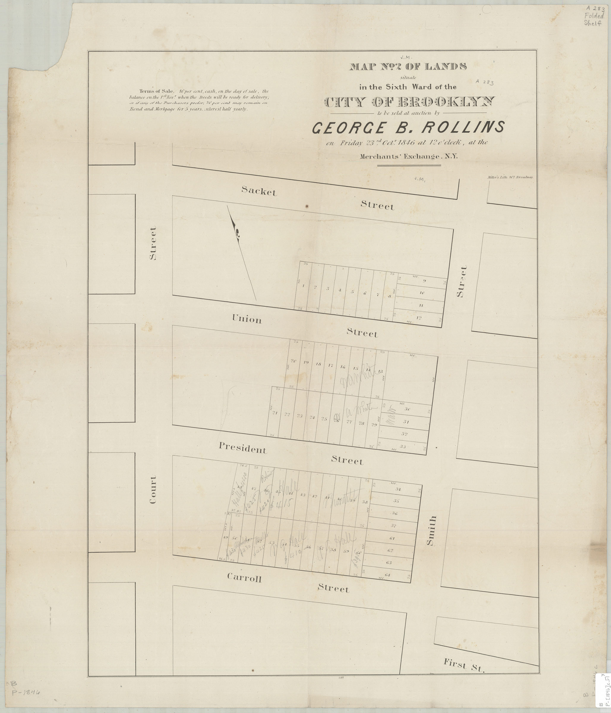
Map no. 2 of lands situate[d] in the Sixth Ward of the city of Brooklyn, to be sold at auction by George B. Rollins on Friday, 23rd Octr., 1846, at 12 o’clock, at the Merchants’ Exchange, N.Y. 1846
Map No. B P-[1846]c.Fl
Cadastral map covering area north from Carroll St. to Sacket St. and east from Court St. to Smith St. (modern-day Carroll Gardens). Shows property (including lot numbers and dimensions). Includes note. “1099”–Lower center margin.
Map area shown
Genre
Cadastral mapsRelation
Full catalog recordSize
63 × 46 cmDownload
Low Resolution Image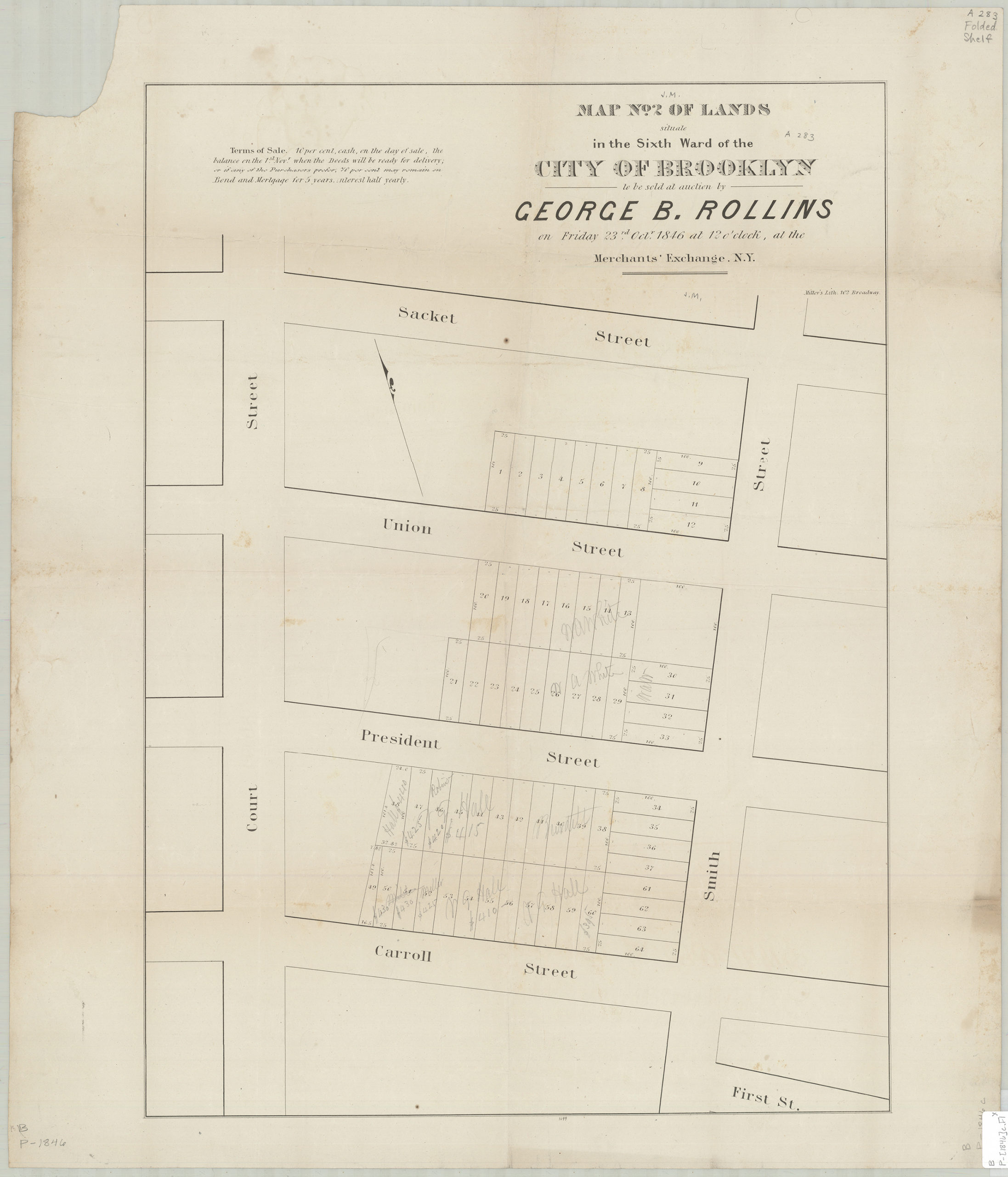
Creator
Miller & Co.,Publisher
Brooklyn Historical SocietyCitation
Map no. 2 of lands situate[d] in the Sixth Ward of the city of Brooklyn, to be sold at auction by George B. Rollins on Friday, 23rd Octr., 1846, at 12 o’clock, at the Merchants’ Exchange, N.Y.; 1846, Map Collection, B P-[1846]c.Fl; Brooklyn Historical Society.Scale
Scale not givenLoading zoom image...