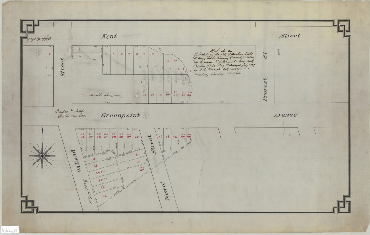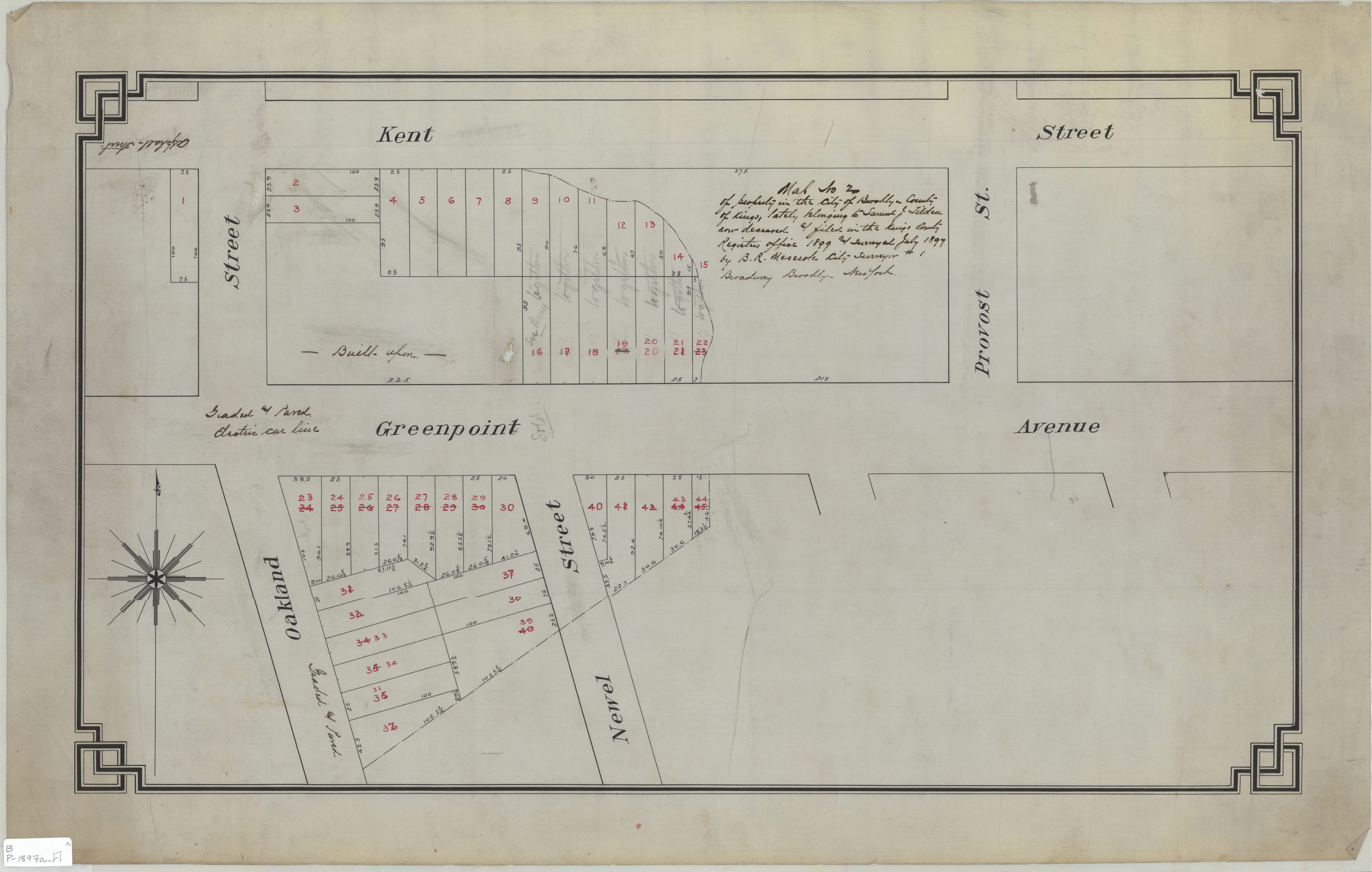
Map no. 2 of property in the city of Brooklyn, county of Kings, lately belonging to Samuel J. Tilden, now deceased, & filed in the Kings County Register’s Office, 1899, and surveyed July 1897: by B.R. Meserole, city surveyor July 1897
Map No. B P-1897a.Fl
Cadastral map covering Greenpoint Ave. between Oakland St. and Provost St. (modern-day Greenpoint). Shows property (including lot numbers and dimensions) and status of roads.
Map area shown
Relation
Full catalog recordSize
40 × 68 cmDownload
Low Resolution Image
Creator
Meserole, B. R., Meserole, B. R.,Publisher
Brooklyn Historical Society, Brooklyn Historical SocietyCitation
Map no. 2 of property in the city of Brooklyn, county of Kings, lately belonging to Samuel J. Tilden, now deceased, & filed in the Kings County Register’s Office, 1899, and surveyed July 1897: by B.R. Meserole, city surveyor; July 1897, Map Collection, B P-1897a.Fl; Brooklyn Historical Society.Scale
Scale not givenLoading zoom image...