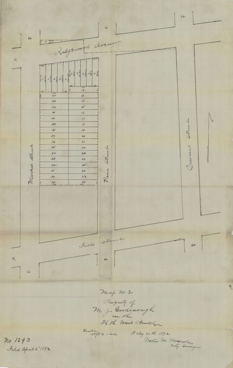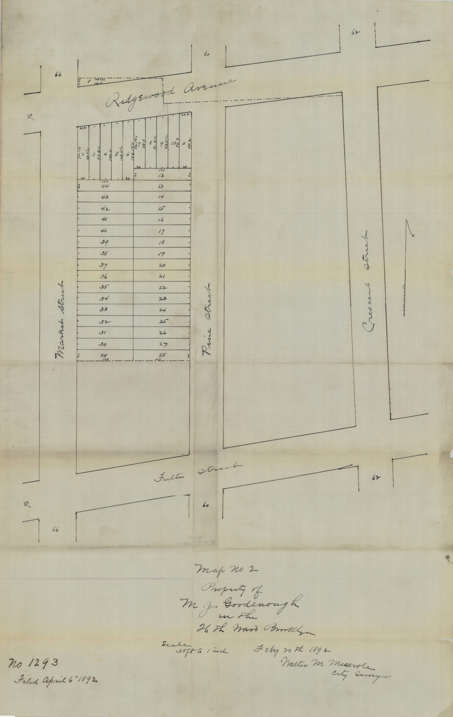
Map no. 2: property of M. J. Goodenough in the 26th Ward, Brooklyn, Feb[ruar]y 20th, 1892: Walter M. Meserole, city surveyor 1892
Map No. B P-1892a.Fl
Cadastral map covers area bounded by Ridgewood Avenue, Crescent Street, Fulton Street, and Market Street in modern-day Cypress HIlls. Shows streets, existing property line, lot numbers and dimensions. Title devised by cataloger. “No. 1293, filed April 6, 1892.” Map found among the Brooklyn, N.Y., Department of Law, Corporation Counsel records at Brooklyn Historical Society.
Map area shown
Relation
Full catalog recordSize
37 × 58 cmDownload
Low Resolution Image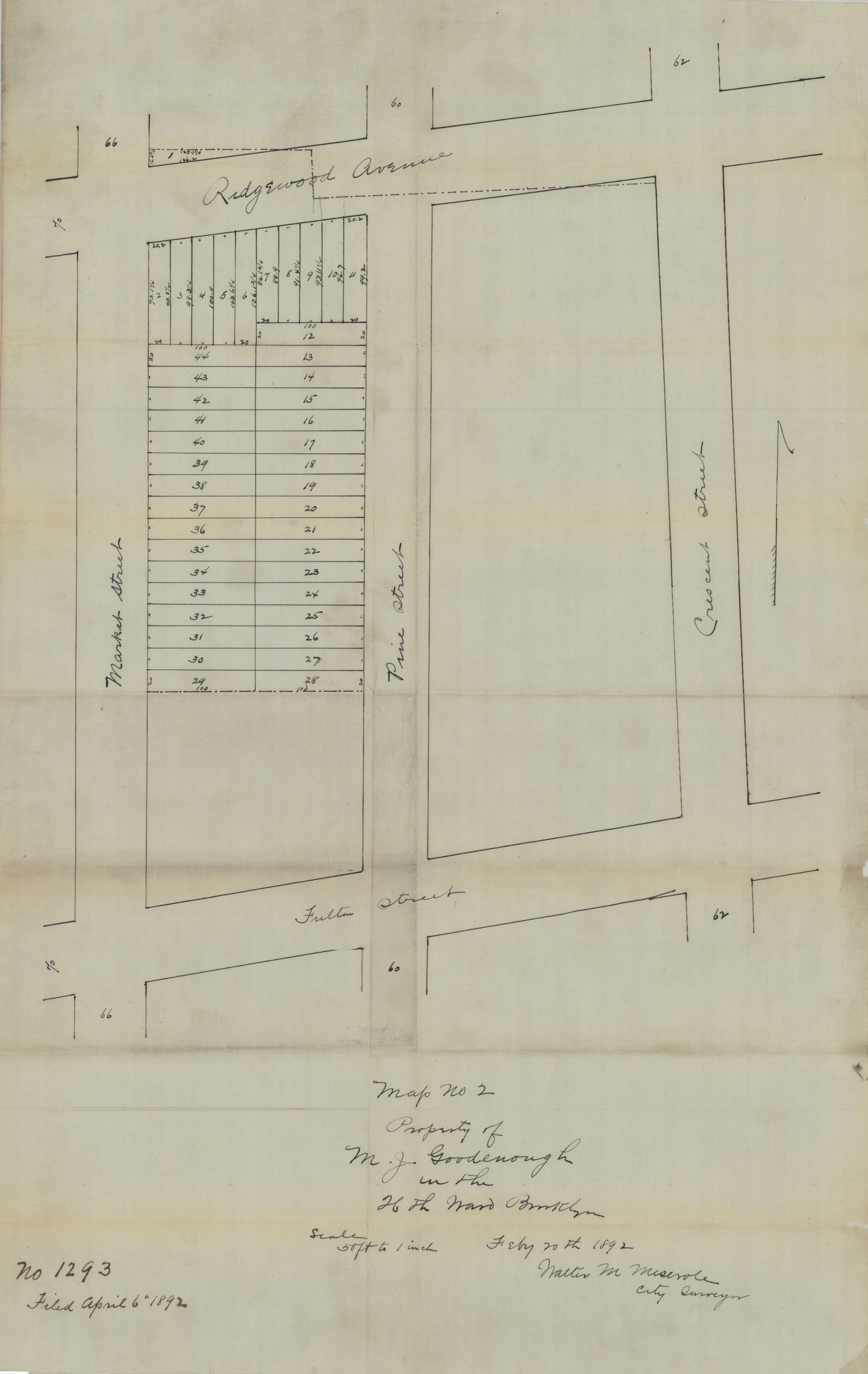
Creator
Meserole, Walter M.,Publisher
Brooklyn Historical SocietyCitation
Map no. 2: property of M. J. Goodenough in the 26th Ward, Brooklyn, Feb[ruar]y 20th, 1892: Walter M. Meserole, city surveyor; 1892, Map Collection, B P-1892a.Fl; Brooklyn Historical Society.Scale
Scale 1:600. 1 in to 50 fLoading zoom image...