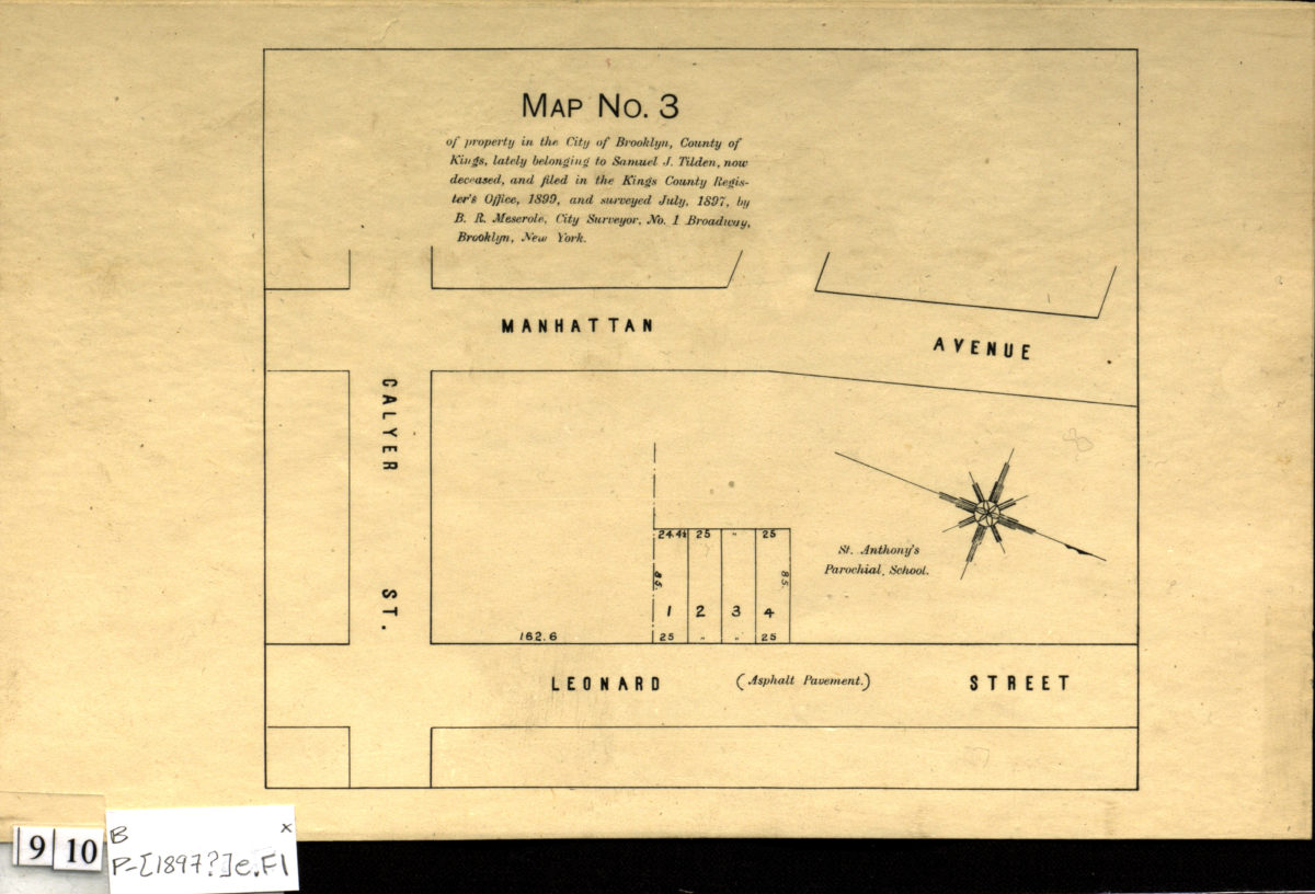
Map no. 3 of property in the city of Brooklyn, county of Kings, lately belonging to Samuel J. Tilden, now deceased, and filed in the Kings County Register’s Office, 1899, and surveyed July 1897: by B.R. Meserole, city surveyor [1897]
Map No. B P-[1897?]e.Fl
Cadastral map covering Calyer St. between Manhattan Ave. and Leonard St. (modern-day Greenpoint). Shows property (including lot numbers and dimensions), St. Anthony’s Parochial School, and status of roads. Oriented with north to the lower right. BHS has 2 copies.
Map area shown
Genre
Cadastral mapsRelation
Full catalog recordSize
14 × 17 cmDownload
Low Resolution Image
Creator
Meserole, B. R.,Publisher
Brooklyn Historical SocietyCitation
Map no. 3 of property in the city of Brooklyn, county of Kings, lately belonging to Samuel J. Tilden, now deceased, and filed in the Kings County Register’s Office, 1899, and surveyed July 1897: by B.R. Meserole, city surveyor; [1897], Map Collection, B P-[1897?]e.Fl; Brooklyn Historical Society.Scale
Scale not givenLoading zoom image...