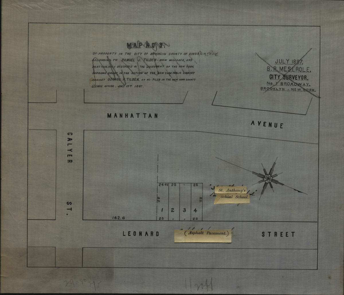
Map no. 3 of property in the city of Brooklyn, county of Kings, lately belonging to Samuel J. Tilden, now deceased, and particularly described in the judgement of the New York Supreme Court, July 17th, 1897 [1897]
Map No. B P-[1897].Fl
Cadastral map covering the area bounded by Manhattan Ave., Leonard St., and Calyer St. (modern-day Greenpoint). Shows property, including lot numbers and dimensions. Oriented with north to the lower right. “July 1897.” Includes pasted-on corrections. BHS copy annotated in gray pencil.
Map area shown
Genre
Cadastral mapsRelation
Full catalog recordSize
28 × 33 cmDownload
Low Resolution ImageCreator
Meserole, B. R.,Publisher
Brooklyn Historical SocietyCitation
Map no. 3 of property in the city of Brooklyn, county of Kings, lately belonging to Samuel J. Tilden, now deceased, and particularly described in the judgement of the New York Supreme Court, July 17th, 1897; [1897], Map Collection, B P-[1897].Fl; Brooklyn Historical Society.Scale
Scale not givenLoading zoom image...