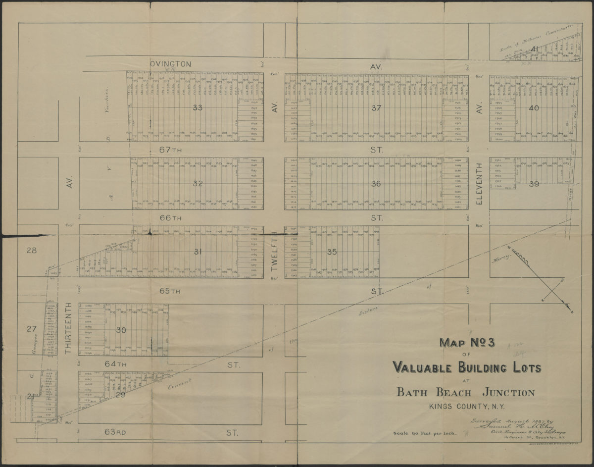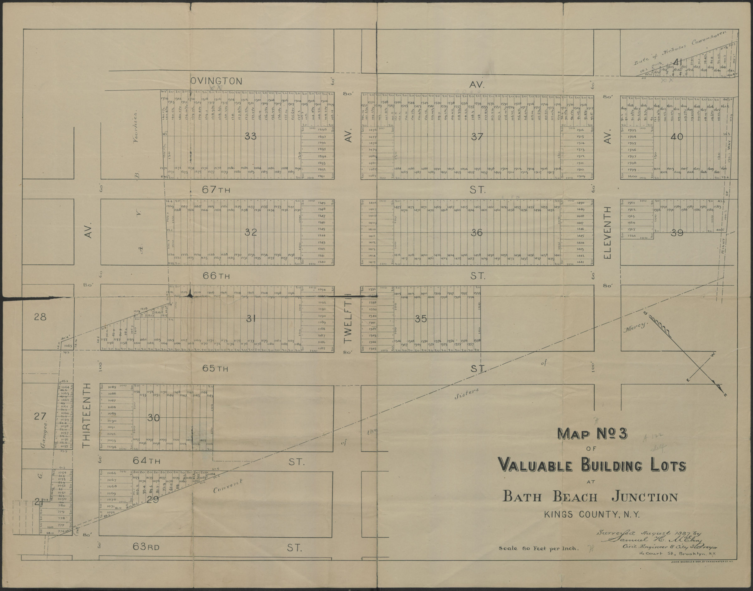
Map no 3 of valuable building lots at Bath Beach Junction, Kings County, N.Y.: surveyed August 1887 by Samuel H McElroy, civil engineer & city surveyor, 16 Court St., Brooklyn, N.Y. [1887]
Map No. B P-1887.Fl
Cadastral map covering area north from Ovington Av. to 63rd St. and west from 13th Ave to 11th Av. (modern-day Dyker Heights). Shows properties (including lot numbers and dimensions) and the Convent of the Sisters of Mercy. Oriented with north to the lower right.
Map area shown
Genre
Cadastral mapsRelation
Full catalog recordSize
51 × 69 cmDownload
Low Resolution Image
Creator
McElroy, Samuel,Publisher
Brooklyn Historical SocietyCitation
Map no 3 of valuable building lots at Bath Beach Junction, Kings County, N.Y.: surveyed August 1887 by Samuel H McElroy, civil engineer & city surveyor, 16 Court St., Brooklyn, N.Y.; [1887], Map Collection, B P-1887.Fl; Brooklyn Historical Society.Scale
Scale [1:960] 1 in to 80Loading zoom image...