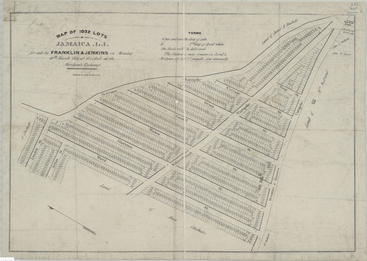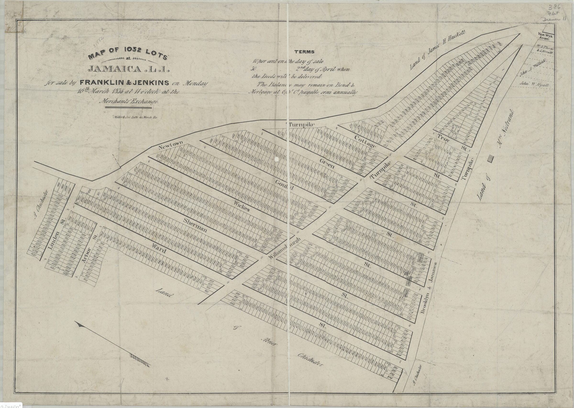
Map of 1,032 lots at Jamaica, L.I., for sale by Franklin & Jenkins on Monday, 16th March, 1835, at 11 o’clock at the Merchants’ Exchange 1835
Map No. Q-[1835].Fl
Cadastral map covering area north from the Brooklyn & Jamaica Turnpike to Linden St. and east from Ward St. to the Newtown Turnpike. Shows property (including lot numbers, dimensions, and buildings), and names of landowners. Oriented with north to the upper left. Includes note.
Map area shown
Genre
Cadastral mapsRelation
Full catalog recordSize
55 × 80 cmDownload
Low Resolution Image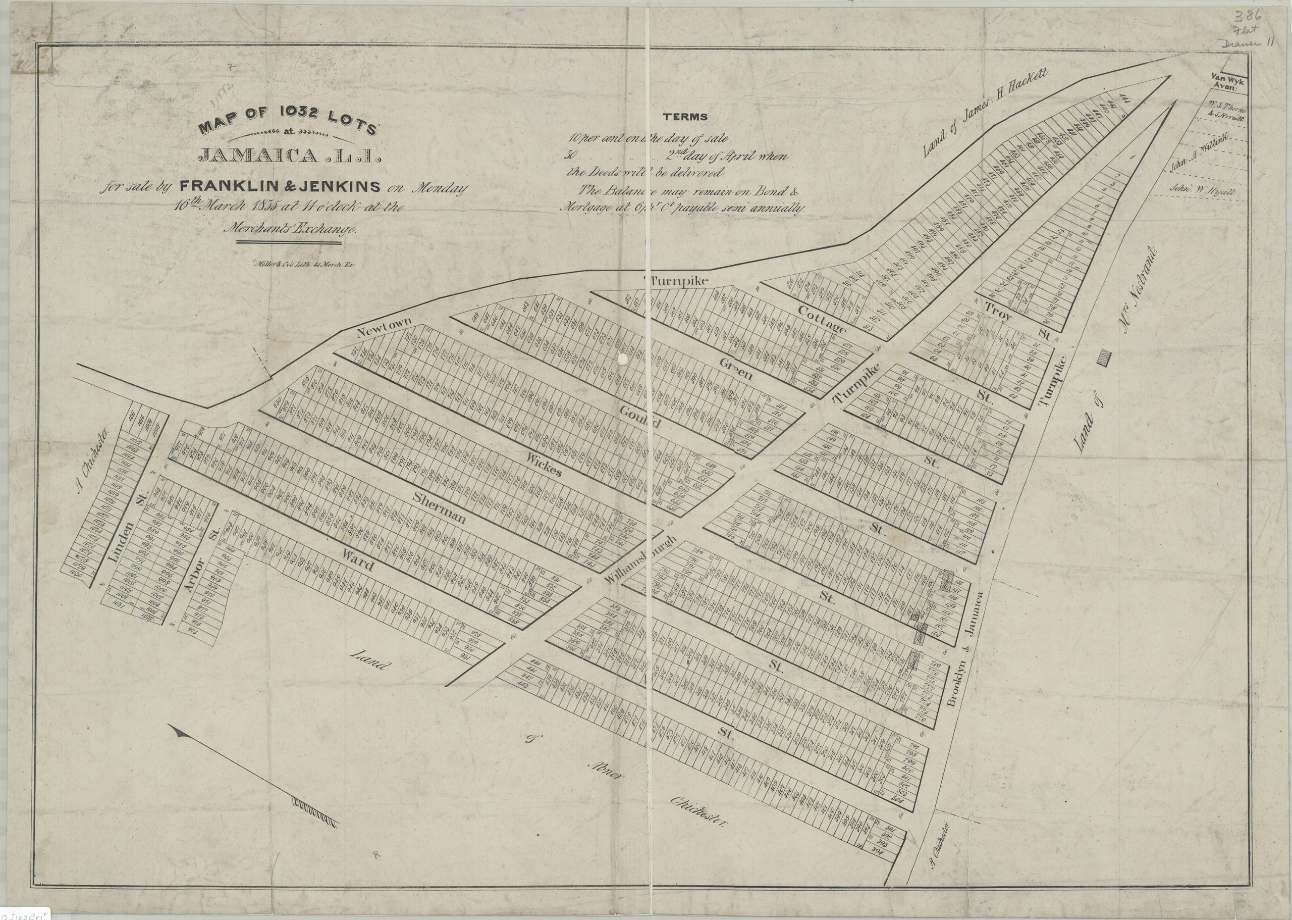
Creator
Miller & Co.,Publisher
Brooklyn Historical SocietyCitation
Map of 1,032 lots at Jamaica, L.I., for sale by Franklin & Jenkins on Monday, 16th March, 1835, at 11 o’clock at the Merchants’ Exchange; 1835, Map Collection, Q-[1835].Fl; Brooklyn Historical Society.Scale
Scale not givenLoading zoom image...